

 Ver en contexto
 Enviar
 Compartir
 Detalles

 Descargar
 Similares
 Radiografía
 Presentación de diapositivas
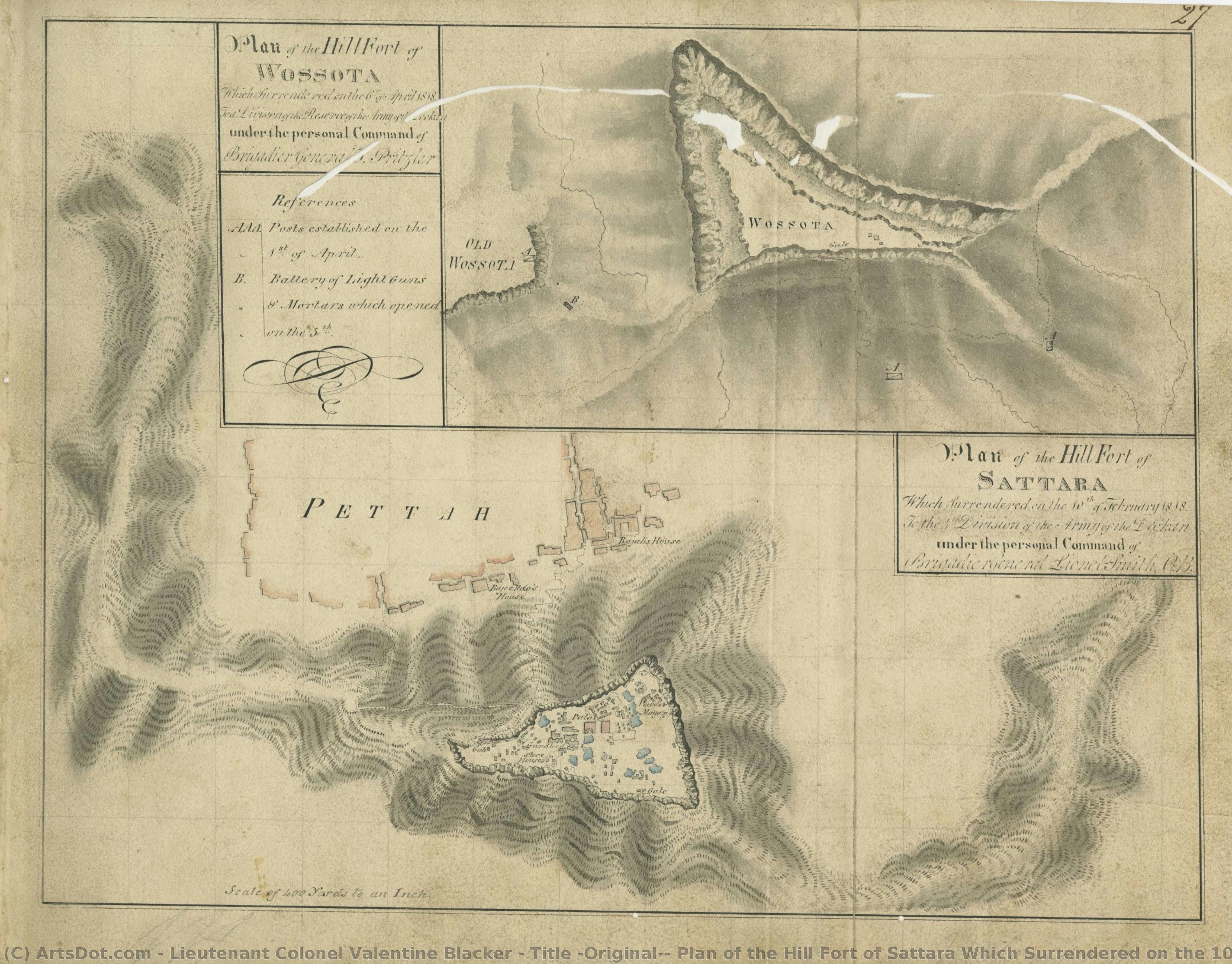
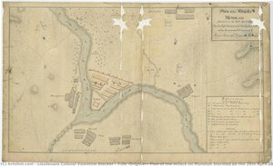
Title (Original): Plan of the Hill Fort of Sattara Which Surrendered on the 10th of February 1818 To a Division of the Reserve of the Army of the Deckan under the personal Command of Brigadier General Lionel Smith C.B. / Plan of the Hill Fort of Woss....
 Ink On Paper
- Other
 1818
1818- 19th Century
 29.0 x 38.0 cm
 Archivos Kalakriti
 Ver más
Reproducción al óleo hecha a mano
Óleo sobre lienzo pintado a mano en el tamaño y marco de su elección, realizado por encargo por nuestros artistas. ( Comprar impresión Comprar imagen)




P118B $10

P118H $10

P118W $10

P438Z $10

P508JH $12

P508YH $12

P805H $10

P805Z $10

P919BZ $10

P919G $10

P919XJ $10

P959ZH $10

P968JZ $12

W106C $8

W218G $10

W218JH $8

W218Y $10

W307PJ $10

W316G $10

W316PJ $8

W316Y $10

W398PJ $8

W4111J $10

W500HY $15

W500JH $15

W692G $12

W849H $8

W940BG $15

W953PJ $8




Elija entre nuestros tamaños predefinidos que respetan las proporciones originales de la obra.

Puede ingresar sus propias dimensiones para adaptarse a un marco o espacio específico. Si el tamaño seleccionado no coincide con las proporciones de la imagen original, recortaremos la obra o extenderemos la pintura con elementos adicionales pintados a mano. Se le enviará una maqueta digital para su aprobación antes de comenzar la producción.
Tenga en cuenta que la vista previa en pantalla no refleja el recorte o la extensión reales. Solo la maqueta mostrará con precisión la composición final.
Si bien existen tamaños personalizados, recomendamos seleccionar una dimensión de la lista predefinida para preservar las proporciones originales.
Tras realizar el pedido, el equipo de ArtsDot.com enviará un correo electrónico al cliente para solicitar instrucciones y proporcionarle una vista previa del boceto.
Envío a todo el mundo () en 3-4 semanas en lugar de las 5 semanas estándar. (29 agosto). Sin comprometer la calidad.

Envío exprés gratuito a todo el mundo

Lienzo de lino de alta calidad

Seguro de envío total

Garantía de reembolso de impuestos aduaneros

Garantía de fidelidad cromática exacta

Política de devolución de 60 días (solo por defectos)

Garantía de devolución del 100% del dinero

Descuento por cantidad
 La opción de vidrio solo está disponible en tamaños inferiores a 110 cm.

Title (Original): Plan of the Hill Fort of Sattara Which Surrendered on the 10th of February 1818 To a Division of the Reserve of the Army of the Deckan under the personal Command of Brigadier General Lionel Smith C.B. / Plan of the Hill Fort of Woss....
Técnica de reproducción
Dimensiones de la reproducción
-


Precio total final
$ 263
Obras relacionadas





Biografía del artista
Lieutenant Colonel Valentine Blacker
Valentine Blacker (19 October 1778 – 4 February 1826) fue un oficial en la Compañía Británica de Indias Orientales y posteriormente Surveyor General de India. Nacido en Armagh, Irlanda del Norte, donde su familia tenía una propiedad ancestral en la baronía de Oneilland Este, Blacker obtuvo un puesto en la Caballería Madras en 1798. Su vida temprana está poco documentada, pero se sabe que adquirió una licenciatura en Artes desde el Universidad de Cambridge en 1799.Military Career
Blacker ascendió rápidamente en las filas militares después de obtener su título universitario. En 1799 fue nombrado cornet en la Caballería Madras y luego ayudante de cámara al comandante Stevenson en el distrito de Wayanad en 1800. Posteriormente, desempeñó funciones como cuartel general en Deccan en 1817 y fue ascendido a teniente coronel. Su servicio más significativo llegó con la Compañía Británica de Indias Orientales cuando asumió el puesto de Surveyor General de India en 1823, reemplazando a John Hodgson. Esta posición le permitió realizar importantes contribuciones al estudio continuo de la trigonometría india, una tarea que demostró un enfoque científico excepcional. Durante su tiempo en Calcuta hasta su fallecimiento en 1826, Blacker lideró proyectos destinados a mapear y comprender el territorio indio con precisión sin precedentes.Artistic Contributions
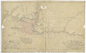
Más allá de sus logros militares, Valentine Blacker fue un artista talentoso cuya pasión por la pintura dejó una huella duradera en la historia del arte británico. Aunque pocos ejemplos de su obra permanecen hoy en día, los dibujos realizados por Blacker ofrecen una visión fascinante de cómo el conocimiento científico podía inspirar la creatividad artística. Sus pinturas destacaban especialmente la habilidad para capturar la luz y el color con precisión excepcional, reflejando las tendencias impresionistas que estaban comenzando a ganar fuerza en ese momento. Entre sus obras más notables se encuentran los planos detallados de operaciones militares, como el Plan de Operaciones del Ejército Reserva Dekkan (1818), que representan una batalla clave en la historia de la Compañía Británica de Indias Orientales y muestran un profundo interés por la representación visual del campo de batalla. También realizó dibujos panorámicos del entorno de Hyderabad, ofreciendo una perspectiva única sobre el paisaje indio de principios del siglo XIX. Estos dibujos no solo eran herramientas útiles para los estudiosos sino también expresiones artísticas significativas que reflejaban la sensibilidad estética de Blacker y su capacidad para traducir conceptos científicos complejos en imágenes poderosas.Legacy and Recognition
La investigación científica realizada por Valentine Blacker tuvo un impacto significativo en el desarrollo del conocimiento geográfico británico sobre India, estableciendo nuevos estándares para la precisión cartográfica y contribuyendo a una comprensión más profunda del territorio indio. Además de sus logros profesionales, Blacker fue reconocido como artista por su trabajo en colaboración con William Blacker, quien también era oficial militar y escritor. Sus obras fueron exhibidas en instituciones prestigiosas como el Museo Norte Irlandés Colección de Arte Civil Servicio y la Academia Real Ulster, donde siguen siendo estudiadas y admiradas por historiadores del arte y amantes de la historia. Su legado artístico continúa inspirando artistas contemporáneos y demuestra cómo el interés por el conocimiento científico puede enriquecer la expresión artística.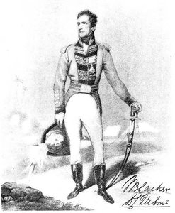
Teniente Coronel Valentine Blacker
1778 - 1826 , República de Irlanda
Datos clave
- Artistic Movement Or Style: Watercolor
- Date Of Birth: 1778-10-19
- Date Of Death: 1826-02-04
- Full Name: Valentine Blacker
- Nationality: Irlandés
- Notable Artworks:
- Plan of the Combat at Ashtee
- Plan of the Hill Fort of Sattara
- Plan of the Assault of the Fort Taulneir
- Place Of Birth: Armagh, República de Irlanda
Artículos relacionados
Los 25 Tesoros del Museo Británico: Arte, Historia y Decoración Excepcional
Descubre los 25 tesoros del Museo Británico: desde la Piedra Rosetta hasta obras de Rembrandt y Van Gogh. Explora su historia, técnica y significado. Reproducciones de arte exclusivas en ArtsDot.com para decorar tu hogar con elegancia.

Frank Brangwyn: A Life Immersed in Colour, Craft & the Spirit of Modern British Art
Explore the vibrant life & prolific work of Frank Brangwyn, a master of British art. Discover his stunning paintings, designs, and monumental Empire Panels – a celebration of colour, craft, and artistic innovation.
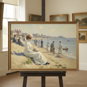
Philip Wilson Steer: Capturing Modern Life & British Impressionism's Essence
Explore the life & art of Philip Wilson Steer, a leading British Impressionist painter. Discover his coastal scenes, influences, and legacy. Expert analysis & high-quality reproductions at ArtsDot.
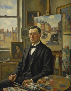
Robert Bevan: Pioneering British Post-Impressionism & the Camden Town Group's Intimate Vision
Explore the life & work of Robert Bevan, a pioneer of British Post-Impressionism and founding member of the Camden Town Group. Discover his vibrant landscapes and lasting impact on early 20th-century art.
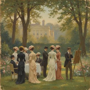
Sir George Clausen: Capturing Edwardian Life & British Impressionism's Nuances
Explore the luminous world of Sir George Clausen, a leading British Impressionist painter. Discover his captivating scenes of Edwardian life, rural England & poignant war art. Learn about his legacy and find high-quality reproductions at ArtsDot.

