

 Ver en contexto
 Enviar
 Compartir
 Detalles

 Descargar
 Similares
 Radiografía
 Presentación de diapositivas
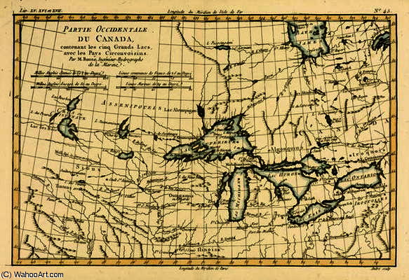
Western Canada, including the Five Great Lakes, from 'Atlas de Toutes les Parties Connues du Globe T

 Ver más
Reproducción al óleo hecha a mano
Óleo sobre lienzo pintado a mano en el tamaño y marco de su elección, realizado por encargo por nuestros artistas. ( Comprar impresión Comprar imagen)




































Elija entre nuestros tamaños predefinidos que respetan las proporciones originales de la obra.

Puede ingresar sus propias dimensiones para adaptarse a un marco o espacio específico. Si el tamaño seleccionado no coincide con las proporciones de la imagen original, recortaremos la obra o extenderemos la pintura con elementos adicionales pintados a mano. Se le enviará una maqueta digital para su aprobación antes de comenzar la producción.
Tenga en cuenta que la vista previa en pantalla no refleja el recorte o la extensión reales. Solo la maqueta mostrará con precisión la composición final.
Si bien existen tamaños personalizados, recomendamos seleccionar una dimensión de la lista predefinida para preservar las proporciones originales.
Tras realizar el pedido, el equipo de ArtsDot.com enviará un correo electrónico al cliente para solicitar instrucciones y proporcionarle una vista previa del boceto.
Envío a todo el mundo () en 3-4 semanas en lugar de las 5 semanas estándar. (29 agosto). Sin comprometer la calidad.

Envío exprés gratuito a todo el mundo

Lienzo de lino de alta calidad

Seguro de envío total

Garantía de reembolso de impuestos aduaneros

Garantía de fidelidad cromática exacta

Política de devolución de 60 días (solo por defectos)

Garantía de devolución del 100% del dinero

Descuento por cantidad
 La opción de vidrio solo está disponible en tamaños inferiores a 110 cm.

Western Canada, including the Five Great Lakes, from 'Atlas de Toutes les Parties Connues du Globe T
Técnica de reproducción
Dimensiones de la reproducción
-


Precio total final
$ 263
Obras relacionadas


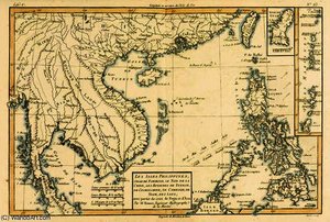
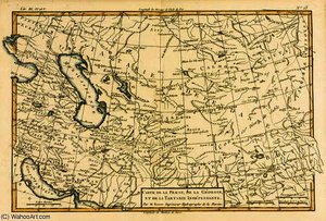



Biografía del artista
The Architect of the Earth: The Life and Legacy of Rigobert Bonne
In the luminous era of the Enlightenment, where the pursuit of scientific truth danced alongside a burgeoning appreciation for aesthetic elegance, Rigobert Bonne emerged as a master of both realms. Born on October 6, 1727, in the quiet Ardennes region of Raucourt, Bonne’s journey was one of profound intellectual transformation. He began not as a scholar of the academy, but as a self-taught mathematician whose innate curiosity drove him to decode the complexities of the physical world. This early period of independent study laid the foundation for a career that would eventually bridge the gap between rigorous mathematical precision and the evocative beauty of cartographic art.
His path was significantly shaped by the discipline of military service during the War of Austrian Succession. Serving as an engineer at Berg-op-Zoom, Bonne developed a meticulous eye for detail and an observational aptitude that would become his hallmark. The rigors of military engineering instilled in him a respect for accuracy and structural integrity—qualities that were later translated into the delicate lines and precise measurements of his maps. When he eventually relocated to Paris, he transitioned from the battlefield to the classroom, establishing himself as a respected educator for the Parisian elite, a role that allowed him to weave scientific discovery into the cultural fabric of the French capital.
A Revolution in Perspective: The Bonne Projection
The true genius of Bonne lies in his ability to solve the fundamental paradox of cartography: how to represent a spherical world upon a flat surface without losing its essence. His most enduring contribution, the Bonne Projection, stands as a testament to his visionary intellect. By devising a method that utilized a heart-shaped configuration to represent the globe, he achieved a revolutionary improvement in geographic proportions. This was not merely a technical triumph; it was an artistic one. The projection minimized the distortions that plagued traditional flat maps, offering a visual representation that felt both more natural and more truthful to the human eye.
This innovation fundamentally altered the trajectory of cartographic history. Through his work, the map ceased to be a mere utilitarian tool and became a sophisticated piece of scientific art. His ability to balance the mathematical necessity of scale with the aesthetic demand for clarity allowed him to create works that were as captivating to look at as they were essential for navigation. This period of his career saw him rise to the prestigious position of Royal Hydrographer, a title that reflected his status as one of France's most vital scientific minds.
The Artistry of Exploration and Historical Significance
Beyond the technicalities of projection, Bonne’s work serves as a breathtaking window into the 18th-century worldview. His detailed engravings, often featured in monumental collections such as Guillaume Raynal’s 'Atlas de Toutes les Parties Connues du Globe Terrestre', capture a moment in time when the world was being rapidly rediscovered and redefined. Each map—whether depicting the vast expanses of the Russian Empire, the intricate coastlines of South America, or the dense landscapes of Asia—is a masterpiece of hand-drawn precision.
The historical significance of Bonne’s output cannot be overstated. His maps were more than just geographic records; they were symbols of human progress and the expansion of global knowledge. To study his work today is to witness the intersection of Enlightenment science and classical artistry. He left behind a legacy where every line, every border, and every shaded terrain serves as a tribute to the era of exploration. Through his eyes, we see a world being measured, mapped, and ultimately, understood with a beauty that remains timeless.
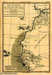
rigobert bonne (charles marie rigobert bonne)
1727 - 1795
Datos clave
- Artistic Movement Or Style: Cartography
- Artists Or Movements Influenced By This Artist: ['Rococo']
- Artists Who Influenced This Artist: ['Jacques-Nicolas Bellin']
- Date Of Birth: October 6, 1727
- Date Of Death: September 2, 1794
- Full Name: Rigobert Bonne
- Nationality: French
- Notable Artworks:
- The Chinese Empire
- West Coast of Africa
- The Canary Islands
- Place Of Birth: Raucourt, Ardennes (France)
Artículos relacionados
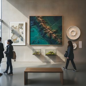
Mapping Beauty: Transform Your Space with Stunning Topographical Artworks
Elevate your interiors with breathtaking topographical art. From vintage cartography to textured 3D reliefs, discover how hand-painted maps and historical landscapes can transform any room into a sophisticated sanctuary of discovery and timeless beauty.
El Siglo XVIII en el Arte: 10 Obras Maestras para Decorar con Historia y Elegancia
Descubre 10 obras maestras del siglo XVIII: Goya, Fragonard y más. Explora la historia, el arte barroco, rococó y neoclasicismo que inspiran decoración elegante. Reproducciones de alta calidad en ArtsDot.com.
Reflections of an Age: Social Commentary & Artistic Representation in 18th-Century Society
Explore the social commentary & artistic representation of 18th-century society. Discover Rococo masterpieces, portraiture's power, and shifting historical perspectives. Expert insights for art lovers.
10 Obras Maestras del Siglo XIX: Arte Clásico para Decorar tu Hogar | ArtsDot
Descubre 10 obras maestras del siglo XIX: Monet, Van Gogh, Goya y más. Explora la historia, el arte y los estilos que definieron una época. Reproducciones de alta calidad para decorar tu hogar con elegancia en ArtsDot.com.
Katsushika Hokusai: Las 25 Obras Maestras del Ukiyo-e que Transformaron el Arte Japonés | ArtsDot
Descubre las 25 obras maestras de Katsushika Hokusai, el genio del ukiyo-e. Explora 'La Gran Ola', paisajes japoneses y su impacto en el arte moderno. Reproducciones de alta calidad para tu hogar en ArtsDot.com.

