

 プレビュー
プレビュー
 プリントを購入
 シェアする
シェアする シェアする
シェアする
 詳細を見る
詳細を見る

 ダウンロード
 似ている作品
 X線調査
X線調査 スライドショー
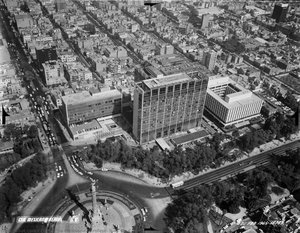
Guerrero


 詳細を見る
詳細を見る




P118B $10

P118H $10

P118W $10

P438Z $10

P508JH $12

P508YH $12

P805H $10

P805Z $10

P919BZ $10

P919G $10

P919XJ $10

P959ZH $10

P968JZ $12

W106C $8

W218G $10

W218JH $8

W218Y $10

W307PJ $10

W316G $10

W316PJ $8

W316Y $10

W398PJ $8

W4111J $10

W500HY $15

W500JH $15

W692G $12

W849H $8

W940BG $15

W953PJ $8




作品のオリジナル比率に合わせた、当店の規定サイズからお選びください。

特定のフレームやスペースに合わせて、ご希望のサイズをご入力いただけます。選択されたサイズが元の画像の比率と異なる場合、アートワークをトリミングするか、手描きで要素を追加して絵画を拡張いたします。デジタルモックアップ を制作し、制作開始前にご確認(承認)をいただきます。
画面上のプレビューは、実際のトリミングや拡張を正確に反映しているものではありません。最終的な構図は、モックアップによってのみ正確にご確認いただけます。
カスタムサイズもご利用いただけますが、元の比率を維持するためには、あらかじめ用意されたリストからサイズを選択することをお勧めいたします。
ご注文後、ArtsDot.com チームより詳細な指示をお送りするとともに、仕上がりイメージ(モックアップ)をご提供いたします。


 ガラスオプションは、110cm未満のサイズでのみご利用いただけます。

Guerrero
複製技法
複製画のサイズ
-


合計金額
$ 288
関連作品





アーティストの略歴
Compañía Mexicana Aerofoto: Chronicling Mexico's Landscape Through Aerial Photography
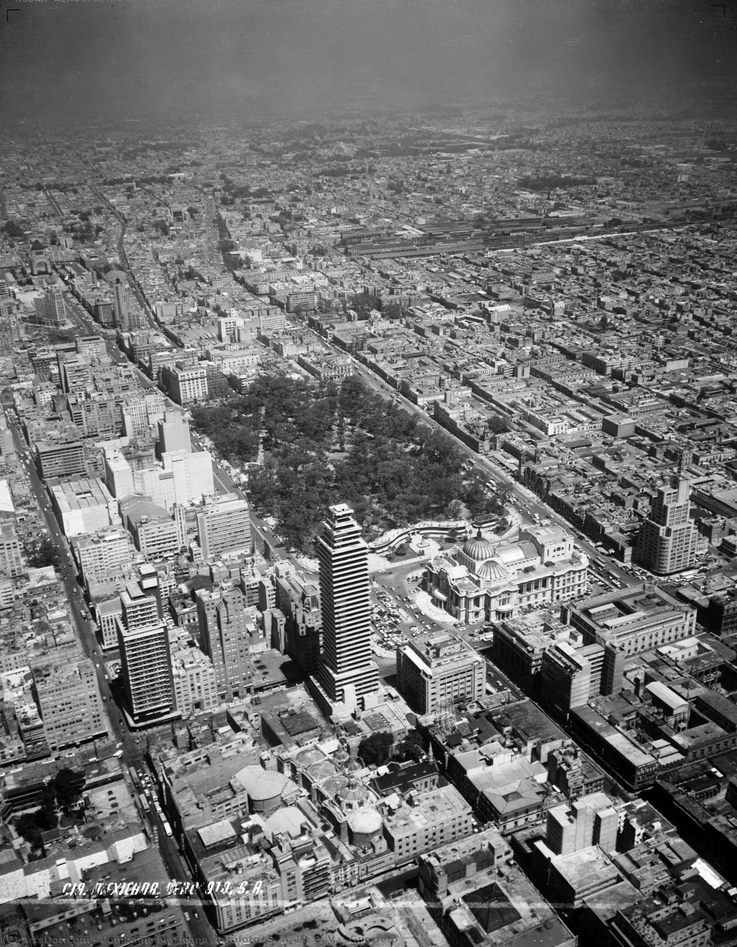
Compañía Mexicana Aerofoto, S.A., a name synonymous with meticulous documentation of Mexican territory from the 1930s to 1989, stands as an unparalleled archive of visual history. Founded in Mexico City by Luis struck, this pioneering company embarked on a mission to capture the essence of Mexico’s geography and urban development through the lens of aviation—a revolutionary approach for its time. More than just taking pictures; Aerofoto undertook a monumental task: assembling nearly one million images spanning 1.2 million square kilometers across Latin America. The legacy of Compañía Mexicana Aerofoto resides in its extraordinary collection, representing an astonishing breadth of subjects. Primarily focused on panoramic views of lakes and lagoons—including Mexico’s majestic Chapala Lake and Guerrero Lagoon—the archive meticulously charted river basins like Río Balsas and Río Lerma, explored forested areas encompassing Sierra Madre Occidental and Sierra Madre Oriental, mapped dam projects reshaping the landscape, documented irrigation districts vital to agricultural productivity, and painstakingly recorded urban centers such as Mexico City and Guadalajara. Furthermore, Aerofoto’s involvement extended beyond simple observation; it collaborated extensively in topographic surveys across Colombia, Dominican Republic, Panama, Peru, and Honduras, utilizing its expertise to advance scientific understanding of these regions. Aerofoto's contribution wasn't merely about recording locations; it was about transforming them into detailed geospatial datasets. Employing aerofotogrammetry—the science of reconstructing terrain from aerial photographs—the company conducted comprehensive cadastral surveys, providing invaluable information for land management and planning. As satellite imagery gained prominence in the late 1980s, Aerofoto gracefully transitioned to this newer technology, marking a pivotal moment in the evolution of mapping and visual representation. The meticulousness of Compañía Mexicana Aerofoto’s work speaks volumes about its dedication to preserving Mexico's heritage. Its archive serves as an invaluable resource for historians, geographers, ecologists, and anyone interested in understanding Mexico’s past and present. The company’s pioneering use of aerial photography established a benchmark for future endeavors in visual documentation, cementing Compañía Mexicana Aerofoto’s place as one of the most significant contributors to Mexican cultural heritage.- Key Achievements: The creation of an unprecedented photographic archive covering vast stretches of Mexico and Latin America.
- Technique: Pioneering aerofotogrammetry and cadastral surveying techniques.
- Collaboration: Extensive partnerships with governments and scientific institutions across multiple countries.
Influences & Context
Luis struck’s vision for Compañía Mexicana Aerofoto stemmed from a fascination with the possibilities offered by aviation—a burgeoning field in the early 20th century. The company drew inspiration from advancements in photographic technology, mirroring developments occurring globally during this period. Moreover, Aerofoto's work coincided with broader societal shifts toward scientific observation and mapping, reflecting the growing importance of geospatial data for economic planning and resource management.Notable Works & Locations
Aerofoto’s portfolio boasts stunning images capturing iconic landscapes like Polanco, Cuauhtémoc and Insurgentes Cuicuilco. These photographs offer a unique glimpse into Mexico's urban sprawl and natural beauty during the mid-century era. The archive continues to be studied by researchers examining environmental change and urban development trends.Legacy & Historical Significance
Compañía Mexicana Aerofoto’s legacy extends far beyond its impressive photographic collection. It represents a cornerstone of Mexican geospatial heritage, demonstrating the transformative potential of combining artistic vision with scientific rigor. The archive stands as testament to a bygone era—a time when meticulous documentation was paramount in shaping our understanding of the world around us.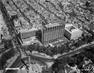
compañía mexicana aerofoto, s. a. de c. v.
1930 - 1989 , Mexico
基本情報
- Artistic Movement Or Style: Aerial Photography
- Artists Or Movements Influenced By This Artist: ['Satellite Photography']
- Artists Who Influenced This Artist: ['Luis struck']
- Date Of Birth: Mexico City, Mexico (1930)
- Full Name: Compañía Mexicana Aerofoto, S.A.
- Nationality: Mexican
- Notable Artworks: ['Panoramic Views of Mexican Landscapes']
- Place Of Birth: Mexico City
関連記事

White on Canvas: 10 Masterpieces & Timeless Elegance for Your Home Decor
Explore 10 iconic white paintings by Monet, Whistler & Rothko! Discover the stories behind these serene masterpieces and their impact on art history. Find museum-quality reproductions for your home decor at .

Monochrome Visions: Exploring the Aesthetic & Historical Significance of Black & White Photography
Explore the rich history & artistic power of black and white photography. From early techniques to iconic masters like Ansel Adams, discover why monochrome continues to captivate art lovers today. Expert insights for collectors.

Dark Masterpieces: 10 Iconic Paintings Dominated by Black Tones |
Explore 10 iconic paintings dominated by black tones, from Rembrandt’s chiaroscuro to Goya's dark expressions. Discover the stories behind these masterpieces & find museum-quality art reproductions for your home at .

Timeless & Chic: Elevating Your New Home with the Sophistication of Black and White Photography
Transform your new home with the timeless allure of black and white photography. ArtsDot.com specializes in elegant monochrome decor and custom hand-painted wedding portraits that turn cherished milestones into lasting, soulful masterpieces. Elevate your space with ease.

Documentary Photography's Defining Moments: 10 Masterpieces for Your Home |
Explore 10 defining documentary photography masterpieces – from Dorothea Lange to Robert Capa. Discover powerful stories, iconic images & timeless art for your home. Museum-quality prints at .

