 プレビュー
プレビュー
 シェアする
シェアする シェアする
シェアする
 詳細を見る
詳細を見る

 ダウンロード
 似ている作品
 X線調査
X線調査 スライドショー
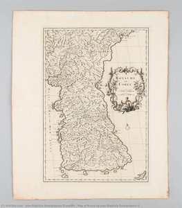
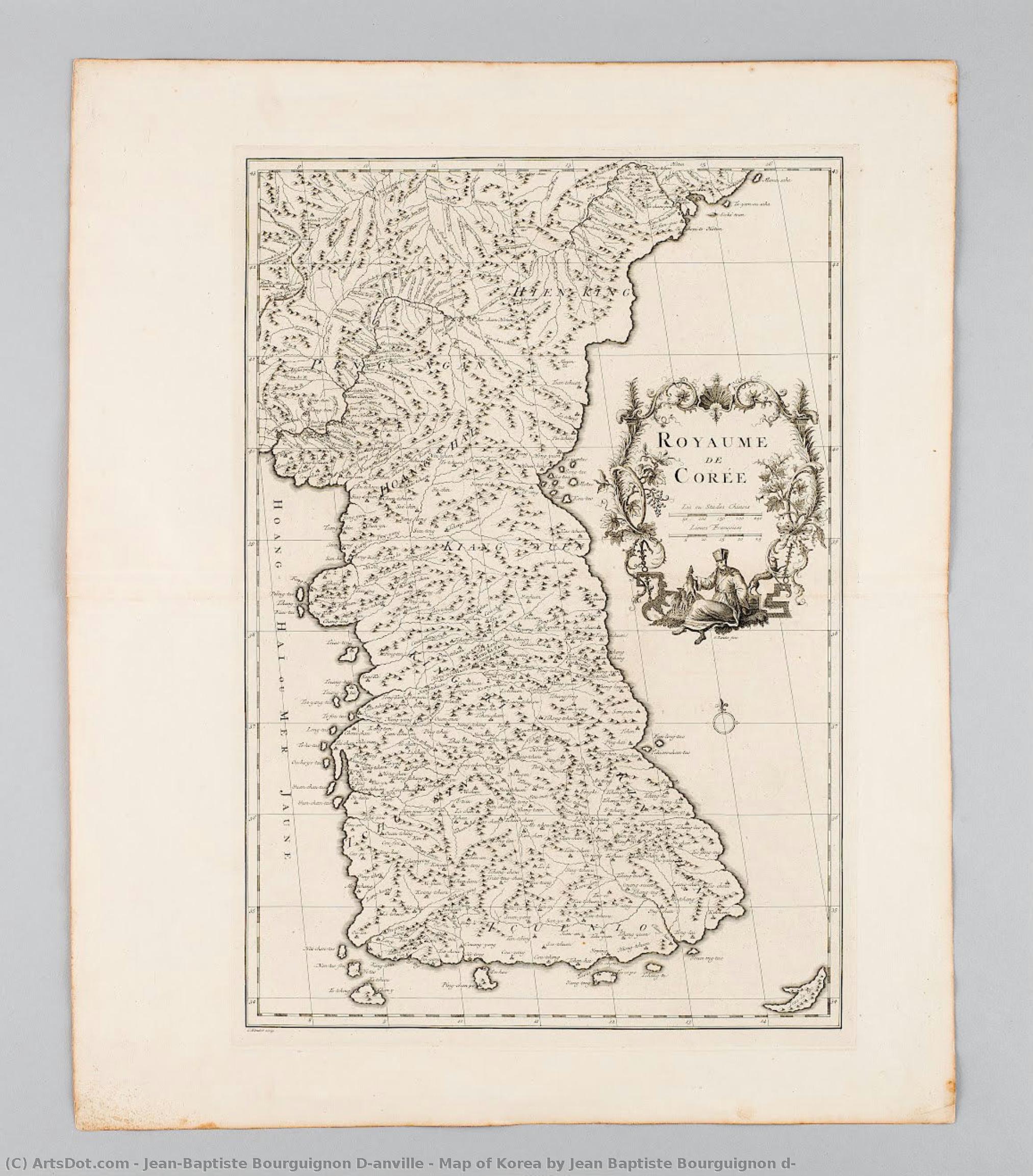
韓国地図 イェン バプティスト ウルゴニオン ド アニヴェル


 詳細を見る
詳細を見る
ジークレー/アートプリント
迅速な制作と多彩な仕上げオプションを備えた、ミュージアムクオリティのジークレーまたはキャンバスプリント。 ( 手描きの絵画を購入 画像を購入)




P118B $10

P118H $10

P118W $10

P438Z $10

P508JH $12

P508YH $12

P805H $10

P805Z $10

P919BZ $10

P919G $10

P919XJ $10

P959ZH $10

P968JZ $12

W106C $8

W218G $10

W218JH $8

W218Y $10

W307PJ $10

W316G $10

W316PJ $8

W316Y $10

W398PJ $8

W4111J $10

W500HY $15

W500JH $15

W692G $12

W849H $8

W940BG $15

W953PJ $8




作品のオリジナル比率に合わせた、当店の規定サイズからお選びください。

特定のフレームやスペースに合わせて、ご自身でサイズを指定することも可能です。選択されたサイズが元の画像の比率と一致しない場合、作品をトリミングするか、鏡面反射または単色での塗りつぶしによって画像を拡張いたします。制作を開始する前に、ご確認用のデジタルモックアップをお送りいたします。
画面上のプレビューには、実際のトリミングや拡張は反映されませんのでご注意ください。最終的な構図を正確に確認できるのは、モックアップのみとなります。
カスタムサイズも承っておりますが、元の比率を維持するためには、あらかじめ用意されたリストからサイズを選択することをお勧めいたします。


 ガラスオプションは、110cm未満のサイズでのみご利用いただけます。

韓国地図 イェン バプティスト ウルゴニオン ド アニヴェル
ジークレー/アートプリント
複製画のサイズ
-


合計金額
$ 62
ジョバンニ・バルトロメオ・ド・アンヴィルの韓国地図:科学と芸術の融合
フランスにおける地図制作の革命を導いたジョバンニ・バルトロメオ・ド・アンヴィルは、1697年にパリで生まれました。彼の幼少期から優れた知的好奇心を持ち、特に地図への情熱は彼を未来へと駆り立てました。当時のヨーロッパでは、地図制作は経験と伝説に基づいたものでしたが、ド・アンヴィルは厳格な観察と徹底的な研究を重視し、地図制作の新たな基準を設定しました。この姿勢こそが彼の業績に輝きを与えたのです。彼は単なる地理情報の記録にとどまらず、当時の社会や文化を反映した芸術作品として評価されています。作品の詳細:科学的精度と視覚的な魅力
ド・アンヴィルの韓国地図は、1735年に制作されました。この地図は、国立海洋博物館(釜山)で展示されており、その美しい色彩と緻密な表現力は見る者を圧倒します。彼はヨーロッパにおける地理学の知識を深め、特にアジアの地図制作において革新的な貢献を果たしました。この地図の特徴は、詳細な地形描写に加えて、当時の韓国社会や文化を象徴する要素が凝縮されている点です。例えば、山脈や川などの地形は、韓国の地理的特徴を正確に表現しており、同時に重要な場所や人物が描かれていることで歴史的な背景を感じさせます。これらの要素は、ド・アンヴィルの地図制作における科学的な知識と芸術的なセンスの両方を反映しています。制作技法:ヨーロッパにおける地図制作の最前線
ド・アンヴィルは、当時のヨーロッパにおける地図制作において最も先進的な技術を用いました。彼は、観測船による航海調査や、新しい測定器具の開発などを行い、地図制作に革命をもたらしました。彼の地図は、従来の地図よりも正確で詳細であり、その美しい色彩と繊細な線画は見る人を惹きつけます。彼は特に、ヨーロッパの地理学的知識を深めるための研究を行っており、その成果は後の地図制作に大きな影響を与えました。ド・アンヴィルの地図は、単なる地理情報の記録ではなく、当時の科学技術の粋を集めた芸術作品として評価されています。歴史的背景:啓蒙時代の韓国と西洋文化の影響
ド・アンヴィルの韓国地図が制作されたのは、啓蒙時代にあたる時期でした。この時代は、ヨーロッパにおける科学的な知識と理性への信頼が高まり、地理学の研究が進められました。ド・アンヴィルは、当時のフランス王室の支援を受けながら、アジアの地図制作に力を注ぎました。彼の地図は、西洋文化の影響を受けただけでなく、韓国社会や文化に対する深い理解を示しています。彼は特に、韓国の地理的特徴を正確に表現するために、当時のヨーロッパにおける地理学の知識を応用しました。ド・アンヴィルの韓国地図は、啓蒙時代の科学技術と芸術的なセンスが融合した傑作であり、歴史的な背景を知る上で重要な資料となります。感動とインスピレーション:現代への遺産
ド・アンヴィルの韓国地図は、今日でも多くの人々を感動させます。彼の地図は、単なる地理情報の記録ではなく、当時の社会や文化に対する深い理解と愛情を表現しています。この地図は、現代のインテリアデザイナーやアート愛好家にインスピレーションを与え、美しい韓国風景を自宅に持ち込むための魅力的な選択肢となります。ド・アンヴィルの韓国地図は、科学と芸術の融合という卓越した創造性を体現しており、その遺産はこれからも多くの人々を魅了し続けるでしょう。関連作品








アーティストの略歴
The Architect of Precision: The Life and Legacy of Jean-Baptiste Bourguignon d’Anville
Jean-Baptiste Bourguignon d’Anville was not merely a maker of maps; he was the visionary who stripped away the myths of the unknown to reveal the true face of the Earth. Born in Paris in 1697, d’Anville emerged from a modest background with an intellect that seemed destined to reshape the boundaries of human knowledge. From the tender age of twelve, when he was already sketching intricate geographies for Latin authors, it was evident that his mind possessed a rare synthesis of mathematical rigor and historical curiosity. His early years were steeped in the classical traditions of Paris, where he cultivated a profound mastery of mathematics, Greek, and Latin—disciplencies that would later allow him to interpret ancient texts and contemporary traveler accounts with unparalleled authority. As his talent blossomed, d’Anville found himself part of an illustrious lineage of French cartographers. He studied under the guidance of Charles-Hubert Alexis Jaillot, a man who carried the mantle of the great Nicolas Sanson. Yet, while he inherited the systematic traditions of his predecessors, d’Anville possessed a revolutionary impulse to move beyond mere decoration. Where his contemporaries often filled the "empty" spaces of the world with sea monsters, fanciful islands, and speculative coastlines to satisfy the aesthetic whims of royalty, d’Anville chose a more difficult, more honest path. He embraced the blank space, treating the unknown not as a canvas for imagination, but as a scientific void that demanded respect and further investigation.A Revolution of Empirical Truth
The true brilliance of d’Anville’s work lay in his unwavering commitment to empirical verification. His career reached its zenith when he was appointed Geographer to the King, a position that granted him access to the most significant geographical data of the eighteenth century. He became a master of synthesis, weaving together the disparate threads of Jesuit missionary reports from China, the accounts of intrepid explorers, and the rigorous mathematical calculations of astronomers. His work on the geography of China, based on the testimonies of missionaries, remains one of the most comprehensive surveys of the era, providing a window into a world that had previously been shrouded in European mystery. This dedication to accuracy earned him prestigious seats within the Académie des Inscriptions et Belles-Lettres and the Académie des Sciences. His maps were characterized by a stark, clean elegance that prioritized clarity over ornamentation. By intentionally leaving unverified territories blank, he established a new standard of scientific integrity. This approach fundamentally changed the purpose of cartography; it was no longer an art of embellishment, but a tool of discovery. His maps did not just show where humans had been; they pointed precisely to where they had yet to go, serving as the essential blueprints for the great age of exploration that followed.The Enduring Map of History
The historical significance of d’Anville cannot be overstated. Throughout the nineteenth century, his cartographic achievements remained the definitive reference point for explorers and scholars alike. His ability to distill complex, often contradictory information into a single, coherent, and scientifically sound document allowed him to influence the geopolitical understanding of entire continents. Even as technology advanced, the foundational accuracy of his work provided the bedrock upon which modern geography was built. Beyond the technicalities of longitude and latitude, d’Anville’s legacy is one of intellectual courage. He had the bravery to admit ignorance, a rare trait in an age of colonial expansion and territorial ambition. His life's work stands as a testament to the power of meticulous research and the beauty of scientific truth. In every clean line and carefully noted doubt, we see the spirit of a man who looked at the world not as a collection of legends, but as a magnificent, measurable reality waiting to be understood.- Born: July 11, 1697, Paris, France
- Died: January 28, 1782, Paris, France
- Key Contributions: Revolutionized cartography through empirical research and the use of blank spaces for unverified territories.
- Major Achievements: Geographer to the King; member of the Académie des Sciences; creator of over 200 highly accurate maps.
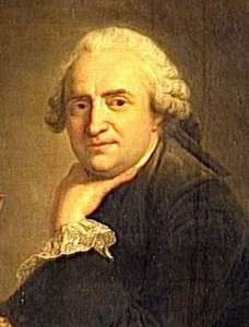
jean-baptiste bourguignon d'anville
1697 - 1782 , France
基本情報
- Artistic Movement Or Style: Cartography
- Artists Or Movements Influenced By This Artist: ['18th Century Maps']
- Artists Who Influenced This Artist:
- Nicolas Sanson
- Guillaume Delisle
- Date Of Birth: July 11, 1697
- Date Of Death: January 28, 1782
- Full Name: Jean Baptiste Bourguignon d'Anville
- Nationality: French
- Notable Artworks:
- Map of Korea
- China maps
- Place Of Birth: Paris, France
関連記事
18th Century Masters: 10 Artworks That Define an Era | ArtsDot
Journey through 18th century art! Explore 10 iconic paintings – from Rococo elegance to Neoclassical grandeur. Discover Fragonard, David & more. Find museum-quality reproductions and elevate your home decor on ArtsDot.com.
パリ・オルセー美術館の至宝25選:印象派とポスト印象派の名作を巡る旅 | ArtsDot
パリ・オルセー美術館の至宝25選。モネ、デガ、ゴッホ…印象派とポスト印象派の名作を紐解き、その感動的な物語と色彩に触れる旅へ。ArtsDotで高品質な複製画やアートプリントを見つけ、お部屋に名画の輝きを。今すぐコレクションをご覧ください。
Yi Eungro: Bridging East & West in the Landscape of Korean Modernism
Explore the captivating world of Yi Eungro (Lee Ungno), a pivotal figure in Korean modernism. Discover his unique fusion of Eastern and Western artistic traditions, abstract masterpieces, and lasting legacy. A must-read for discerning art collectors.
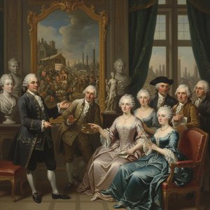
Reflections of an Age: Social Commentary & Artistic Representation in 18th-Century Society
Explore the social commentary & artistic representation of 18th-century society. Discover Rococo masterpieces, portraiture's power, and shifting historical perspectives. Expert insights for art lovers.
Iconic Art of the 18th & 19th Centuries: Masterpieces for Your Home | ArtsDot
Journey through 18th & 19th century art! Explore iconic masterpieces by Monet, Van Gogh & more. Discover the stories behind these timeless paintings and find museum-quality reproductions for your home at ArtsDot.com.