

 プレビュー
プレビュー
 シェアする
シェアする シェアする
シェアする
 詳細を見る
詳細を見る

 ダウンロード
 似ている作品
 X線調査
X線調査 スライドショー
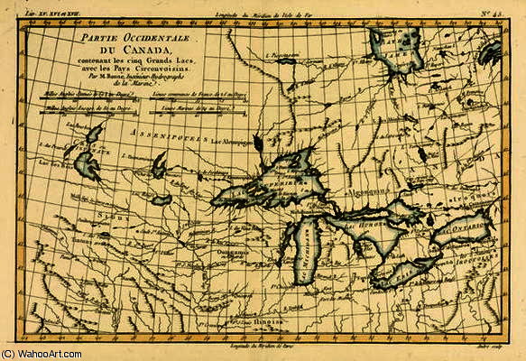
Western Canada, including the Five Great Lakes, from 'Atlas de Toutes les Parties Connues du Globe T

 詳細を見る
詳細を見る
ジークレー/アートプリント
迅速な制作と多彩な仕上げオプションを備えた、ミュージアムクオリティのジークレーまたはキャンバスプリント。 ( 手描きの絵画を購入 画像を購入)




































作品のオリジナル比率に合わせた、当店の規定サイズからお選びください。

特定のフレームやスペースに合わせて、ご自身でサイズを指定することも可能です。選択されたサイズが元の画像の比率と一致しない場合、作品をトリミングするか、鏡面反射または単色での塗りつぶしによって画像を拡張いたします。制作を開始する前に、ご確認用のデジタルモックアップをお送りいたします。
画面上のプレビューには、実際のトリミングや拡張は反映されませんのでご注意ください。最終的な構図を正確に確認できるのは、モックアップのみとなります。
カスタムサイズも承っておりますが、元の比率を維持するためには、あらかじめ用意されたリストからサイズを選択することをお勧めいたします。


 ガラスオプションは、110cm未満のサイズでのみご利用いただけます。

Western Canada, including the Five Great Lakes, from 'Atlas de Toutes les Parties Connues du Globe T
ジークレー/アートプリント
複製画のサイズ
-


合計金額
$ 62
関連作品


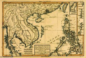
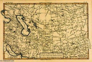



アーティストの略歴
The Architect of the Earth: The Life and Legacy of Rigobert Bonne
In the luminous era of the Enlightenment, where the pursuit of scientific truth danced alongside a burgeoning appreciation for aesthetic elegance, Rigobert Bonne emerged as a master of both realms. Born on October 6, 1727, in the quiet Ardennes region of Raucourt, Bonne’s journey was one of profound intellectual transformation. He began not as a scholar of the academy, but as a self-taught mathematician whose innate curiosity drove him to decode the complexities of the physical world. This early period of independent study laid the foundation for a career that would eventually bridge the gap between rigorous mathematical precision and the evocative beauty of cartographic art.
His path was significantly shaped by the discipline of military service during the War of Austrian Succession. Serving as an engineer at Berg-op-Zoom, Bonne developed a meticulous eye for detail and an observational aptitude that would become his hallmark. The rigors of military engineering instilled in him a respect for accuracy and structural integrity—qualities that were later translated into the delicate lines and precise measurements of his maps. When he eventually relocated to Paris, he transitioned from the battlefield to the classroom, establishing himself as a respected educator for the Parisian elite, a role that allowed him to weave scientific discovery into the cultural fabric of the French capital.
A Revolution in Perspective: The Bonne Projection
The true genius of Bonne lies in his ability to solve the fundamental paradox of cartography: how to represent a spherical world upon a flat surface without losing its essence. His most enduring contribution, the Bonne Projection, stands as a testament to his visionary intellect. By devising a method that utilized a heart-shaped configuration to represent the globe, he achieved a revolutionary improvement in geographic proportions. This was not merely a technical triumph; it was an artistic one. The projection minimized the distortions that plagued traditional flat maps, offering a visual representation that felt both more natural and more truthful to the human eye.
This innovation fundamentally altered the trajectory of cartographic history. Through his work, the map ceased to be a mere utilitarian tool and became a sophisticated piece of scientific art. His ability to balance the mathematical necessity of scale with the aesthetic demand for clarity allowed him to create works that were as captivating to look at as they were essential for navigation. This period of his career saw him rise to the prestigious position of Royal Hydrographer, a title that reflected his status as one of France's most vital scientific minds.
The Artistry of Exploration and Historical Significance
Beyond the technicalities of projection, Bonne’s work serves as a breathtaking window into the 18th-century worldview. His detailed engravings, often featured in monumental collections such as Guillaume Raynal’s 'Atlas de Toutes les Parties Connues du Globe Terrestre', capture a moment in time when the world was being rapidly rediscovered and redefined. Each map—whether depicting the vast expanses of the Russian Empire, the intricate coastlines of South America, or the dense landscapes of Asia—is a masterpiece of hand-drawn precision.
The historical significance of Bonne’s output cannot be overstated. His maps were more than just geographic records; they were symbols of human progress and the expansion of global knowledge. To study his work today is to witness the intersection of Enlightenment science and classical artistry. He left behind a legacy where every line, every border, and every shaded terrain serves as a tribute to the era of exploration. Through his eyes, we see a world being measured, mapped, and ultimately, understood with a beauty that remains timeless.
rigobert bonne (charles marie rigobert bonne)
1727 - 1795
基本情報
- Artistic Movement Or Style: Cartography
- Artists Or Movements Influenced By This Artist: ['Rococo']
- Artists Who Influenced This Artist: ['Jacques-Nicolas Bellin']
- Date Of Birth: October 6, 1727
- Date Of Death: September 2, 1794
- Full Name: Rigobert Bonne
- Nationality: French
- Notable Artworks:
- The Chinese Empire
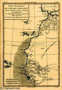
- West Coast of Africa
- The Canary Islands
- Place Of Birth: Raucourt, Ardennes (France)
関連記事
Mapping Beauty: Transform Your Space with Stunning Topographical Artworks
Elevate your interiors with breathtaking topographical art. From vintage cartography to textured 3D reliefs, discover how hand-painted maps and historical landscapes can transform any room into a sophisticated sanctuary of discovery and timeless beauty.
18th Century Masters: 10 Artworks That Define an Era | ArtsDot
Journey through 18th century art! Explore 10 iconic paintings – from Rococo elegance to Neoclassical grandeur. Discover Fragonard, David & more. Find museum-quality reproductions and elevate your home decor on ArtsDot.com.
Reflections of an Age: Social Commentary & Artistic Representation in 18th-Century Society
Explore the social commentary & artistic representation of 18th-century society. Discover Rococo masterpieces, portraiture's power, and shifting historical perspectives. Expert insights for art lovers.
Iconic Art of the 18th & 19th Centuries: Masterpieces for Your Home | ArtsDot
Journey through 18th & 19th century art! Explore iconic masterpieces by Monet, Van Gogh & more. Discover the stories behind these timeless paintings and find museum-quality reproductions for your home at ArtsDot.com.
葛飾北斎:25の傑作が語る浮世絵の世界 - ArtsDot
葛飾北斎の25選:『神奈川沖浪裏』や『富嶽三十六景』など、浮世絵の世界を深く探求。木版画の技法と日本美術の美をArtsDotで。高品質なアートプリントで空間に感動を。コレクションはこちら。

