

 プレビュー
プレビュー
 シェアする
シェアする シェアする
シェアする
 詳細を見る
詳細を見る

 ダウンロード
 似ている作品
 X線調査
X線調査 スライドショー
 統計情報
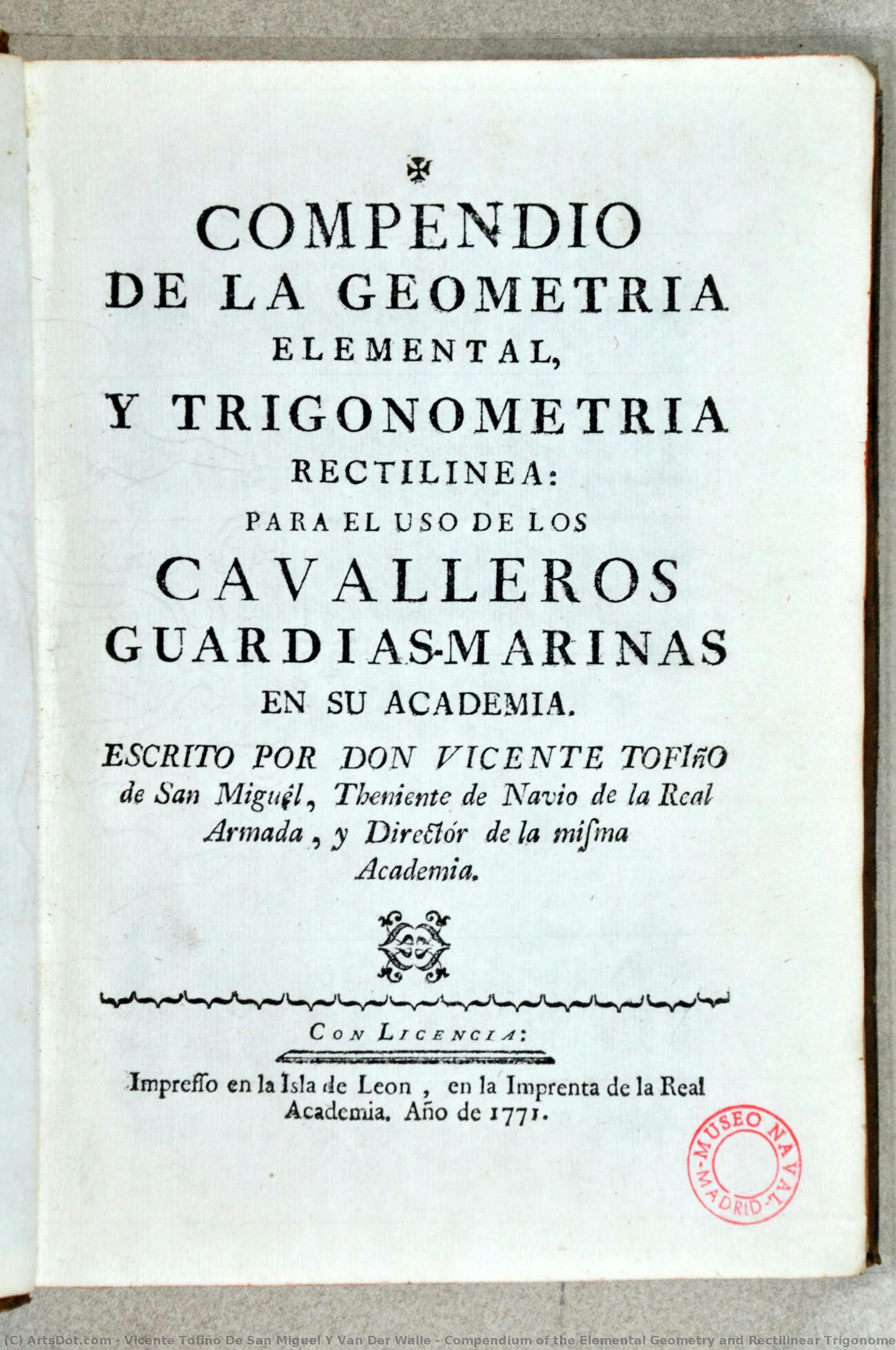
統計情報Compendium of the Elemental Geometry and Rectilinear Trigonometry


 詳細を見る
詳細を見る
手描き油彩複製画
当社のアーティストが、お客様のご希望のサイズと額縁に合わせて、キャンバスに手描きで制作する油彩画です。 ( プリント版に切り替え デジタル画像販売へ切り替え)




































作品のオリジナル比率に合わせた、当店の規定サイズからお選びください。

特定のフレームやスペースに合わせて、ご希望のサイズをご入力いただけます。選択されたサイズが元の画像の比率と異なる場合、アートワークをトリミングするか、手描きで要素を追加して絵画を拡張いたします。デジタルモックアップ を制作し、制作開始前にご確認(承認)をいただきます。
画面上のプレビューは、実際のトリミングや拡張を正確に反映しているものではありません。最終的な構図は、モックアップによってのみ正確にご確認いただけます。
カスタムサイズもご利用いただけますが、元の比率を維持するためには、あらかじめ用意されたリストからサイズを選択することをお勧めいたします。
ご注文後、ArtsDot.com チームより詳細な指示をお送りするとともに、仕上がりイメージ(モックアップ)をご提供いたします。


 ガラスオプションは、110cm未満のサイズでのみご利用いただけます。

Compendium of the Elemental Geometry and Rectilinear Trigonometry
複製技法
複製画のサイズ
-


合計金額
$ 263
関連作品

アーティストの略歴
A Cartographer of the Spanish Seas: The Life and Legacy of Vicente Tofiño de San Miguel
Vicente Tofiño de San Miguel y Van der Walle, born in Cartagena, Spain, in 1732, was a figure whose life embodied the spirit of Enlightenment-era scientific exploration interwoven with dedicated naval service. He wasn’t merely a cartographer; he was an architect of Spanish maritime power, a hydrographer who meticulously charted not just coastlines but also the ambitions of an empire. His story is one of rigorous study, practical application, and a lasting contribution to the understanding and navigation of the Iberian Peninsula's complex waters.
Tofiño’s early life hinted at his future path. He initially pursued studies in experimental physics before entering the military. However, it was through his association with Jorge Juan y Santacilia – a pivotal figure in Spanish scientific expeditions – that Tofiño found his true calling. Appointed as a mathematics master at the Academia de Guardia Marinas in Cádiz in 1755, he seamlessly transitioned into naval service as an alférez de navío. This period marked not just a career shift but a deepening engagement with the practical demands of seafaring and the necessity for accurate nautical knowledge.
The Director of Academies and the Pursuit of Hydrographic Precision
Tofiño’s ascent within the Spanish naval hierarchy was swift, reflecting his dedication and burgeoning expertise. In 1768, he assumed the directorship of the Academia de Guardia Marinas in Cádiz, a position he would simultaneously hold at similar institutions in Ferrol and Cartagena by 1773. This oversight allowed him to standardize curricula and instill a new generation of naval officers with his commitment to precision and scientific methodology. He understood that effective cartography wasn’t simply about drawing lines on paper; it was about fostering a culture of observation, calculation, and meticulous record-keeping.
His involvement in the 1775 expedition against Algiers and the subsequent siege of Gibraltar (1779-1783) underscored the critical importance of accurate charts. These campaigns revealed deficiencies in existing nautical maps, fueling Tofiño’s determination to create a comprehensive atlas that would address these shortcomings. He recognized firsthand the dangers posed by imprecise navigation – shipwrecks, logistical failures, and ultimately, compromised military operations.
The Atlas Marítimo de España: A Monumental Achievement
Tofiño’s magnum opus, the Atlas Marítimo de España completed in 1787, stands as a testament to his unwavering dedication. This wasn't merely an update of existing charts; it was a complete re-evaluation and detailed mapping of the entire Spanish coastline. The atlas incorporated not only precise geographical data but also descriptions of coasts, harbors, bays, depths, currents, and potential hazards. It represented years of painstaking work – surveying coastlines, correcting errors in previous maps, and synthesizing information from diverse sources.
The Atlas was revolutionary for its time. Its clarity, accuracy, and comprehensiveness set a new standard for nautical cartography. It wasn’t simply a tool for military strategists; it facilitated trade, exploration, and the overall economic prosperity of Spain. The detailed depictions of harbors allowed for safer navigation, while accurate representations of currents aided in more efficient voyages. It is a remarkable example of how scientific endeavor could directly translate into tangible benefits for society.
Influence and Historical Significance
Vicente Tofiño de San Miguel’s influence extended far beyond the immediate impact of his Atlas Marítimo de España. He trained generations of Spanish naval officers, instilling in them a commitment to scientific rigor and meticulous observation. His work laid the foundation for future hydrographic endeavors within Spain and contributed significantly to the development of modern cartography.
While perhaps not as widely celebrated as some of his contemporaries, Tofiño’s contribution was profoundly practical and enduring. He wasn't a flamboyant explorer or a daring admiral; he was a dedicated scientist and naval officer who understood that knowledge – specifically, accurate nautical knowledge – was power. His legacy lives on in the charts still used today, a silent testament to the vision of a man who meticulously mapped the Spanish seas and, in doing so, helped shape the course of an empire.
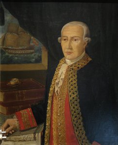
vicente tofiño de san miguel y van der walle
1732 - 1795 , Spain
基本情報
- Artistic Movement Or Style: Cartography, Hydrography
- Date Of Birth: September 6, 1732
- Date Of Death: January 15, 1795
- Full Name: Vicente Tofiño de San Miguel y Van der Walle
- Nationality: Spanish
- Notable Artworks:
- Maritime Atlas of Spain
- Compendium of Geometry
- Cape Santa Maria Chart
- Place Of Birth: Cartagena, Spain