


 Предпросмотр
 Поделиться
 Поделиться
 Детали произведения

 Скачать
 Похожие работы
 Рентгенография
 Слайд-шоу
 Статистика
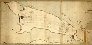
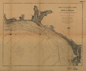
Maritime Atlas of Spain—Cape Santa Maria

 Читать далее
Приобретите цифровое изображение высокого разрешения в улучшенном качестве, которое значительно превосходит онлайн-превью.
Каждый файл тщательно подготавливается нашими специалистами с использованием передовых инструментов и экспертной ручной ретуши. Мы гарантируем исключительную четкость, точную цветопередачу и детальную проработку каждого изображения.
Финальный файл доставляется по электронной почте в течение 72 часов и оптимизирован для немедленного использования в профессиональной среде, при верстке и печати. Это тот же уровень качества, которому доверяют ведущие дизайнерские студии, издательства и галереи.
Цифровое изображение
Скачайте файл высокого разрешения для личного использования, печати и творческих проектов. ( Перейти к печати Купить картину ручной работы)
Включено в каждый заказ цифровых изображений
Гарантия экспертной цифровой доставки
Выбирая ArtsDot.com, вы получаете не просто изображение — вы приобретаете профессионально обработанное цифровое произведение искусства, созданное с безупречной точностью и под защитой гарантии качества. Вот всё, что автоматически входит в ваш заказ:

Мгновенная доставка по e-mail
Ваш цифровой файл в высоком разрешении будет отправлен вам по электронной почте в течение 72 часов после оформления заказа — и сразу станет доступен для использования.

Цифровой файл с ИИ-улучшением
Ваше произведение искусства проходит профессиональную оптимизацию с использованием передовых инструментов ИИ и ручной обработки, что гарантирует максимальную детализацию, четкость и точность цветопередачи.

Бессрочная бесплатная повторная доставка
Случайно удалили или потеряли файл? Не беспокойтесь — мы отправим его вам повторно в любое время и совершенно бесплатно.

Без импортных пошлин — навсегда
Наслаждайтесь вашим произведением искусства мгновенно без таможенных пошлин, сборов или затрат на доставку — цифровые загрузки всегда не облагаются налогом.

Гарантия точности цветопередачи
Мы гарантируем, что ваше цифровое изображение максимально точно передает оригинальные цвета благодаря использованию профессиональных инструментов и систем управления цветом.

Гарантия удовлетворенности 100 дней
Если вы не будете удовлетворены своим цифровым изображением, мы внесем правки или вернем 100% стоимости в течение 100 дней — без лишних вопросов.

100% Гарантия возврата средств
Не удовлетворены покупкой? Получите полный возврат средств в течение 100 дней после получения цифрового файла — без лишних вопросов.

Скидки на оптовые заказы
Купите 3 изображения, сэкономьте 10% — Купите 5, сэкономьте 15% — Купите 10+, сэкономьте 20%. Отличное решение для творческих проектов, галерей и агентств.
Похожие произведения

Биография художника
A Cartographer of the Spanish Seas: The Life and Legacy of Vicente Tofiño de San Miguel
Vicente Tofiño de San Miguel y Van der Walle, born in Cartagena, Spain, in 1732, was a figure whose life embodied the spirit of Enlightenment-era scientific exploration interwoven with dedicated naval service. He wasn’t merely a cartographer; he was an architect of Spanish maritime power, a hydrographer who meticulously charted not just coastlines but also the ambitions of an empire. His story is one of rigorous study, practical application, and a lasting contribution to the understanding and navigation of the Iberian Peninsula's complex waters.
Tofiño’s early life hinted at his future path. He initially pursued studies in experimental physics before entering the military. However, it was through his association with Jorge Juan y Santacilia – a pivotal figure in Spanish scientific expeditions – that Tofiño found his true calling. Appointed as a mathematics master at the Academia de Guardia Marinas in Cádiz in 1755, he seamlessly transitioned into naval service as an alférez de navío. This period marked not just a career shift but a deepening engagement with the practical demands of seafaring and the necessity for accurate nautical knowledge.
The Director of Academies and the Pursuit of Hydrographic Precision
Tofiño’s ascent within the Spanish naval hierarchy was swift, reflecting his dedication and burgeoning expertise. In 1768, he assumed the directorship of the Academia de Guardia Marinas in Cádiz, a position he would simultaneously hold at similar institutions in Ferrol and Cartagena by 1773. This oversight allowed him to standardize curricula and instill a new generation of naval officers with his commitment to precision and scientific methodology. He understood that effective cartography wasn’t simply about drawing lines on paper; it was about fostering a culture of observation, calculation, and meticulous record-keeping.
His involvement in the 1775 expedition against Algiers and the subsequent siege of Gibraltar (1779-1783) underscored the critical importance of accurate charts. These campaigns revealed deficiencies in existing nautical maps, fueling Tofiño’s determination to create a comprehensive atlas that would address these shortcomings. He recognized firsthand the dangers posed by imprecise navigation – shipwrecks, logistical failures, and ultimately, compromised military operations.
The Atlas Marítimo de España: A Monumental Achievement
Tofiño’s magnum opus, the Atlas Marítimo de España completed in 1787, stands as a testament to his unwavering dedication. This wasn't merely an update of existing charts; it was a complete re-evaluation and detailed mapping of the entire Spanish coastline. The atlas incorporated not only precise geographical data but also descriptions of coasts, harbors, bays, depths, currents, and potential hazards. It represented years of painstaking work – surveying coastlines, correcting errors in previous maps, and synthesizing information from diverse sources.
The Atlas was revolutionary for its time. Its clarity, accuracy, and comprehensiveness set a new standard for nautical cartography. It wasn’t simply a tool for military strategists; it facilitated trade, exploration, and the overall economic prosperity of Spain. The detailed depictions of harbors allowed for safer navigation, while accurate representations of currents aided in more efficient voyages. It is a remarkable example of how scientific endeavor could directly translate into tangible benefits for society.
Influence and Historical Significance
Vicente Tofiño de San Miguel’s influence extended far beyond the immediate impact of his Atlas Marítimo de España. He trained generations of Spanish naval officers, instilling in them a commitment to scientific rigor and meticulous observation. His work laid the foundation for future hydrographic endeavors within Spain and contributed significantly to the development of modern cartography.
While perhaps not as widely celebrated as some of his contemporaries, Tofiño’s contribution was profoundly practical and enduring. He wasn't a flamboyant explorer or a daring admiral; he was a dedicated scientist and naval officer who understood that knowledge – specifically, accurate nautical knowledge – was power. His legacy lives on in the charts still used today, a silent testament to the vision of a man who meticulously mapped the Spanish seas and, in doing so, helped shape the course of an empire.
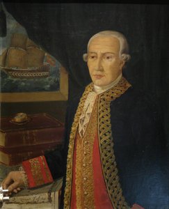
vicente tofiño de san miguel y van der walle
1732 - 1795 , Spain
Основные сведения
- Artistic Movement Or Style: Cartography, Hydrography
- Date Of Birth: September 6, 1732
- Date Of Death: January 15, 1795
- Full Name: Vicente Tofiño de San Miguel y Van der Walle
- Nationality: Spanish
- Notable Artworks:
- Maritime Atlas of Spain
- Compendium of Geometry
- Cape Santa Maria Chart
- Place Of Birth: Cartagena, Spain