
Showing 7 artworks with Rigobert Bonne (Charles Marie Rigobert Bonne)
-
Rigobert Bonne (Charles Marie Rigobert Bonne)
Not available for this selection
- Khaki
- Putty
- Driftwood
- Rosy Brown
Not available for this selection



- Rigobert Bonne Map
- 18Th Century Map
- Historical Maps
- Vintage Cartography
- Cartographic Artwork
- Atlas De Toutes Globe
- Antique Map Print
- Cartographic Art
- Old World Maps
- Antique World Map
- Historical Map Art
- Topographical Map
- Engraved Map Artwork
- Spain Coastline Map
- Brown Ink Map
- Hand Colored Map
- Rare Map Collectible
- “Sepia Map”
- Map Collection
- Western Canada Map
- World Map Details
- Faded Ink Map
- Brown Ochre Colors
- Antique Cartography
- Madeira Island Map
- “Historical Map”
- Great Lakes Map
- Newfoundland Map
- “Gulf Of Mexico Map”
- Antilles Map”
- Map Collector Item
- “Engraving Map”
- Vintage Canadian Map
- Porto Santo Map
- Antique Paper Map
- World Map Vintage
- Russian Empire Map
- Old World Map Print
- Atlantic Coast Map
- Grenada Map Antique
- “Vintage Map”
- 18Th Century Cartography
- Vintage Map Design
- Brown And Blue Map
- Vintage Paper Map
- 18Th Century Design
- Canada Map History
- Hand Drawn Map
- New Andalucia Map
- New France Map
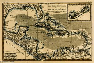
Discover Rigobert Bonne’s 18th-century map of the Antilles & Gulf of Mexico! A detailed engraving showcasing colonial Caribbean geography. Explore historical cartography.
Discover Rigobert Bonne’s antique map of Western Canada & the Great Lakes (1795). A detailed, hand-drawn topographical chart in faded colors – a rare glimpse into 18th/19th-century cartography.
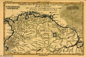
Discover 'The New Kingdoms of Grenada' by Rigobert Bonne (1727-1795). A stunning 18th-century map showcasing Guyana & Andalucia, engraved with intricate detail. Explore historical cartography!
Discover Rigobert Bonne’s antique map of West Africa (1795). A detailed 18th-century cartographic masterpiece showcasing Spain's coastline in monochrome hatching & line work.
Explore Rigobert Bonne’s antique map of the Canary Islands & Madeira (1795). Detailed cartography in brown ink reveals 18th-century exploration & navigation.
Vintage map of New France by Rigobert Bonne (1727-1795). Detailed 18th-century cartography showcasing Newfoundland, Nova Scotia & St John Island. Hand-colored engraving.
Discover Rigobert Bonne’s stunning 18th-century map of the Russian Empire! A detailed, hand-drawn cartographic masterpiece showcasing Europe & Asia. Explore its classical style and historical significance.

