

 Ver en contexto
 Enviar
 Compartir
 Detalles

 Descargar
 Similares
 Radiografía
 Presentación de diapositivas
 Estadísticas
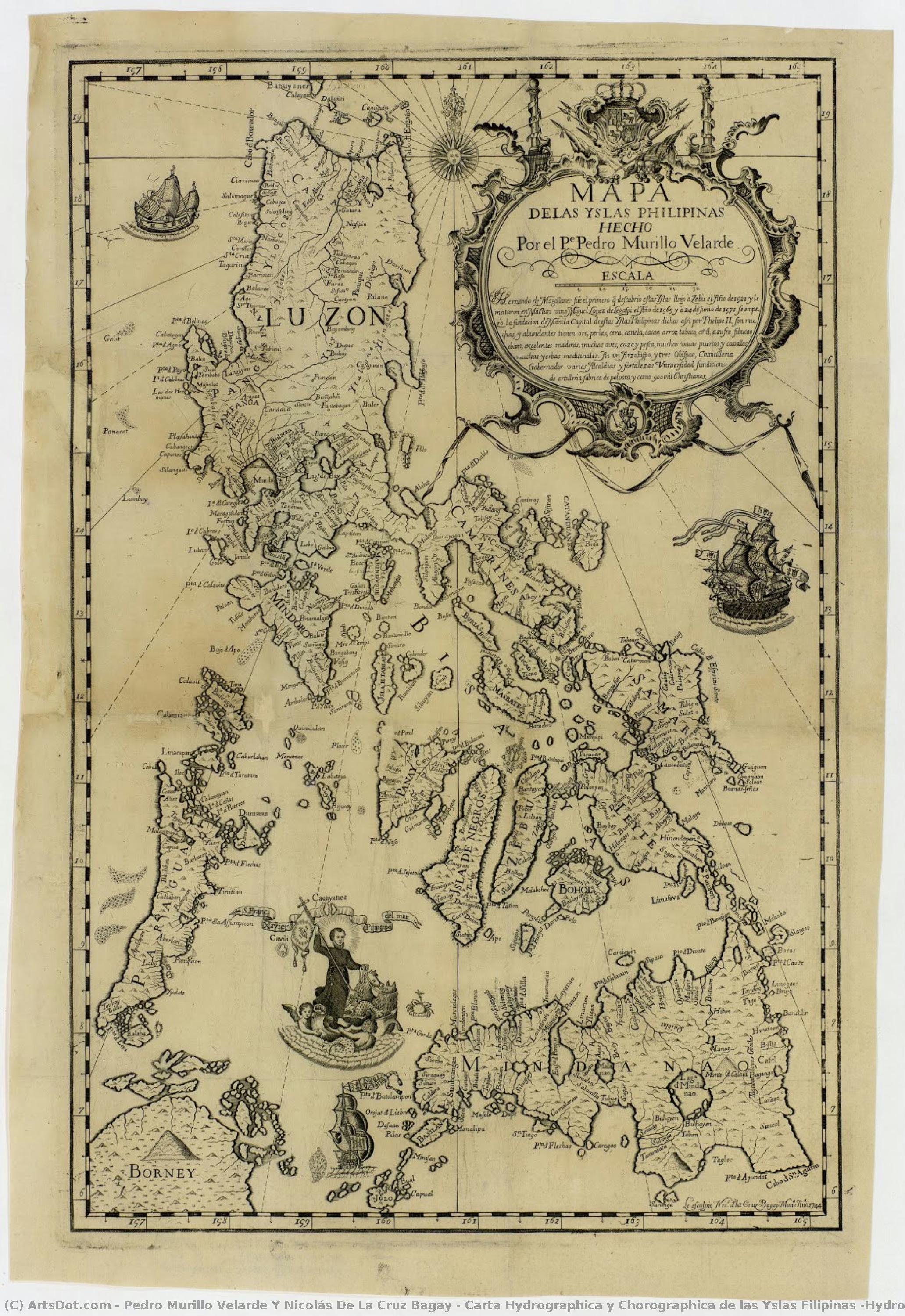
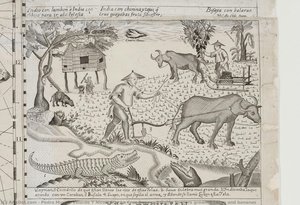
Carta Hydrographica y Chorographica de las Yslas Filipinas (Hydrographic and Chorographic Map of the Philippines)


 Ver más
Adquiera una imagen digital de alta resolución y optimizada, muy superior a la vista previa en línea.
Cada archivo es preparado meticulosamente por nuestros especialistas internos mediante el uso de herramientas avanzadas y un experto retoque manual. Nos aseguramos de que cada imagen posea una claridad excepcional, una precisión cromática impecable y un detalle minucioso.
El archivo final se entrega por correo electrónico en un plazo de 72 horas, optimizado para su uso inmediato en entornos profesionales, editoriales y de impresión. Esta es la misma calidad en la que confían los estudios de diseño, las editoriales y las galerías de primer nivel.
Imagen Digital
Descarga un archivo de alta resolución para exhibición personal, impresión y proyectos creativos. ( Cambiar a Impresión Comprar pintura hecha a mano)
Incluido en cada pedido de imágenes digitales
Entrega digital experta, garantizada.
Al elegir ArtsDot.com, no solo está adquiriendo una imagen; está recibiendo una obra de arte digital mejorada profesionalmente, elaborada con precisión y respaldada por una garantía de satisfacción. Esto es todo lo que incluye su pedido, automáticamente:

Entrega rápida por email
Recibirá su archivo de imagen digital en alta resolución por correo electrónico en un plazo de 72 horas tras realizar su pedido, listo para su uso inmediato.

Archivo digital optimizado por IA
Su obra de arte se optimiza profesionalmente mediante herramientas avanzadas de IA y edición manual, garantizando el máximo detalle, claridad y precisión cromática.

Reenvío gratuito de por vida
¿Has borrado o perdido tu archivo por error? No te preocupes: te lo volveremos a enviar en cualquier momento, sin coste adicional.

Sin gastos de importación, siempre
Disfrute de su obra de arte al instante sin aduanas, aranceles ni gastos de envío; las descargas digitales siempre están libres de impuestos.

Garantía de fidelidad de color
Garantizamos que su imagen digital refleje los colores originales con la mayor fidelidad posible, mediante el uso de herramientas profesionales y gestión del color.

Garantía de satisfacción de 100 días
Si no está satisfecho con su imagen digital, la revisaremos o le reembolsaremos el 100% en un plazo de 100 días, sin preguntas.

100% Garantía de devolución de dinero
¿No está satisfecho? Obtenga un reembolso completo dentro de los 100 días posteriores a la recepción de su archivo digital, sin preguntas.

Descuentos por pedidos grandes
Compra 3 imágenes, ahorra 10% - Compra 5, ahorra 15% - Compra 10+, ahorra 20%. Ideal para proyectos creativos, galerías y agencias.
Obras relacionadas







Biografía del artista
The Architect of the Archipelago: The Legacy of Pedro Murillo Velarde
In the golden age of Spanish maritime exploration, few names resonate with as much scientific and cultural weight as Pedro Murillo Velarde. A man whose life was defined by the intersection of faith, mathematics, and discovery, Velarde was far more than a mere cartographer; he was a visionary who sought to capture the very soul of the Philippine archipelago through the precision of science. Born in Madrid, Spain, his early years were steeped in the rigorous intellectual traditions of Jesuit education. At Loyola College Madrid, he honed his mastery over the celestial and the terrestrial, developing an exceptional aptitude for astronomy and geometric calculations. This profound scientific foundation would later serve as the compass for his most enduring contribution to human knowledge.
The trajectory of Velarde’s life shifted irrevocably in 1726 when he accepted a prestigious mission from the Jesuit Order to relocate to Manila. Tasked with establishing a new observatory in the Spanish East Indies, Velarde brought with him an unwavering dedication to empirical observation. His arrival in the Philippines marked the beginning of a transformative era where European scientific methodology met the rich, complex realities of the Pacific. This period of his life was not merely about mapping coastlines; it was about translating the vast, intricate geography of a burgeoning colonial frontier into a language that the rest of the world could comprehend.
A Symphony of Collaboration and Craft
The true brilliance of Velarde’s work lies in its profound collaborative nature, representing a rare and beautiful union between European scholarship and indigenous artistry. While Velarde provided the mathematical rigor and hydrographic data gathered from arduous Jesuit expeditions, he recognized that such a monumental undertaking required a master's touch in physical form. This led to his historic partnership with Nicolás de la Cruz Bagay, an artisan of extraordinary talent from Pangasinan. As an engraver of unparalleled skill, Bagay possessed the ability to translate complex topographical surveys onto copper plates with breathtaking clarity.
Together, they breathed life into the Carta Hydrographica y Chorographica de las Islas Filipinas. This was not a solitary achievement but a multidisciplinary masterpiece that also drew upon the artistic vision of Francisco Suárez. The resulting work was a tapestry of information, where scientific accuracy met aesthetic splendor. Through their combined efforts, the map became more than a navigational tool; it became a narrative medium. It depicted not only the intricate web of rivers, harbors, and islands but also the human element of the archipelago, illustrating various ethnic groups and the vibrant life that pulsed through the Spanish East Indies.
The Mother of All Philippine Maps
Completed in 1734, the Velarde Map has earned its venerable title as the "Mother of all Philippine Maps." Its historical significance cannot be overstated, as it stands as the first and most important scientific chart of the Philippines ever produced. The map’s intricate detail—capturing maritime routes from Manila to Spain and New Spain—provided a vital lifeline for colonial commerce and naval strategy. It was a document of immense political power, dedicated to the King of Spain, yet it possessed an ethnographic depth that captured the diverse identities of the islands, from the Sangley to the various indigenous tribes.
The map’s journey through history is as dramatic as its creation. During the British occupation of Manila in the late 18th century, the very copper plates used to print this masterpiece were seized and transported to England. This displacement led to a proliferation of copies across Europe, turning the Velarde Map into a celebrated antiquity that commanded high prices among collectors. Today, we look upon the work of Pedro Murillo Velarde not just as a relic of colonial cartography, but as a monumental achievement of human intellect—a moment in time when science and art converged to define the identity of an entire nation.
Breves datos
- Artistic Movement Or Style: Jesuit Cartography
- Artists Or Movements Influenced By This Artist: ['Cartography']
- Artists Who Influenced This Artist: ['Juan Ruiz Zafra']
- Date Of Birth: Living
- Full Name: Pedro Murillo Velarde y Nicolás de la Cruz Bagay
- Nationality: Spanish
- Notable Artworks: ['Carta Hydrographica y Chorographica de las Islas Filipinas']
- Place Of Birth: Spain