

 プレビュー
プレビュー
 プリントを購入
 シェアする
シェアする シェアする
シェアする
 詳細を見る
詳細を見る

 ダウンロード
 似ている作品
 X線調査
X線調査 スライドショー
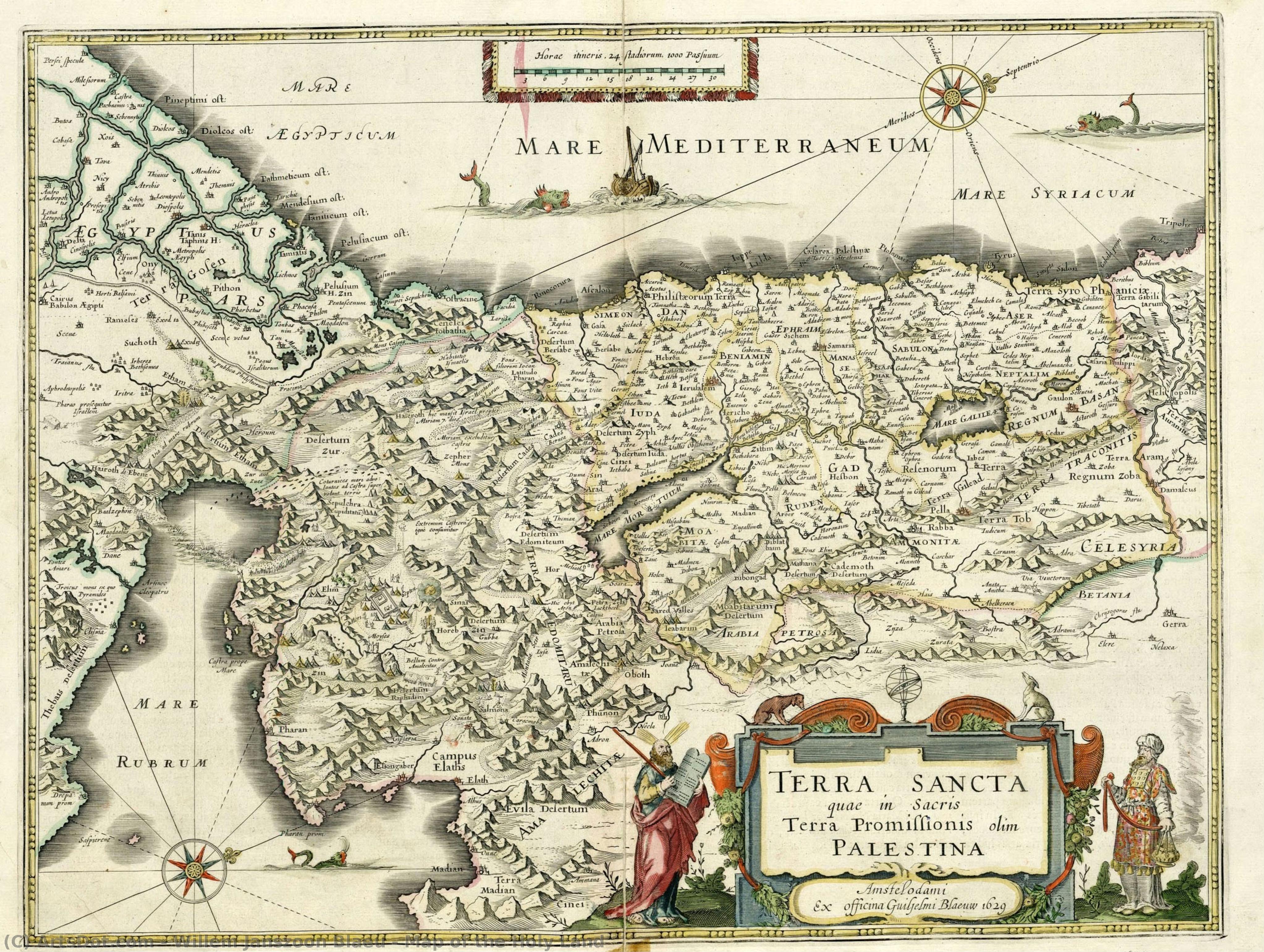
Map of the Holy Land
 Oil On Copper
- Baroque
 1629
1629- Early Modern
 38.0 x 49.0 cm
 イスラエル国立図書館
 詳細を見る
詳細を見る
オンラインプレビューをはるかに凌ぐ、高解像度で鮮明なデジタル画像をご購入いただけます。
各ファイルは、社内の専門家が高度なツールと熟練した手作業によるレタッチを用いて、細心の注意を払って準備されています。すべての画像において、卓越した鮮明度、正確な色彩再現性、そして繊細なディテールを保証いたします。
最終ファイルは、プロフェッショナルな編集・印刷環境ですぐにご利用いただけるよう最適化された状態で、72時間以内にメールにてお届けいたします。これは、一流のデザインスタジオ、出版社、ギャラリーから信頼されているものと同等の品質です。
デジタル画像のご注文に付随する特典
高品質なデジタル画像配信を、確かな品質で。
ArtsDot.com を選ぶことは、単に画像を手に入れることではありません。それは、プロの手によって精密に仕上げられ、満足保証が付いた高品質なデジタルアートワークを受け取ることを意味します。ご注文いただいた際に自動的に付随する内容は、以下の通りです:

メールですぐにお届け
ご注文から72時間以内に、高解像度のデジタル画像ファイルがメールでお手元に届きます。すぐにそのままご利用いただけます。

AI技術で最適化されたデジタルファイル
お客様の作品は、高度なAIツールと専門家による手作業の編集を組み合わせてプロフェッショナルに最適化されており、細部のディテール、鮮明さ、そして正確な色再現性を最大限に引き出しています。

一生涯無料の再送サービス
ファイルを誤って削除したり、紛失してしまったりしましたか?ご安心ください。いつでも無料で再送いたします。

輸入手数料は一切かかりません
関税や手数料、配送料を気にすることなく、お気に入りのアートワークをすぐにお楽しみいただけます。デジタルダウンロードは常に免税です。

色彩再現の保証
プロ仕様のツールとカラーマネジメント技術を用いることで、デジタル画像が元の色を最大限に忠実に再現することを保証いたします。

60日間満足保証
ご購入いただいたデジタル画像にご満足いただけない場合は、60日以内であれば、修正または100%の返金(理由を問う必要はありません)をさせていただきます。

100% 返金保証
ご満足いただけない場合は、デジタルファイルを受け取ってから60日以内であれば、理由を問わず全額返金いたします。

まとめ買い割引
3枚購入で10%OFF - 5枚購入で15%OFF - 10枚以上購入で20%OFF。クリエイティブなプロジェクト、ギャラリー、エージェンシーに最適です。
作品の詳細
A Journey Through Time: The Cartographic Mastery of Willem Janszoon Blaeu
In the quiet corridors of the National Library of Israel, there exists a window into the seventeenth century that transcends mere geography. Map of the Holy Land, created in 1629 by the legendary Dutch cartographer Willem Janszoon Blaeu, is far more than a navigational tool; it is a profound piece of historical storytelling. Rendered with the meticulous precision that defined the Dutch Golden Age, this work captures the sacred topography of a region central to human faith and history. As one gazes upon the intricate details of Jerusalem, Bethlehem, and Nazareth, the map ceases to be a flat surface and becomes a spiritual pilgrimage, inviting the viewer to wander through the ancient landscapes of Mount Sinai and Mount Tabor.
The technical brilliance of this piece lies in its medium and execution. Originally etched onto copper, the work possesses a clarity and sharpness that allowed Blaeu to communicate complex topographical data with unparalleled elegance. In this particular presentation, the monochromatic palette lends an air of timelessness and gravity to the composition. The stark contrast of black and white emphasizes the delicate linework, highlighting the rugged silhouettes of mountains and the precise placement of ancient settlements. For the discerning collector or interior designer, this aesthetic offers a sophisticated, understated elegance that complements both classical and contemporary spaces, providing a focal point that is intellectually stimulating and visually serene.
To understand this map is to understand the era of great exploration. Willem Janszoon Blaeu was not merely a drawer of lines; he was a man shaped by the scientific revolutions of his time, having worked alongside the great astronomer Tycho Brahe. His work represents the intersection of art, science, and theology. During the 1600s, maps like this served as vital bridges between the known world and the mysteries of the divine. Every mountain range and riverbed depicted was a testament to the human desire to document, understand, and honor the sacred geography of the Earth. Owning a reproduction of such a masterpiece is an opportunity to possess a fragment of the Age of Discovery, bringing the spirit of intellectual curiosity and historical reverence into the modern home.
関連作品







作家の略歴
Willem Janszoon Blaeu: Life and Legacy
Early Life and Education
- Born: 1571, possibly in Alkmaar or Uitgeest, Netherlands.
- Willem Janszoon Blaeu’s early life was rooted in the family's herring trade business. However, his interests soon shifted towards more intellectual pursuits.
- He developed a keen interest in mathematics and astronomy, leading him to seek guidance from Adriaan Anthonisz, a surveyor and astronomer who became his scientific advisor.
- In 1592, at the age of 23, Blaeu moved to Amsterdam intending to further his involvement in the herring trade but quickly prioritized his burgeoning passion for cartography.
Years with Tycho Brahe and Early Cartographic Work
- A pivotal moment in Blaeu’s development came with a two-year stay (1594-1596) on the island of Hven, Denmark.
- There, he worked alongside Tycho Brahe, the renowned Danish astronomer, assisting with astronomical observations and mapmaking. This experience honed his skills in precision measurement and celestial mapping.
- Upon returning to Amsterdam, Blaeu established himself as a cartographer and globe maker, quickly gaining recognition for his accuracy and innovative techniques.
Establishing a Cartographic Empire
- In 1604, Blaeu published a world map that drew heavily from the work of Gerardus Mercator, particularly his projection. This map established Blaeu’s reputation as a leading cartographer.
- He expanded his business, producing globes and atlases alongside individual maps. His workshop became one of the largest and most productive in Amsterdam.
- Blaeu's Atlas Novus, published in 1635, was a landmark achievement – a comprehensive collection of maps renowned for their detail, accuracy, and artistic quality.
- The family business continued after his death with his sons Joan Blaeu and Cornelis Blaeu continuing the work.
Influences and Artistic Development
- Gerardus Mercator’s map projections profoundly influenced Blaeu's cartographic approach, particularly his use of the Mercator projection for nautical charts.
- Tycho Brahe’s emphasis on precise astronomical observation instilled in Blaeu a commitment to accuracy and scientific rigor.
- Blaeu integrated artistic elements into his maps, employing decorative cartouches, elaborate borders, and detailed illustrations. This combined scientific precision with aesthetic appeal.
Major Achievements and Historical Significance
- Innovation in Mapmaking: Blaeu pioneered new techniques for map production, including the use of multiple plates to create colored maps.
- Comprehensive Atlases: His atlases were among the most comprehensive and influential of their time, providing detailed geographical information for merchants, explorers, and scholars.
- Stimulating Competition: Blaeu’s rivalry with Jodocus Hondius and his heirs spurred a period of intense competition in cartography, leading to unprecedented levels of production and innovation during the Dutch Golden Age.
- Legacy: Willem Janszoon Blaeu's maps remain valuable historical documents, offering insights into 17th-century geography, exploration, and artistic sensibilities. His work significantly contributed to the advancement of cartography and our understanding of the world.
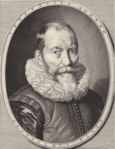
willem janszoon blaeu
1571 - 1638 , Netherlands
プロフィール概要
- Birth Date: 1571
- Birth Place: Alkmaar, Netherlands
- Death Date: 1638
- Influenced: Jodocus Hondius
- Influenced By: Gerardus Mercator, Tycho Brahe
- Movement: Golden Age Cartography
- Name: Willem Janszoon Blaeu
- Nationality: Dutch
- Notable Works: World Map (1604), Atlases, Globes

