

 Предпросмотр
 Поделиться
 Поделиться
 Детали произведения

 Скачать
 Похожие работы
 Рентгенография
 Слайд-шоу
 Статистика
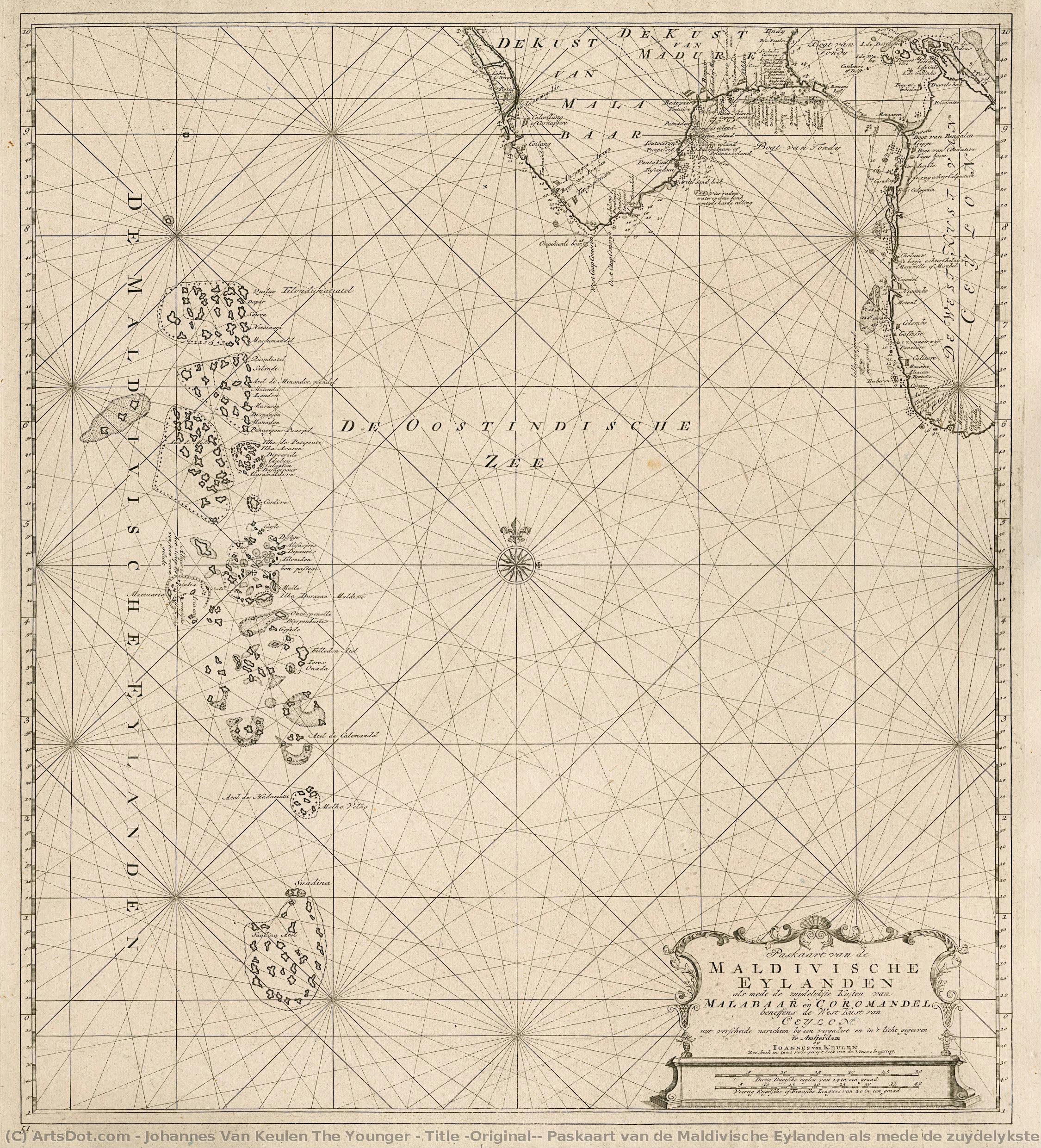
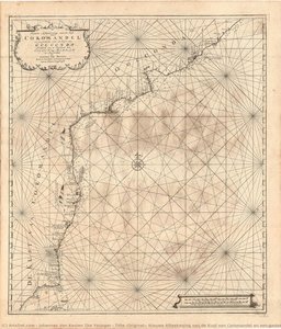
Title (Original): Paskaart van de Maldivische Eylanden als mede de zuydelykste kusten van Malabaar en Coromandel beneffens de west-kust van Ceylon.
 Engraving
 Early Modern
 59.0 x 53.0 cm
 Kalakriti Archives
 Читать далее
Приобретите цифровое изображение высокого разрешения в улучшенном качестве, которое значительно превосходит онлайн-превью.
Каждый файл тщательно подготавливается нашими специалистами с использованием передовых инструментов и экспертной ручной ретуши. Мы гарантируем исключительную четкость, точную цветопередачу и детальную проработку каждого изображения.
Финальный файл доставляется по электронной почте в течение 72 часов и оптимизирован для немедленного использования в профессиональной среде, при верстке и печати. Это тот же уровень качества, которому доверяют ведущие дизайнерские студии, издательства и галереи.
Цифровое изображение
Скачайте файл высокого разрешения для личного использования, печати и творческих проектов. ( Перейти к печати Купить картину ручной работы)
Включено в каждый заказ цифровых изображений
Гарантия экспертной цифровой доставки
Выбирая ArtsDot.com, вы получаете не просто изображение — вы приобретаете профессионально обработанное цифровое произведение искусства, созданное с безупречной точностью и под защитой гарантии качества. Вот всё, что автоматически входит в ваш заказ:

Мгновенная доставка по e-mail
Ваш цифровой файл в высоком разрешении будет отправлен вам по электронной почте в течение 72 часов после оформления заказа — и сразу станет доступен для использования.

Цифровой файл с ИИ-улучшением
Ваше произведение искусства проходит профессиональную оптимизацию с использованием передовых инструментов ИИ и ручной обработки, что гарантирует максимальную детализацию, четкость и точность цветопередачи.

Бессрочная бесплатная повторная доставка
Случайно удалили или потеряли файл? Не беспокойтесь — мы отправим его вам повторно в любое время и совершенно бесплатно.

Без импортных пошлин — навсегда
Наслаждайтесь вашим произведением искусства мгновенно без таможенных пошлин, сборов или затрат на доставку — цифровые загрузки всегда не облагаются налогом.

Гарантия точности цветопередачи
Мы гарантируем, что ваше цифровое изображение максимально точно передает оригинальные цвета благодаря использованию профессиональных инструментов и систем управления цветом.

Гарантия удовлетворенности 100 дней
Если вы не будете удовлетворены своим цифровым изображением, мы внесем правки или вернем 100% стоимости в течение 100 дней — без лишних вопросов.

100% Гарантия возврата средств
Не удовлетворены покупкой? Получите полный возврат средств в течение 100 дней после получения цифрового файла — без лишних вопросов.

Скидки на оптовые заказы
Купите 3 изображения, сэкономьте 10% — Купите 5, сэкономьте 15% — Купите 10+, сэкономьте 20%. Отличное решение для творческих проектов, галерей и агентств.
Похожие произведения





Биография художника
early life and background
johannes van keulen the younger, a dutch cartographer and publisher, was born in amsterdam in 1704. he was the grandson of johannes van keulen, a renowned cartographer who had published influential nautical atlases.family business and official mapmaker
johannes van keulen the younger took over the family business from his father, gerard van keulen, becoming the official mapmaker for the amsterdam office of the dutch east india company. this position allowed him to continue the legacy of his grandfather's cartographic work.publishing new editions of the zee-fakkel
one of johannes van keulen the younger's notable achievements was publishing new editions of the zee-fakkel, a five-volume atlas that had been first published by his grandfather. this atlas was a significant contribution to the field of cartography, providing accurate and detailed maps for navigation.artistic style and influences
although johannes van keulen the younger's work was primarily focused on cartography, his engravings and maps showcased a unique blend of artistic style and technical precision. his use of engraving techniques and attention to detail reflect the influence of dutch golden age art.notable works and collections
- the museum stedelijk museum amsterdam, netherlands, features a collection of johannes van keulen the younger's works, including his cartographic contributions.
- some of his notable engravings can be found in the huis ten bosch (the hague, netherlands) museum collection.
legacy and death
johannes van keulen the younger passed away in amsterdam in 1755, leaving behind a legacy in cartography. his contributions to the field continue to be recognized through his published works and the impact of his family's business on the development of navigation.- view more artworks by johannes van keulen the younger at https://ArtsDot.com/@/johannes-van-keulen-the-younger
- explore the stedelijk museum amsterdam collection at /en/art/show/art-d3bby5-en/
- learn more about johannes van keulen's life and work on wikipedia at https://en.wikipedia.org/wiki/johannes_van_keulen
johannes van keulen the younger
1704 - 1755 , Netherlands
Основные сведения
- Artistic Movement Or Style: Rococo Painter
- Artists Or Movements Influenced By This Artist: ['Lancret']
- Artists Who Influenced This Artist: ['Watteau']
- Date Of Birth: June 24, 1704
- Date Of Death: December 10, 1761
- Full Name: Johann Georg Platzer
- Nationality: Austrian
- Notable Artworks:
- Allegory of the Four Seasons
- Dancing scene
- Fountain scene
- Place Of Birth: Eppan, Austria