

 Pregledaj u prostoru
 Pošalji
 Podeli
 Detalji o delu

 Преузми
 Slični predmeti
 Rendgenski snimak
 Slajdovi
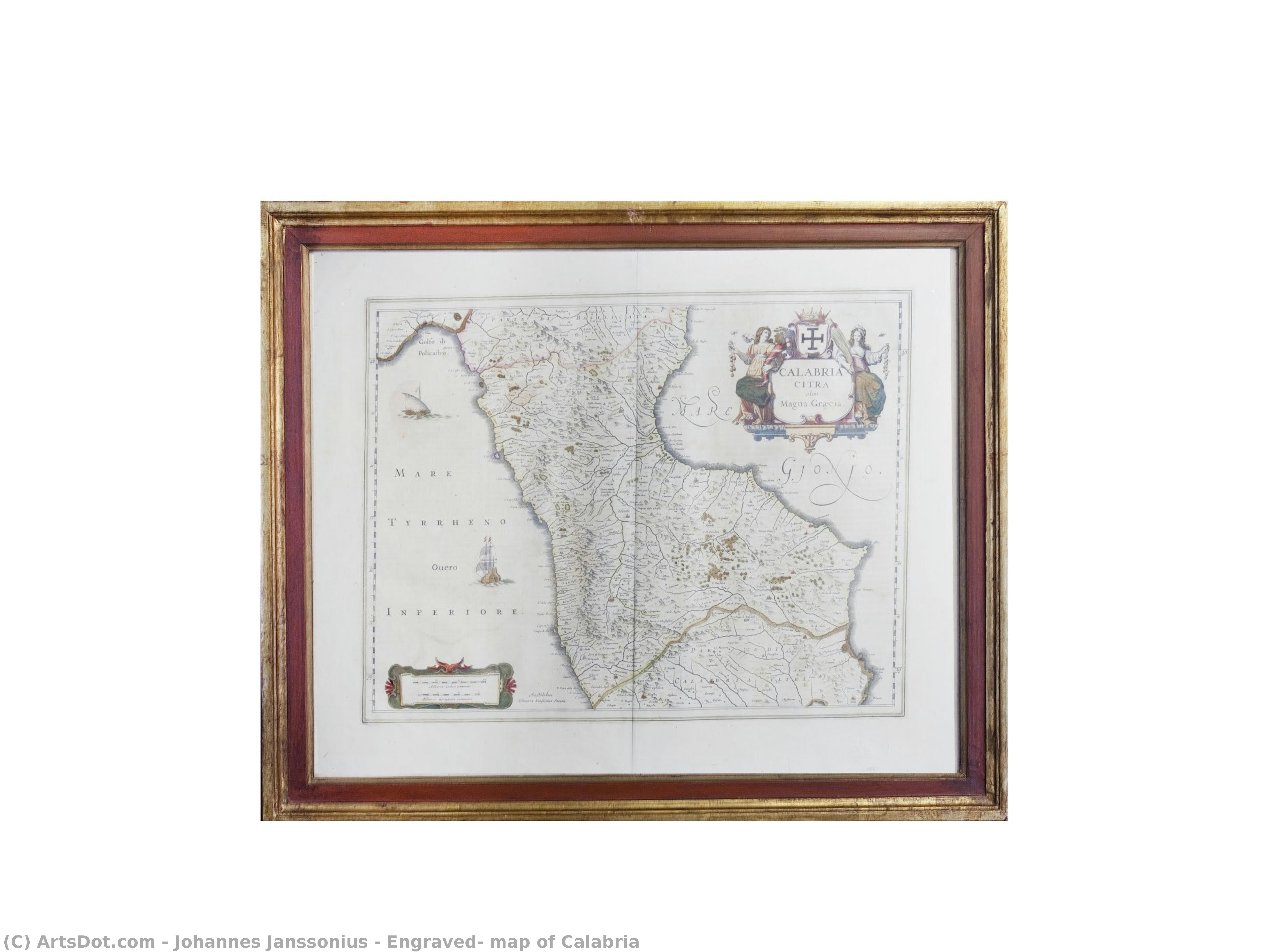
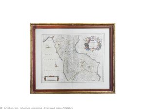
Engraved, map of Calabria

 Pročitaj više
Ručno rađena uljana reprodukcija
Ručno oslikano uljanim bojama na platnu u dimenzijama i okviru po vašem izboru, izrađeno po porudžbini od strane naših umetnika. ( Kupi print Kupi digitalnu sliku)




































Izaberite jednu od naših unapred definisanih veličina koje odgovaraju originalnim proporcijama umetničkog dela.

Можете унети сопствене димензије како бисте прилагодили дело одређеном оквиру или простору. Ако одабрана величина не одговара пропорцијама оригинала, слика ће бити исечена или проширена додатним елементима који се ручно насликавају. Дигитални prikaz ће вам бити послат на одобрење пре почетка производње.
Имајте на уму да преглед на екрану не одражава стварно исецање или проширење. Само приказ (mockup) ће тачно приказати коначну композицију.
Иако су доступне прилагођене величине, препоручујемо да одаберете димензију из дефинисане листе како бисте сачували оригиналне пропорције.
Nakon narudžbine, tim ArtsDot.com će klijentu putem e-pošte poslati uputstva i dostaviti prikaz predloženog rešenja
Isporuka širom sveta () za 3/4 nedelje umesto uobičajenih 5 nedelja. (6 септембар). Bez kompromisa po pitanju kvaliteta.

Besplatna ekspresna dostava širom sveta

Visokokvalitetno laneno platno

Kompletno osiguranje transporta

Garancija povraćaja carine i uvoznih dažbina

Garancija vernosti boja

Politika povrata u roku od 100 dana (samo u slučaju nedostataka)

Garancija povrata novca od 100%

Popust pri grupnoj kupovini
 Opcija sa staklom dostupna je samo za dimenzije manje od 110 cm

Engraved, map of Calabria
Tehnika reprodukcije
Dimenzije reprodukcije
-


Konačna cena
$ 263
Srodna umetnička dela

Biografija umetnika
The Architect of the Known World: The Life and Legacy of Johannes Janssonius
In the vibrant, salt-aired atmosphere of the seventeenth-century Netherlands, a period defined by unparalleled maritime prowess and intellectual expansion, few figures captured the essence of human curiosity as profoundly as Johannes Janssonius. Born in 1588 in Arnhem to a family deeply embedded in the scholarly traditions of printing, Janssonius was destined to become more than a mere merchant of paper; he was a visionary who helped define the boundaries of the known world. His life, spanning the golden age of Dutch cartography, was a masterful blend of scientific precision and artistic elegance, transforming the cold data of geography into works of breathtaking beauty that served both the navigator and the connoisseur.
The trajectory of Janssonius’s career was irrevocably shaped by his strategic and personal connections to the great dynasties of Dutch publishing. Through his marriage to the daughter of the legendary cartographer Jodocus Hondius, he did not merely enter a family; he entered an intellectual lineage. This union facilitated a formidable creative partnership with his brother-in-law, Hendrick Hondius, leading to the establishment of the renowned Mercator & Hondius publishing house. Within this crucible of innovation, Janssonius refined a style that balanced the rigorous demands of accuracy with the aesthetic splendor expected by the burgeoning European middle class. His early works, including detailed depictions of France and Italy, served as the foundational stones for a career built on the meticulous rendering of terrain, coastlines, and the intricate ornamentation that characterized the era.
The Grandeur of the Atlas Novus
The zenith of Janssonius’s contribution to the world of print was undoubtedly the production of the Atlas Novus. This monumental undertaking was not merely a collection of maps but a sprawling, multi-volume encyclopedia of the Earth's surface that captured the imagination of a continent. As the work expanded through the mid-1640s, it became one of the most ambitious cartographic projects ever attempted, showcasing an incredible breadth of geographical knowledge. To hold a volume of the Atlas Novus was to hold the world itself; each page offered a window into distant lands, adorned with exquisite engravings that featured mythical sea creatures, allegorical figures, and detailed vignettes of local customs.
The technical mastery displayed in these works reflected the pinnacle of Dutch engraving techniques. Janssonius possessed an uncanny ability to utilize fine lines and delicate shading to convey depth, texture, and movement. His maps were characterized by:
- Intricate Border Decorations: Elaborate frames that often contained symbolic imagery representing the virtues of exploration and the bounty of nature.
- Cartographic Precision: A dedication to updating geographical details as new maritime discoveries reached the ports of Amsterdam.
- Artistic Ornamentation: The seamless integration of decorative elements, such as compass roses and heraldic crests, which elevated a functional tool into a piece of fine art.
A Lasting Impression on the Golden Age
Beyond the physical beauty of his prints, the historical significance of Johannes Janssonius lies in his role as a primary conduit for the dissemination of knowledge. During an era when the Dutch Republic was becoming the center of global trade, Jansson_ius provided the visual language necessary to navigate and understand this new, interconnected reality. He did not simply record geography; he helped construct the European perception of global space. His work bridged the gap between the medieval concept of a mysterious, uncharted wilderness and the modern era of scientific exploration.
As we look back upon his life from his passing in Amsterdam in 1664, we see an artist whose influence persists in every map that seeks to marry truth with beauty. Janssonius remains a titan of the Dutch Golden Age, a man who understood that to map a territory is to claim it, and to illustrate it is to immortalize it. His legacy lives on in the museums and archives of the world, where his meticulously crafted engravings continue to whisper stories of discovery, ambition, and the eternal human desire to see what lies beyond the horizon.
johannes janssonius
1588 - 1664 , Netherlands
Osnovne informacije
- Artistic Movement Or Style: Early Mapmaking
- Artists Or Movements Influenced By This Artist: ['Cartography']
- Artists Who Influenced This Artist:
- Blaeu
- Mercator
- Date Of Birth: 1588 Arnhem Netherlands
- Date Of Death: 1664 Amsterdam Netherlands
- Full Name: Johannes Janssonius
- Nationality: Dutch
- Notable Artworks:
- Stiftskirche St. Johann Regensburg
- Propsteikirche Dortmund
- Place Of Birth: Arnhem Netherlands