

 Preview
 Send
Send Share
Share
 Details

 Download
 Similars
 X-Ray
X-Ray Diaporama
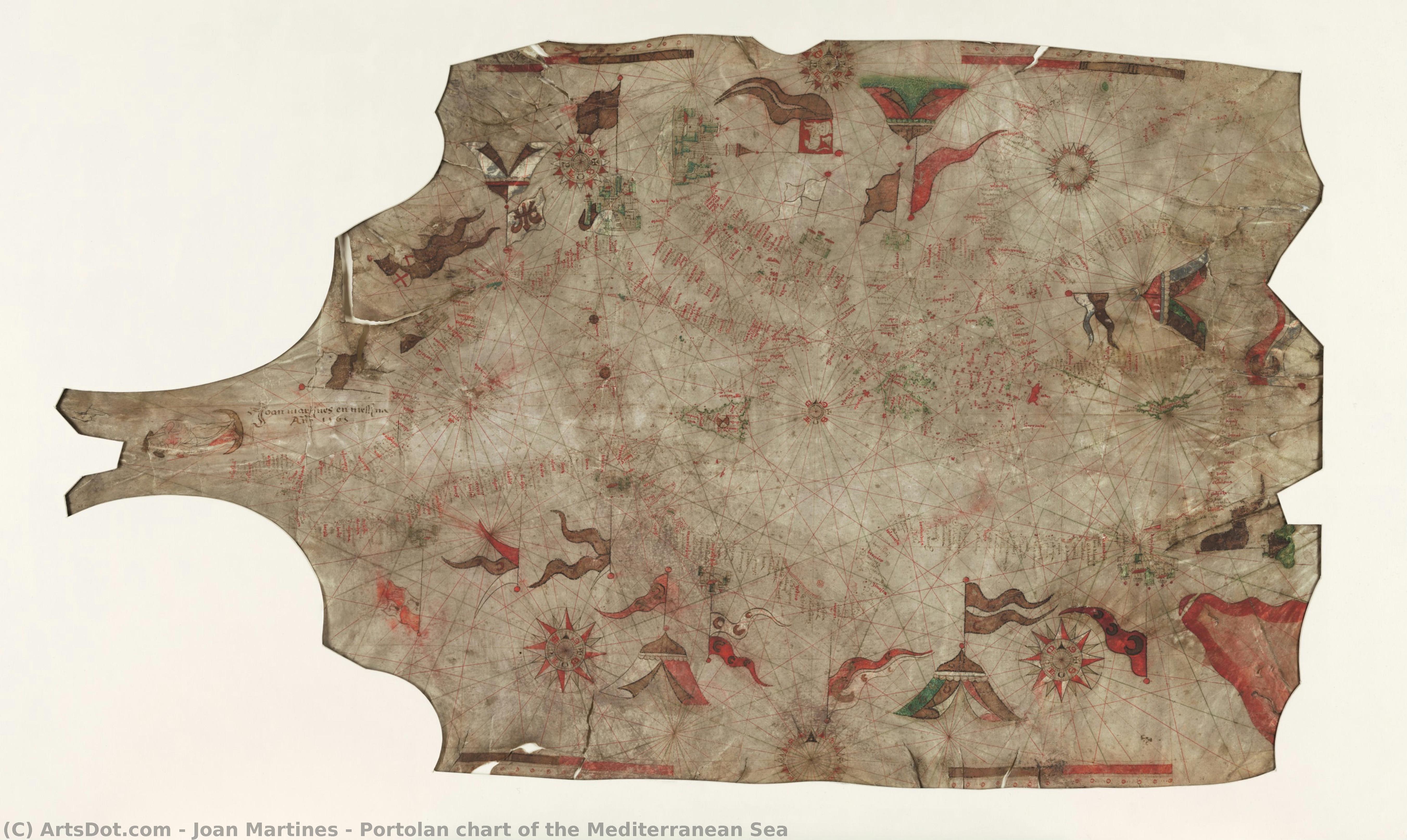
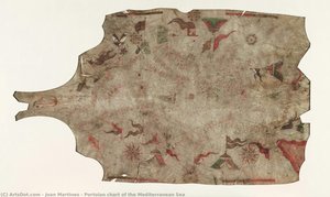
Portolan chart of the Mediterranean Sea


 Read More
Purchase a high-resolution, enhanced digital image, far superior to the online preview.
Each file is meticulously prepared by our in-house specialists using advanced tools and expert manual retouching. We ensure every image has exceptional clarity, precise color accuracy, and fine detail.
The final file is delivered via email within 72 hours, optimized for immediate use in professional, editorial, and print environments. This is the same quality trusted by top-tier design studios, publishers, and galleries.
Digital Image
Download a high-resolution file for personal display, printing, and creative projects. ( Buy Print Buy Hand Made Painting)
Included in Every Digital Image Order
Expert Digital Delivery, Guaranteed
When you choose ArtsDot.com, you're not just getting an image - you're receiving a professionally enhanced digital artwork, crafted with precision and backed by a satisfaction guarantee. Here's everything that comes with your order, automatically:

Fast Email Delivery
Your high-resolution digital image file will be emailed to you within 72 hours of ordering - ready for immediate use.

AI-Enhanced Digital File
Your artwork is professionally optimized using advanced AI tools and manual editing, ensuring maximum detail, clarity, and color accuracy.

Free Lifetime Re-Delivery
Accidentally deleted or lost your file? No worries - we'll resend it to you anytime, free of charge.

No Import Fees - Ever
Enjoy your artwork instantly with zero customs, duties, or delivery fees - digital downloads are always tax-free.

Color Accuracy Guarantee
We ensure your digital image reflects the original colors as closely as possible using professional tools and color management.

60-Day Satisfaction Guarantee
If you're not satisfied with your digital image, we'll revise it or refund 100% within 60 days - no questions asked.

100% Money-Back Guarantee
Not satisfied? Get a full refund within 60 days of receiving your digital file - no questions asked.

Bulk Order Discounts
Buy 3 images, save 10% - Buy 5, save 15% - Buy 10+, save 20%. Great for creative projects, galleries, and agencies.
Collectible Description
Related Artworks






Artist Biography
The Cartographic Vision of Joan Martínez
In the golden age of maritime exploration, where the edges of the known world were still shrouded in myth and mystery, few figures captured the intersection of science and artistry as profoundly as Joan Martínez. A master cartographer and cosmographer of the sixteenth century, Martínez did not merely draw maps; he sculpted the very perception of the Earth's oceans and continents. While his precise origins remain a subject of scholarly debate—with whispers of Majorcan or Catalan roots suggesting a lineage deeply connected to the Mediterranean’s seafaring traditions—his professional identity was inextricably linked to Messina. It was here, in this vibrant Sicilian hub, that he spent much of his prolific career, eventually moving to Naples to serve as the official cosmographer to the Kingdom.
The work of Martínez represents a breathtaking transition in the history of geography. His manuscripts and atlases, such as the celebrated Atlas nautique du monde, are far more than utilitarian tools for navigation; they are exquisite specimens of Renaissance craftsmanship. Unlike the standard portolan charts of his era, which often relied on heavy, repetitive motifs, Martínez’s compositions frequently embraced a refined elegance. His hand is visible in the meticulous execution and the splendor of color that characterizes his most famous works. He possessed a unique ability to blend the rigorous demands of maritime accuracy—utilizing complex rhumb lines and compass bearings—with a decorative sensibility that transformed a navigational instrument into a piece of high art.
A Legacy Written in Ink and Sea
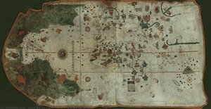
To study the evolution of Martínez’s work is to witness the tension between emerging scientific observation and the lingering shadows of medieval legend. His maps are remarkable for their careful execution, yet they often serve as a bridge between two worlds. In some of his most celebrated charts, such as his 1565 Mediterranean portolan, one finds a striking balance of technical precision and spiritual symbolism. The inclusion of imagery like the Virgin and Child reflects the deep-seated theological currents of the age, where the exploration of the physical world was seen as an extension of understanding the divine order. This fusion of the celestial and the terrestrial allowed his maps to function as both guides for the sailor and objects of contemplation for the scholar.
Despite his immense skill, Martínez’s work also captures a moment in time when the map was still catching up to reality. His charts occasionally preserved the ghosts of forgotten legends, such as the depiction of the mythical Seven Cities of Cibola or the archaic separation of England and Scotland. These elements do not diminish his greatness; rather, they enrich his historical significance, marking him as a pivotal figure standing at the threshold of the modern era. His prolific output—comprising dozens of identified atlases and numerous individual charts—ensured that his vision of the world would influence generations of explorers, scholars, and artists alike, cementing his place as one of the most influential cartographers of the sixteenth century.
joan martines
Spain
Quick Facts
- Artistic Movement Or Style: Cartography
- Full Name: Joan Martínez
- Nationality: Spanish
- Notable Artworks: ['Mediterranean Portolan Chart']
- Place Of Birth: Spain

