 Preview
 Send
Send Share
Share
 Details

 Download
 Similars
 X-Ray
X-Ray Diaporama
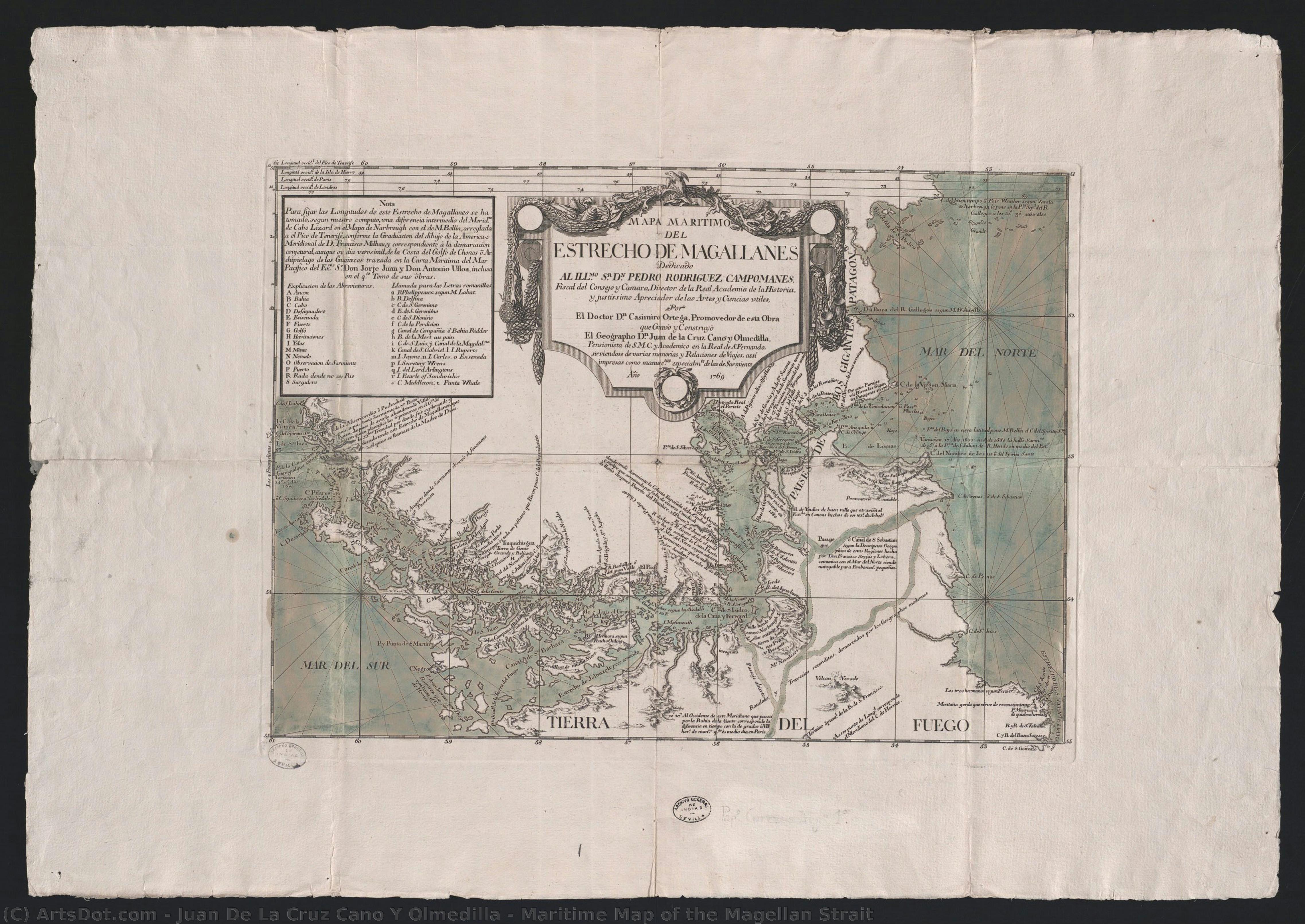
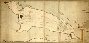
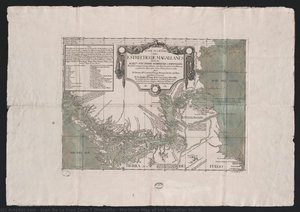
Maritime Map of the Magellan Strait

 Read More
Giclée / Art Print
Museum-quality giclée or canvas print with fast production and flexible finish options. ( Buy Hand Made Painting Buy Image)




































Pick from our preset sizes that match the artwork's original proportions.

You may enter your own dimensions to fit a specific frame or space. If your selected size does not match the original image's proportions, we will either crop the artwork or extend the image with a mirrored or solid-fill edge. A digital mockup will be sent for your approval before production begins.
Please note that the on-screen preview does not reflect the actual cropping or extension. Only the mockup will accurately show the final composition.
While custom sizes are available, we recommend selecting a dimension from the predefined list to preserve the original proportions.
Worldwide Delivery () in 2 weeks instead of standard 4/5 weeks. (30 August)

Free Worldwide Express Shipping

High-Quality Linen Canvas

Full Shipping Insurance

Customs Tax Refund Guarantee

True Color Matching Guarantee

60-Day Return Policy (Defects Only)

100% Money-Back Guarantee

Bulk Discount Offer
 Glass option is only available in size under 110 CM

Maritime Map of the Magellan Strait
Giclée / Art Print
Reproduction Size
-


Total Price
$ 63
Related Artworks


Artist Biography
The Cartographer of Enlightenment: The Life of Juan de la Cruz Cano y Olmedilla
In the heart of eighteenth-century Madrid, a period defined by the luminous intellectual fervor of the Enlightenment, the boundaries of the known world were being redrawn through the lens of reason and scientific rigor. It was within this atmosphere of discovery that Juan de la $\text{Cruz}$ Cano y Olmedilla (1734–1790) emerged, not merely as a maker of maps, but as a visionary who translated the complexities of geography into the elegant language of art. Born into a lineage where science and intellect were woven into the very fabric of daily life—his father, José María Cano y Olmedilla, was a distinguished astronomer—Juan de la Cruz was destined to bridge the gap between the empirical observations of the laboratory and the aesthetic beauty of the printed page.
His early years in Madrid provided him with a unique vantage point, situated at the intersection of burgeoning scientific disciplines. As the Enlightenment championed the power of observation and the systematic categorization of nature, Cano y Olmedilla embraced these ideals, applying them to the vast, often mysterious territories of the Spanish Empire. His work was never a mere exercise in topography; rather, it was an attempt to capture the essence of a changing world. This dedication to precision eventually led to his prestigious appointment as the royal cartographer for King Carlos III in 1768, a role that placed him at the center of Spain's geopolitical and scientific ambitions.
Mastery of Line and Light: Technique and Artistic Vision
To gaze upon the works of Cano y Olmedilla is to witness a profound marriage of technical mastery and understated elegance. Eschewing the overly decorative flourishes that characterized much of the era's ornamental cartography, he pursued a style rooted in realism and clarity. His primary medium, the meticulous craft of copper engraving, allowed him to achieve a level of detail that was both functional for navigators and breathtaking for scholars. Through delicate shading and precise linework, he could convey the ruggedness of coastlines, the depth of maritime straits, and the vastness of continental interiors with remarkable spatial accuracy.
<- Scientific Precision: His maps were informed by rigorous astronomical observations, ensuring that longitudinal and latitudinal measures were as accurate as the technology of the time permitted.
- Copper Engraving: The use of fine engraving allowed for a crispness of detail that captured everything from subtle coastal indentations to complex annotations.
- Clarity over Ornamentation: While his work possessed an inherent beauty, he prioritized legibility and factual truth, reflecting the Enlightenment's rejection of unnecessary artifice.
This commitment to accuracy extended beyond the physical lines on the paper; it was a philosophical stance. In pieces such as his 1769 maritime map of the Magellan Strait, one finds a work that serves as both a navigational tool and a historical document. The map is imbued with a sense of purpose, utilizing various reference meridians—from Tenerife to London—to anchor the viewer in a global context, effectively shrinking the perceived distance between the Old and New Worlds.
A Legacy Written in Ink and Earth
The historical significance of Juan de la Cruz Cano y Olmedilla lies in his ability to document the expansion of the Spanish colonial empire with an eye toward the future. His most celebrated achievement, the 1775 map of South America, stands as a testament to his role as a chronicler of the age. This work, which drew upon various manuscripts and travels, provided a vital visual record of the continent's geography during a period of intense colonial administration and scientific inquiry. Through his hands, the vast landscapes of Latin America were brought into sharper focus for the European intellect.
Ultimately, Cano y Olmedilla’s legacy is one of integration. He successfully integrated the precision of the astronomer with the sensitivity of the artist, creating a body of work that served the practical needs of the state while contributing to the broader cultural movement of his time. As the world moved toward an era of unprecedented global connectivity, his maps remained essential landmarks of human understanding, marking the transition from the age of myth to the age of measurable truth. His life remains a profound example of how art, when wedded to science, can illuminate the very shape of our existence.
juan de la cruz cano y olmedilla
1734 - 1790 , Spain
Quick Facts
- Artistic Movement Or Style: Cartography
- Date Of Birth: Madrid, Spain (1734)
- Date Of Death: 1790
- Full Name: Juan de la Cruz Cano y Olmedilla
- Nationality: Spanish
- Notable Artworks: ['Maritime Map of the Magellan Strait']
- Place Of Birth: Madrid