

 Preview
 Send
Send Share
Share
 Details

 Download
 Similars
 X-Ray
X-Ray Diaporama
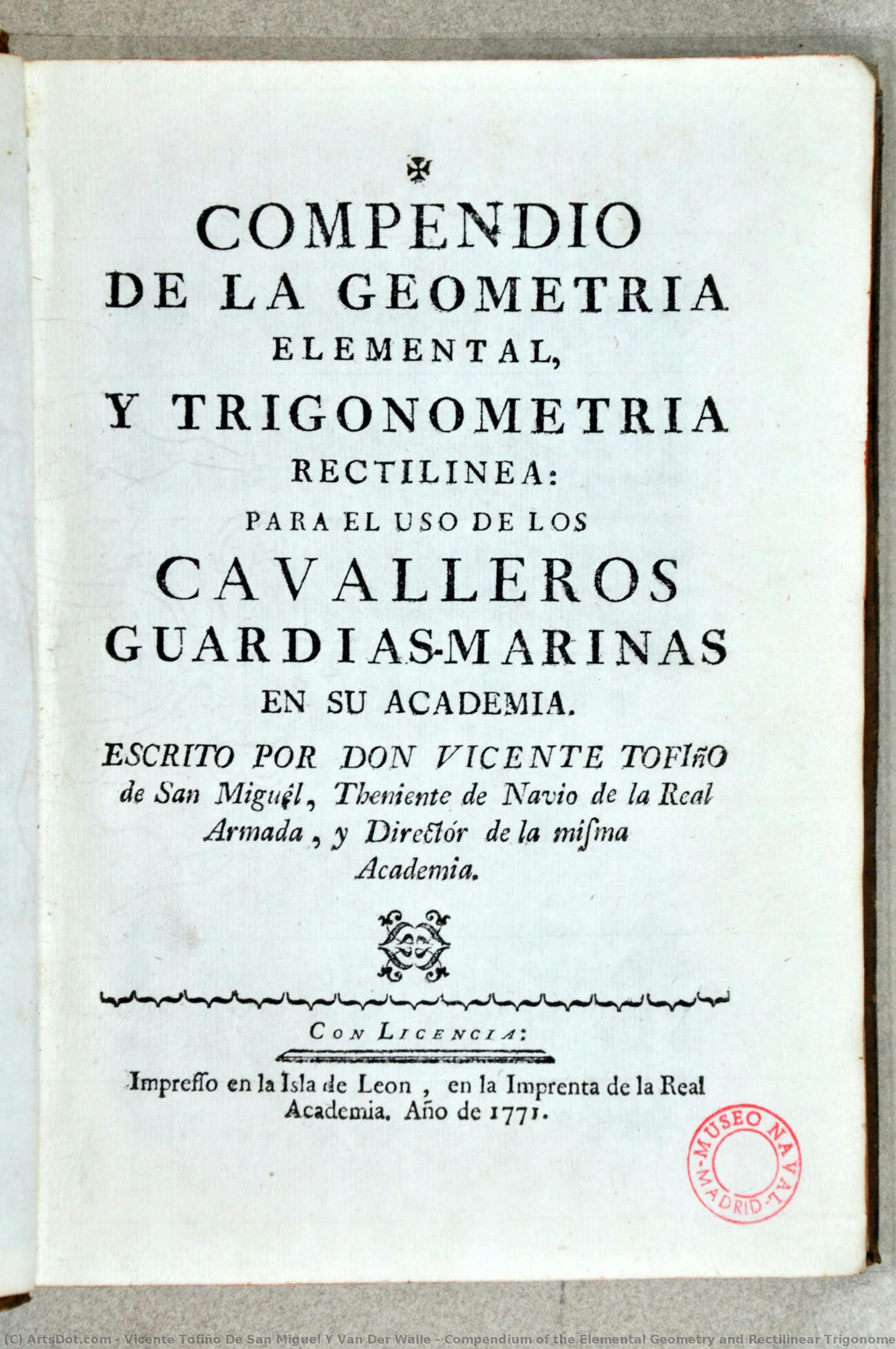
Compendium of the Elemental Geometry and Rectilinear Trigonometry


 Read More
Purchase a high-resolution, enhanced digital image, far superior to the online preview.
Each file is meticulously prepared by our in-house specialists using advanced tools and expert manual retouching. We ensure every image has exceptional clarity, precise color accuracy, and fine detail.
The final file is delivered via email within 72 hours, optimized for immediate use in professional, editorial, and print environments. This is the same quality trusted by top-tier design studios, publishers, and galleries.
Digital Image
Download a high-resolution file for personal display, printing, and creative projects. ( Buy Print Buy Hand Made Painting)
Included in Every Digital Image Order
Expert Digital Delivery, Guaranteed
When you choose ArtsDot.com, you're not just getting an image - you're receiving a professionally enhanced digital artwork, crafted with precision and backed by a satisfaction guarantee. Here's everything that comes with your order, automatically:

Fast Email Delivery
Your high-resolution digital image file will be emailed to you within 72 hours of ordering - ready for immediate use.

AI-Enhanced Digital File
Your artwork is professionally optimized using advanced AI tools and manual editing, ensuring maximum detail, clarity, and color accuracy.

Free Lifetime Re-Delivery
Accidentally deleted or lost your file? No worries - we'll resend it to you anytime, free of charge.

No Import Fees - Ever
Enjoy your artwork instantly with zero customs, duties, or delivery fees - digital downloads are always tax-free.

Color Accuracy Guarantee
We ensure your digital image reflects the original colors as closely as possible using professional tools and color management.

60-Day Satisfaction Guarantee
If you're not satisfied with your digital image, we'll revise it or refund 100% within 60 days - no questions asked.

100% Money-Back Guarantee
Not satisfied? Get a full refund within 60 days of receiving your digital file - no questions asked.

Bulk Order Discounts
Buy 3 images, save 10% - Buy 5, save 15% - Buy 10+, save 20%. Great for creative projects, galleries, and agencies.
Related Artworks





![Los Trabajos De Persiles Y Sigismunda (trans. The Trials Of Persiles And Sigismunda) (biblioteca Nacional De España)\n\n[2] — Cervantes Saavedra, Miguel, Baroque](/media/artworks/images-thumb/24/0d/240dd607a1820db624a8917b792ba42c.jpg)
Artist Biography
A Cartographer of the Spanish Seas: The Life and Legacy of Vicente Tofiño de San Miguel
Vicente Tofiño de San Miguel y Van der Walle, born in Cartagena, Spain, in 1732, was a figure whose life embodied the spirit of Enlightenment-era scientific exploration interwoven with dedicated naval service. He wasn’t merely a cartographer; he was an architect of Spanish maritime power, a hydrographer who meticulously charted not just coastlines but also the ambitions of an empire. His story is one of rigorous study, practical application, and a lasting contribution to the understanding and navigation of the Iberian Peninsula's complex waters.
Tofiño’s early life hinted at his future path. He initially pursued studies in experimental physics before entering the military. However, it was through his association with Jorge Juan y Santacilia – a pivotal figure in Spanish scientific expeditions – that Tofiño found his true calling. Appointed as a mathematics master at the Academia de Guardia Marinas in Cádiz in 1755, he seamlessly transitioned into naval service as an alférez de navío. This period marked not just a career shift but a deepening engagement with the practical demands of seafaring and the necessity for accurate nautical knowledge.
The Director of Academies and the Pursuit of Hydrographic Precision
Tofiño’s ascent within the Spanish naval hierarchy was swift, reflecting his dedication and burgeoning expertise. In 1768, he assumed the directorship of the Academia de Guardia Marinas in Cádiz, a position he would simultaneously hold at similar institutions in Ferrol and Cartagena by 1773. This oversight allowed him to standardize curricula and instill a new generation of naval officers with his commitment to precision and scientific methodology. He understood that effective cartography wasn’t simply about drawing lines on paper; it was about fostering a culture of observation, calculation, and meticulous record-keeping.
His involvement in the 1775 expedition against Algiers and the subsequent siege of Gibraltar (1779-1783) underscored the critical importance of accurate charts. These campaigns revealed deficiencies in existing nautical maps, fueling Tofiño’s determination to create a comprehensive atlas that would address these shortcomings. He recognized firsthand the dangers posed by imprecise navigation – shipwrecks, logistical failures, and ultimately, compromised military operations.
The Atlas Marítimo de España: A Monumental Achievement
Tofiño’s magnum opus, the Atlas Marítimo de España completed in 1787, stands as a testament to his unwavering dedication. This wasn't merely an update of existing charts; it was a complete re-evaluation and detailed mapping of the entire Spanish coastline. The atlas incorporated not only precise geographical data but also descriptions of coasts, harbors, bays, depths, currents, and potential hazards. It represented years of painstaking work – surveying coastlines, correcting errors in previous maps, and synthesizing information from diverse sources.
The Atlas was revolutionary for its time. Its clarity, accuracy, and comprehensiveness set a new standard for nautical cartography. It wasn’t simply a tool for military strategists; it facilitated trade, exploration, and the overall economic prosperity of Spain. The detailed depictions of harbors allowed for safer navigation, while accurate representations of currents aided in more efficient voyages. It is a remarkable example of how scientific endeavor could directly translate into tangible benefits for society.
Influence and Historical Significance
Vicente Tofiño de San Miguel’s influence extended far beyond the immediate impact of his Atlas Marítimo de España. He trained generations of Spanish naval officers, instilling in them a commitment to scientific rigor and meticulous observation. His work laid the foundation for future hydrographic endeavors within Spain and contributed significantly to the development of modern cartography.
While perhaps not as widely celebrated as some of his contemporaries, Tofiño’s contribution was profoundly practical and enduring. He wasn't a flamboyant explorer or a daring admiral; he was a dedicated scientist and naval officer who understood that knowledge – specifically, accurate nautical knowledge – was power. His legacy lives on in the charts still used today, a silent testament to the vision of a man who meticulously mapped the Spanish seas and, in doing so, helped shape the course of an empire.
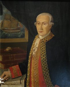
vicente tofiño de san miguel y van der walle
1732 - 1795 , Spain
Quick Facts
- Artistic Movement Or Style: Cartography, Hydrography
- Date Of Birth: September 6, 1732
- Date Of Death: January 15, 1795
- Full Name: Vicente Tofiño de San Miguel y Van der Walle
- Nationality: Spanish
- Notable Artworks:
- Maritime Atlas of Spain
- Compendium of Geometry
- Cape Santa Maria Chart
- Place Of Birth: Cartagena, Spain

