

 プレビュー
プレビュー
 シェアする
シェアする シェアする
シェアする
 詳細を見る
詳細を見る

 ダウンロード
 似ている作品
 X線調査
X線調査 スライドショー
 統計情報
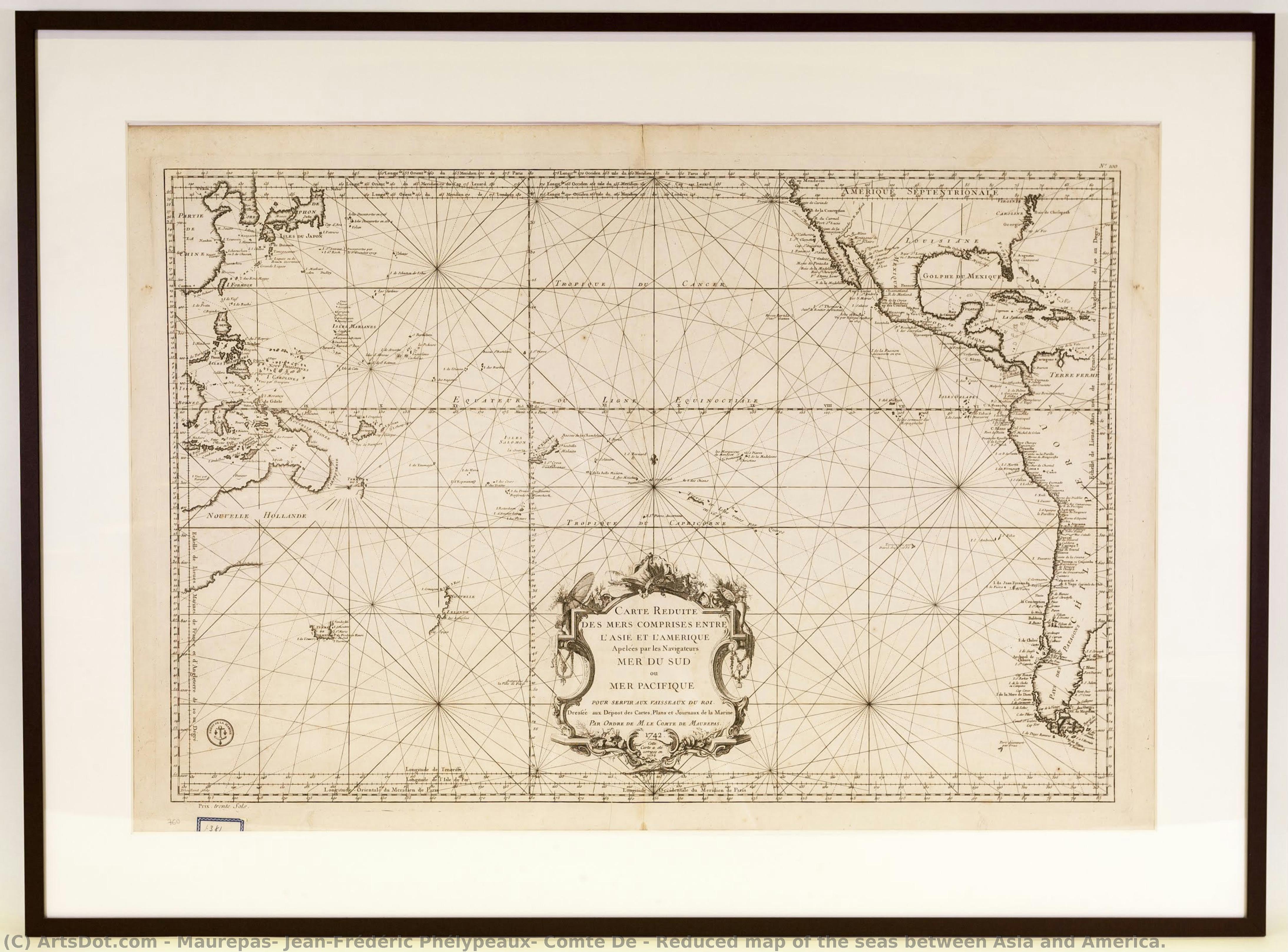
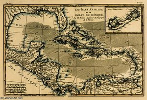
統計情報Reduced map of the seas between Asia and America.
 Other
Other 5.0 x 93.0 cm
 Maritime Museum of Barcelona
 詳細を見る
詳細を見る
ジークレー/アートプリント
迅速な制作と多彩な仕上げオプションを備えた、ミュージアムクオリティのジークレーまたはキャンバスプリント。 ( 手描きの絵画を購入 デジタル画像販売へ切り替え)




P118B $10

P118H $10

P118W $10

P438Z $10

P508JH $12

P508YH $12

P805H $10

P805Z $10

P919BZ $10

P919G $10

P919XJ $10

P959ZH $10

P968JZ $12

W106C $8

W218G $10

W218JH $8

W218Y $10

W307PJ $10

W316G $10

W316PJ $8

W316Y $10

W398PJ $8

W4111J $10

W500HY $15

W500JH $15

W692G $12

W849H $8

W940BG $15

W953PJ $8




作品のオリジナル比率に合わせた、当店の規定サイズからお選びください。

特定のフレームやスペースに合わせて、ご自身でサイズを指定することも可能です。選択されたサイズが元の画像の比率と一致しない場合、作品をトリミングするか、鏡面反射または単色での塗りつぶしによって画像を拡張いたします。制作を開始する前に、ご確認用のデジタルモックアップをお送りいたします。
画面上のプレビューには、実際のトリミングや拡張は反映されませんのでご注意ください。最終的な構図を正確に確認できるのは、モックアップのみとなります。
カスタムサイズも承っておりますが、元の比率を維持するためには、あらかじめ用意されたリストからサイズを選択することをお勧めいたします。


 ガラスオプションは、110cm未満のサイズでのみご利用いただけます。

Reduced map of the seas between Asia and America.
ジークレー/アートプリント
複製画のサイズ
-


合計金額
$ 62
関連作品






アーティストの略歴
A Cartographer of the Enlightenment: The Legacy of Jean-Frédéric Phélypeaux
In the gilded era of the 18th century, where the boundaries of the known world were still being etched by the ink of explorers and the precision of scientists, Jean-FrEXdré Phélypeaux, Comte de Maurepas, emerged as a figure of profound influence. Born in Versailles in 1701 into a lineage of administrative nobility, his life was inextricably linked to the pulse of the French state. While history often remembers him through the lens of political power—as a statesman who navigated the complex reigns of Louis XV and Louis XVI—his true artistic and intellectual essence resided in the delicate intersection of geography and visual artistry. Maurepas did not merely observe the world; he sought to document it with a meticulousness that mirrored the burgeoning spirit of the Enlightenment.
His early years were steeped in an atmosphere of strategic importance and maritime tradition. Growing up under the shadow of his illustrious grandfather, Louis de Pontchartrain, Maurepas was raised to appreciate the vital connection between territorial knowledge and national sovereignty. This upbringing fostered a unique discipline, allowing him to approach cartography not just as a technical necessity, but as a fine art. During his formative period, he immersed himself in the study of geographical representation alongside luminaries such as Nicolas Cochin and Jean Picard. These interactions were transformative, exposing him to the cutting-edge scientific techniques of the age and instilling in him a profound respect for the marriage of aesthetic beauty and empirical accuracy.
The Artistry of Navigation and the Dépôt des Cartes
As Maurepas ascended to the directorship of the Dépôt des cartes et plans de la marine in 1720, his role transitioned from that of a student to a visionary architect of French maritime identity. Under his stewardship, the institution became much more than a repository for naval charts; it became a laboratory of visual excellence. He understood that a map was a powerful instrument of diplomacy and conquest, and therefore, it required an unparalleled level of craftsmanship. The charts produced under his guidance were characterized by a breathtaking clarity and an elegant use of detail that captured the vastness of unexplored territories with poetic precision.
His most significant achievements lay in the expansion of the French maritime horizon. Through his leadership, the Dépôt undertook monumental projects that sought to illuminate the mysteries of the globe. One of the most enduring legacies of this era was the creation of expansive works such as “Asia & America,” which served as a testament to the era's ambition. These maps were not merely navigational tools for sailors; they were masterpieces of graphic design that utilized intricate line work, delicate shading, and sophisticated typography to convey the complexity of the natural world. In these works, one can see the influence of the scientific revolution—a drive toward total accuracy tempered by the classical elegance of French decorative arts.
A Lasting Impression on History and Art
The historical significance of Maurepas extends far beyond the borders of France or the confines of naval administration. He stood at the crossroads of an era where the pursuit of knowledge was becoming a central pillar of human progress. By elevating cartography to a level of high artistic achievement, he helped shape the visual language of the Enlightenment. His work provided the intellectual and visual framework through which European powers perceived the vastness of the oceans and the potential of new continents.
Though his political career was marked by the turbulent shifts of the late 18th century, his contribution to the art of the map remains a serene and enduring monument to human curiosity. To look upon a chart from the era of Maurepas is to witness a moment in time when science and art were perfectly aligned, working in harmony to transform the unknown into the known. His legacy lives on in every meticulously drawn coastline and every elegantly rendered compass rose, reminding us of a time when the world was being rediscovered through the eyes of a true master of detail.
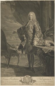
maurepas, jean-frédéric phélypeaux, comte de
1701 - 1781 , France
基本情報
- Artistic Movement Or Style: Cartography
- Artists Or Movements Influenced By This Artist: ['European Navigation']
- Artists Who Influenced This Artist:
- Louis XIV
- Jérôme Phélypeaux
- Date Of Birth: July 9, 1701
- Full Name: Jean Frédéric Phélypeaux, Comte de Maurepas
- Nationality: French
- Notable Artworks: ['Reduced Map of the Seas']
- Place Of Birth: Versailles, France
関連記事
Seafoam & Masterpieces: 10 Paintings Dominated by Medium Sea Green | ArtsDot
Dive into serenity with 10 famous paintings bathed in calming medium sea green. Explore Impressionist masterpieces by Monet, Degas & Renoir. Find museum-quality art reproductions and elevate your home decor at ArtsDot.com.
18th Century Masters: 10 Artworks That Define an Era | ArtsDot
Journey through 18th century art! Explore 10 iconic paintings – from Rococo elegance to Neoclassical grandeur. Discover Fragonard, David & more. Find museum-quality reproductions and elevate your home decor on ArtsDot.com.
Reflecting Nobility & Nuance: 18th-Century Portraiture as a Window into Societal Values
Explore the world of 18th-century portraiture with ArtsDot. Discover symbolism, artistic innovation & societal values reflected in masterpieces by Reynolds, Hogarth & more. Expert insights for collectors.
Navigating the Depths of Representation: A Historical Exploration of Marine Painting
Explore the rich history of marine painting with ArtsDot. Discover Dutch Masters, Romantic seascapes & renowned artists like Wyllie and Harris. Expert guidance for collectors & custom reproductions.
The Azure Depths: Exploring Representations of the Ocean in Art History
Explore the rich history of ocean art! Discover Romantic seascapes, renowned artists like Aivazovsky & Harris, and expert guidance for collectors at ArtsDot.com.