 Preview
 Send
Send Share
Share
 Details

 Download
 Similars
 X-Ray
X-Ray Diaporama
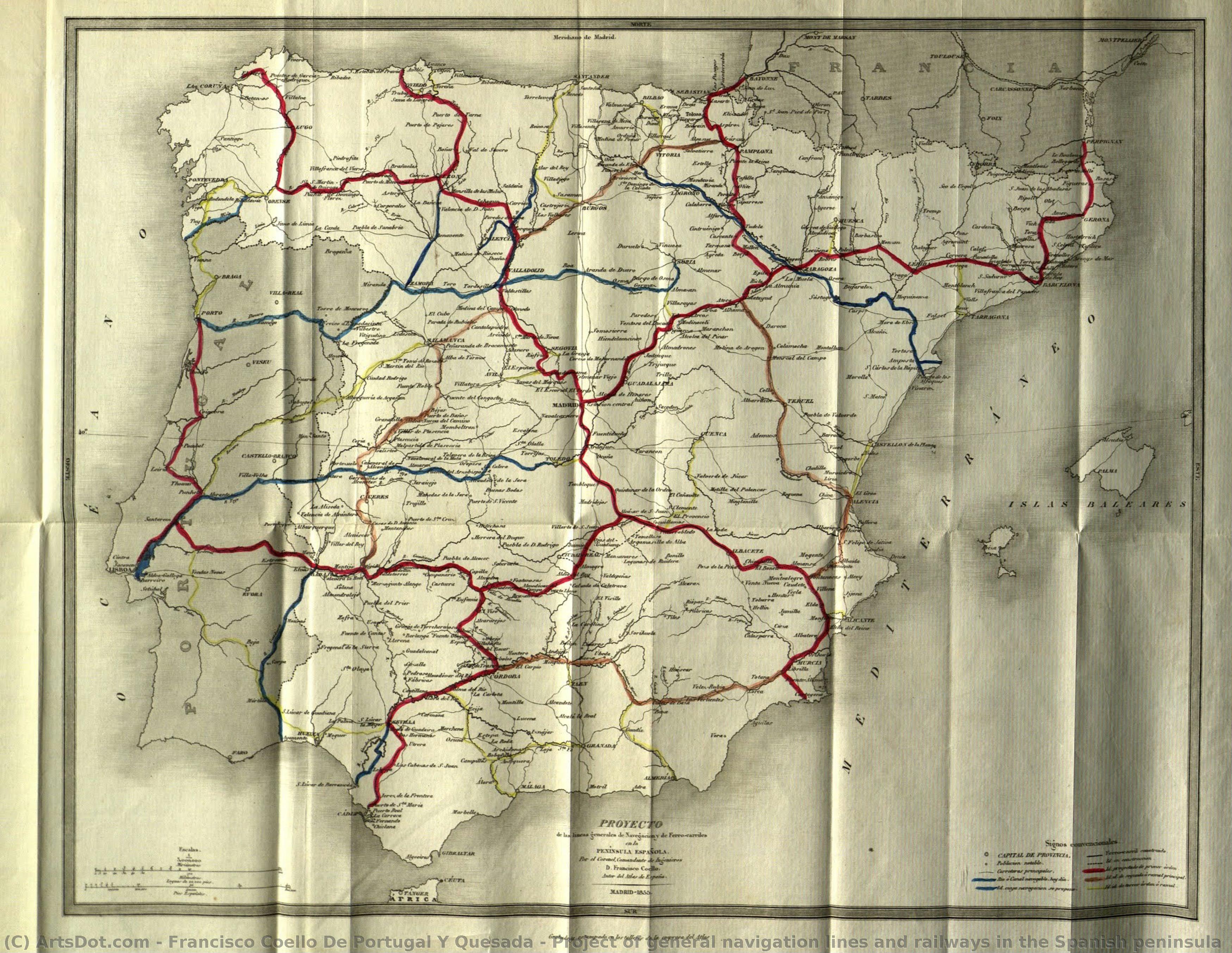
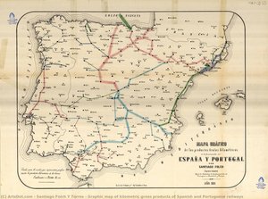
Project of general navigation lines and railways in the Spanish peninsula


 Read More
Hand Made Oil Reproduction
Hand-painted oil on canvas in your size and frame, made to order by our artists. ( Buy Print Buy Image)




P118B $10

P118H $10

P118W $10

P438Z $10

P508JH $12

P508YH $12

P805H $10

P805Z $10

P919BZ $10

P919G $10

P919XJ $10

P959ZH $10

P968JZ $12

W106C $8

W218G $10

W218JH $8

W218Y $10

W307PJ $10

W316G $10

W316PJ $8

W316Y $10

W398PJ $8

W4111J $10

W500HY $15

W500JH $15

W692G $12

W849H $8

W940BG $15

W953PJ $8




Pick from our preset sizes that match the artwork's original proportions.

You may enter your own dimensions to fit a specific frame or space. If your selected size does not match the original image's proportions, we will either crop the artwork or extend the painting with additional hand-painted elements. A digital mockup will be sent for your approval before production begins.
Please note that the on-screen preview does not reflect the actual cropping or extension. Only the mockup will accurately show the final composition.
While custom sizes are available, we recommend selecting a dimension from the predefined list to preserve the original proportions.
After order, ArtsDot.com team will email client for instructions and provide a mockup preview
Worldwide Delivery () in 3/4 weeks instead of standard 5 weeks. (26 August). No compromise on quality.

Free Worldwide Express Shipping

High-Quality Linen Canvas

Full Shipping Insurance

Customs Tax Refund Guarantee

True Color Matching Guarantee

60-Day Return Policy (Defects Only)

100% Money-Back Guarantee

Bulk Discount Offer
 Glass option is only available in size under 110 CM

Project of general navigation lines and railways in the Spanish peninsula
Reproduction Medium
Reproduction Size
-


Total Price
$ 263
Related Artworks



Artist Biography
Francisco Coello de Portugal y Quesada: A Pioneer of Spanish Cartography
- Born: Jaén, Spain (1822)
- Died: Madrid, Spain (1898)
- Occupation: Geographer, Cartographer, Military Engineer
Early Life and Education
Francisco Coello de Portugal y Quesada was born in Jaén, Spain, in 1822. His family background included a lineage of military and diplomatic service; his brother, Diego Coello de Portugal y Quesada, would later become a Spanish ambassador. Coello's early education took place at the Colegio Mayor de Cuenca and the University of Salamanca. He also spent time as an alcalde del crimen in Lima, Peru, demonstrating an early exposure to administrative roles. A significant portion of his formative years was dedicated to military training, studying at the Academy of Military Engineering of Guadalajara from 1836 to 1839. This period shaped his technical skills and instilled a discipline that would be crucial to his later cartographic endeavors.Career as a Cartographer and Engineer
The Atlas de España y sus posesiones de Ultramar: Coello’s most significant contribution was the creation of the *Atlas de España y sus posesiones de Ultramar* (Atlas of Spain and its Overseas Possessions). This ambitious project aimed to produce scientifically accurate maps of all Spanish provinces, as well as territories overseas. The atlas represented a major advancement in Spanish cartography, moving away from earlier, less precise methods. It was intended to be published at scales of 1:200,000 for mainland Spain and 1:280,000 for the Canary Islands. While the project wasn't fully completed due to his death, it remains a landmark achievement. Military Engineering and Other Projects: Beyond the Atlas, Coello was involved in various engineering projects. He contributed to Pascual Madoz’s *Diccionario geográfico-estadístico-histórico de España y sus posesiones de Ultramar*, providing cartographic support for this extensive geographical dictionary. He also developed a "Project of general navigation lines and railways in the Spanish peninsula," showcasing his expertise in both cartography and engineering planning, housed at the Spanish Railways Foundation. His military service included participation in the First Carlist War and later as a military attaché in Algeria, where he created an atlas of Tunisia and Algeria.Influences and Artistic Style
Coello’s work was influenced by the broader context of 19th-century scientific advancements and the Spanish Renaissance. The Spanish Renaissance, emerging from the Italian Renaissance, emphasized classical antiquity and Greco-Roman traditions. While not a painter in the traditional sense, Coello's cartographic style reflected this era's focus on precision, detail, and systematic organization. His maps were characterized by their meticulousness and scientific rigor, aiming to provide accurate representations of geographical features. He utilized burin engraving techniques for his map production, ensuring high-quality prints suitable for both military and civilian use.Legacy and Historical Significance
Francisco Coello de Portugal y Quesada’s legacy lies in his pioneering work in Spanish cartography. His *Atlas de España* set a new standard for accuracy and detail, influencing subsequent generations of cartographers and engineers. He is considered one of the key figures in modernizing Spanish mapmaking. His contributions extended beyond purely technical aspects; he played a role in planning colonial expansion and infrastructure development within Spain and its overseas territories. His work continues to be studied by historians and geographers interested in 19th-century Spain and the history of cartography. He was also a founding member and president of the Geographical Society of Madrid, further solidifying his impact on the field.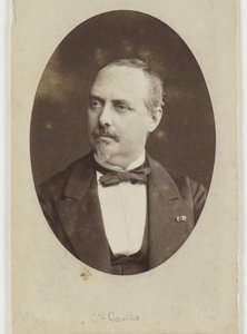
francisco coello de portugal y quesada
1822 - 1898 , Spain
Quick Facts
- Artistic Movement Or Style: Spanish Renaissance
- Artists Who Influenced This Artist:
- El Greco
- Diego Velázquez
- Bartolomé Esteban Murillo
- Date Of Birth: April 26, 1822
- Date Of Death: September 30, 1898
- Full Name: Francisco Coello de Portugal y Quesada
- Nationality: Spanish
- Notable Artworks:
- Project of general navigation lines
- Atlas de España y sus posesiones
- Place Of Birth: Jaén, Spain
Related Articles

Crimson Threads of Narrative: Exploring Symbolism & Representation in Artworks Featuring the Red Dress
Explore the rich symbolism of the red dress in art history! From ancient power displays to iconic portraits like Cézanne’s 'Madame Cezanne', discover the cultural and artistic significance behind this captivating color. Expert analysis & insights.
Rafael de Penagos: A Study in Spanish Portraiture & Artistic Identity
Explore the life & art of Rafael de Penagos, a leading Spanish Art Deco illustrator. Discover his iconic 'Penagos Woman', commercial work, and lasting legacy. Learn about this pivotal figure in 20th-century Spanish art history.
Echoes of Time: Nostalgia, Technique & Cultural Significance in Vintage Paintings
Explore the captivating world of vintage paintings! Discover key styles, cultural significance & collecting tips from art experts at ArtsDot. Find authentic reproductions and elevate your home décor.
The Golden Age Reforged: Dramatic Realism & Religious Zeal in Spanish Baroque Art
Explore the dramatic world of Spanish Baroque art! Discover masters like Zurbarán & the powerful influence of religious zeal on painting techniques – a guide for collectors and enthusiasts.

Mark Rothko's Masterpieces: 25 Paintings That Define Abstract Expressionism | ArtsDot
Explore 25 iconic Mark Rothko paintings that define Abstract Expressionism. Discover the stories, colors & emotions behind these masterpieces. Find museum-quality art reproductions and curated decor ideas at ArtsDot.com.