Showing 3 artworks with John Emslie and with artwork date before 1857 and with artwork date after 1847
-
John Emslie
-
-1857
-
1847+
Not available for this selection

- Gray
- Rosy Brown
- Putty
- Antique World Map Decor
- Rocky Stone Texture
- John Emslie Engraving
- John Emslie Artist
- Global Architecture
- Victorian Cartography
- Architectural Drawing
- Vintage Geography Wall Art
- Geographical Diagram
- Architectural Study
- Victorian Science Art
- 19Th Century Art
- Victorian Diagram
- Pen And Ink Drawing
- Building Elevation
- Green Mountain Tops
- Academic Art Print
- Mountain Summits
- British Isles Peaks
- Monochromatic Art
- John Emslie Artwork
- 19Th Century World Map
- 1850 Building Map
- Scientific Illustration Art
- Diagram Comparative View
- Topographical Illustratio
- Historical Diagram Print
- Historical Buildings
- Clouded Sky
- Victorian Topography
- Engraved Map Reproduction
- Geological Map Art
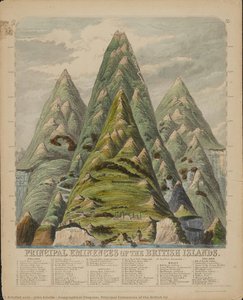
A majestic depiction of the British Isles' highest peaks featuring lush green summits by Victorian cartographer John Emslie that brings historical topographical beauty to your collection.
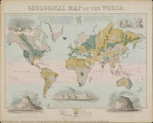
Explore John Emslie's detailed 1850 geological map of the world, a stunning Victorian cartographic masterpiece; discover this historical view today.
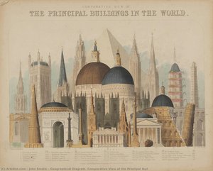
Explore John Emslie’s 'Comparative View of Buildings'! This 1850 diagram showcases global architecture in a detailed, monochromatic topographical illustration. Victorian science & art!