

 Preview
 Send
Send Share
Share
 Details

 Download
 Similars
 X-Ray
X-Ray Diaporama
 Stats
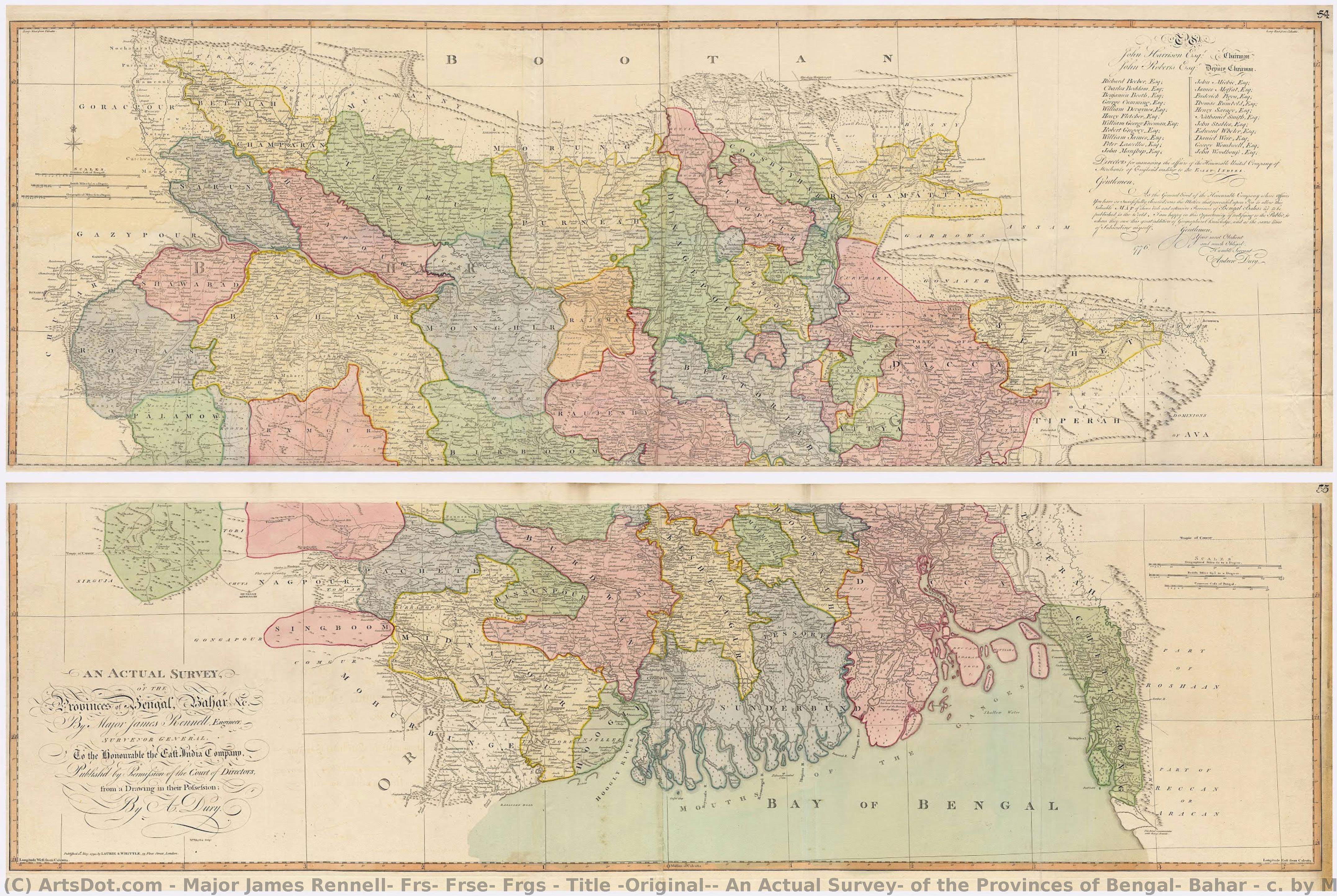
StatsTitle (Original): An Actual Survey, of the Provinces of Bengal, Bahar & c. by Major James Rennell Esq. Engineer to the Honorable the East India Company. Published by Permission of the Court of Directors from a Drawing in their Possession by A. Dury.
 Wash
Wash Early Modern
 108.0 x 151.0 cm
 Kalakriti Archives
 Read More
Purchase a high-resolution, enhanced digital image, far superior to the online preview.
Each file is meticulously prepared by our in-house specialists using advanced tools and expert manual retouching. We ensure every image has exceptional clarity, precise color accuracy, and fine detail.
The final file is delivered via email within 72 hours, optimized for immediate use in professional, editorial, and print environments. This is the same quality trusted by top-tier design studios, publishers, and galleries.
Digital Image
Download a high-resolution file for personal display, printing, and creative projects. ( Switch to Print Buy Hand Made Painting)
Included in Every Digital Image Order
Expert Digital Delivery, Guaranteed
When you choose ArtsDot.com, you're not just getting an image - you're receiving a professionally enhanced digital artwork, crafted with precision and backed by a satisfaction guarantee. Here's everything that comes with your order, automatically:

Fast Email Delivery
Your high-resolution digital image file will be emailed to you within 72 hours of ordering - ready for immediate use.

AI-Enhanced Digital File
Your artwork is professionally optimized using advanced AI tools and manual editing, ensuring maximum detail, clarity, and color accuracy.

Free Lifetime Re-Delivery
Accidentally deleted or lost your file? No worries - we'll resend it to you anytime, free of charge.

No Import Fees - Ever
Enjoy your artwork instantly with zero customs, duties, or delivery fees - digital downloads are always tax-free.

Color Accuracy Guarantee
We ensure your digital image reflects the original colors as closely as possible using professional tools and color management.

100-Day Satisfaction Guarantee
If you're not satisfied with your digital image, we'll revise it or refund 100% within 100 days - no questions asked.

100% Money-Back Guarantee
Not satisfied? Get a full refund within 100 days of receiving your digital file - no questions asked.

Bulk Order Discounts
Buy 3 images, save 10% - Buy 5, save 15% - Buy 10+, save 20%. Great for creative projects, galleries, and agencies.
A Cartographic Masterpiece: The Vision of Bengal
In the annals of geographical discovery, few works command as much reverence as Major James Rennell’s 1783 survey, An Actual Survey, of the Provinces of Bengal, Bahar & c. This breathtaking piece is far more than a mere navigational tool; it is a profound intersection of scientific precision and imperial ambition. As one gazes upon this reproduction, one is immediately transported to the late 18th century, an era defined by the expansion of the East India Company and the meticulous documentation of the unknown. The map serves as a window into a world being systematically measured, categorized, and brought under the gaze of the British Crown, making it a captivating centerpiece for any collector of historical or colonial-era art.
The artistry of the piece lies in its incredible technical detail and the delicate use of original wash colors. Each subha, or district, is distinguished by soft, hand-painted hues that breathe life into the terrain, allowing the viewer to trace the intricate veins of rivers, the dense networks of swamps, and the vital arteries of trade roads. The composition is a masterclass in balance; while the vastness of the Ganges and Nerbudla river systems dominates the visual field, the deliberate vagueness applied to the distant Himalayan ranges reflects the true spirit of 18th-century empiricism—a commitment to recording only what could be scientifically verified. For the interior designer, this map offers a sophisticated texture, blending the organic flow of natural geography with the structured elegance of classical cartography.
The Symbolism of Power and Discovery
Beyond its topographical accuracy, the work carries a heavy symbolic weight, acting as a silent witness to the foundation of the ‘Company Raj.’ Every meticulously labeled village and every delineated path represents the encroaching influence of the East India Company. The map was envisioned by Warren Hastings not merely for military strategy, but as a "Doomsday Book" for Bengal—a tool for taxation, property registration, and social oversight. This layer of historical gravity adds an intellectual depth to the artwork, making it a conversation piece that invites contemplation on how knowledge and mapping have historically been used as instruments of governance.
The presence of subtle decorative elements, such as the dedication by publisher Andrew Dury and the occasional inclusion of period-specific motifs, lends the work a sense of narrative depth. It captures a moment in time when the boundaries of the known world were being redrawn through the sweat and science of pioneers like Rennell. For those seeking to adorn a study, library, or grand hall, this reproduction offers an evocative emotional impact, evoking a sense of nostalgia for the Age of Discovery and a profound respect for the meticulous craftsmanship that defined an era of global transformation.
Related Artworks






Artist Biography
**early life and contributions to geography**
major james rennell, frs, frse, frgs, a prominent figure in the realm of geography and oceanography, was born on december 3, 1742, in the united kingdom. his work not only bridged the gap between these two disciplines but also set the foundation for modern geographical studies. * **pioneering oceanography**: rennell is often referred to as the “father of oceanography”, a testament to his groundbreaking contributions to the field. * **accurate maps of bengal and india**: his detailed maps, produced at a scale of one inch to five miles, remain some of the most accurate geographical representations of his time.**notable artworks and their significance**
while rennell's primary focus was on geography and oceanography, his influence can also be seen in the artistic community. though not a painter himself, his work has inspired numerous artists who have captured the essence of geographical discovery through their art. * walter westley russell’s artwork, "bertram sidney thomas (1892–1950), explorer and arabist", is a notable example. this piece not only reflects the spirit of exploration but also pays homage to rennell's legacy. * the faculty of asian and middle eastern studies in cambridge, united kingdom, houses an impressive collection that includes artworks inspired by rennell’s contributions to geography.**legacy and impact on modern geography**
* **founding member of the royal geographical society**: in 1830, rennell was one of the founders of this prestigious institution in london. * **influence on contemporary art and geography**: his work continues to inspire both artists and geographers, demonstrating the enduring impact of his contributions.- for more information on major james rennell, frs, frse, frgs, visit https://ArtsDot.com/@/major-james-rennell-frs-frse-frgs
- explore the faculty of asian and middle eastern studies collection at /en/art/show/art-d3bnn9-en/
- discover the tate modern, a hub for modern and contemporary art, at https://ArtsDot.com/@@/a@d3bb9k-tate-modern:-o-museu-de-arte-contemporanea-na-gra-bretanha
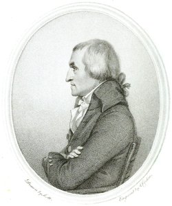
major james rennell, frs, frse, frgs
1742 - 1830 , United Kingdom
Quick Facts
- Artists Or Movements Influenced By This Artist: ['Faculty of Asian and Middle Eastern Studies']
- Artists Who Influenced This Artist: ['Walter Westley Russell']
- Date Of Birth: December 3, 1742
- Date Of Death: March 29, 1830
- Full Name: James Rennell
- Nationality: British
- Notable Artworks:
- A Bengal Atlas
- Map of the Provinces of Delhi
- Place Of Birth: Chidley, United Kingdom