 Preview
 Send
Send Share
Share
 Details

 Download
 Similars
 X-Ray
X-Ray Diaporama
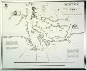
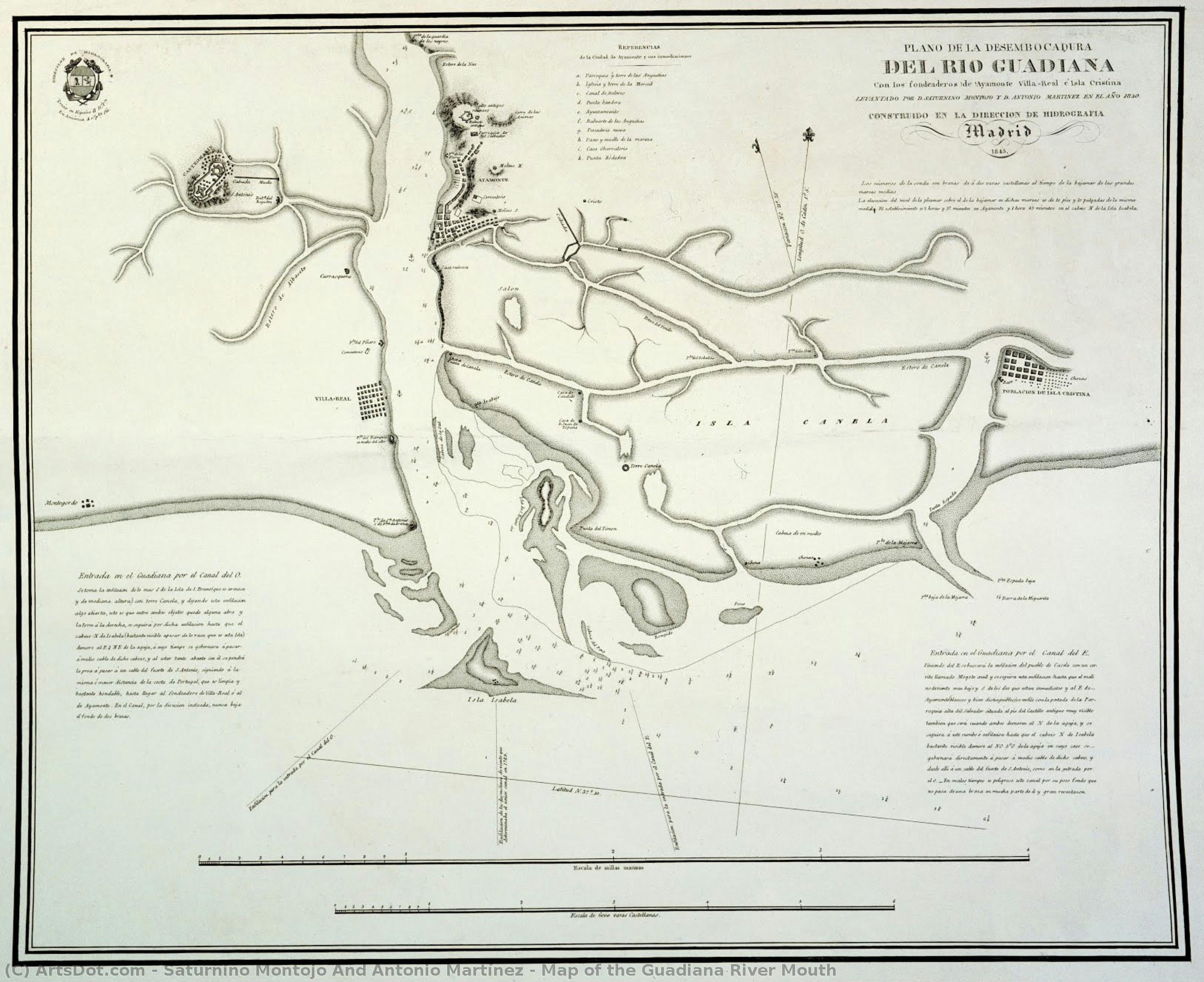
Map of the Guadiana River Mouth
 1840
1840 46.0 x 56.0 cm
 Andalusian Archives
 Read More
Giclée / Art Print
Museum-quality giclée or canvas print with fast production and flexible finish options. ( Buy Hand Made Painting Buy Image)




































Pick from our preset sizes that match the artwork's original proportions.

You may enter your own dimensions to fit a specific frame or space. If your selected size does not match the original image's proportions, we will either crop the artwork or extend the image with a mirrored or solid-fill edge. A digital mockup will be sent for your approval before production begins.
Please note that the on-screen preview does not reflect the actual cropping or extension. Only the mockup will accurately show the final composition.
While custom sizes are available, we recommend selecting a dimension from the predefined list to preserve the original proportions.
Worldwide Delivery () in 2 weeks instead of standard 4/5 weeks. (4 September)

Free Worldwide Express Shipping

High-Quality Linen Canvas

Full Shipping Insurance

Customs Tax Refund Guarantee

True Color Matching Guarantee

60-Day Return Policy (Defects Only)

100% Money-Back Guarantee

Bulk Discount Offer
 Glass option is only available in size under 110 CM

Map of the Guadiana River Mouth
Giclée / Art Print
Reproduction Size
-


Total Price
$ 63
Related Artworks
Artist Biography
Saturnino Montojo and Antonio Martínez: Navigators of the Guadiana
The world of 19th-century cartography was driven by a relentless pursuit of accuracy, fueled by burgeoning scientific understanding and the demands of expanding empires. Emerging from the vibrant port city of Ferrol in Spain, Saturnino Montojo and Antonio Martínez stand as pivotal figures in this narrative, renowned for their meticulous creation of the Map of the Guadiana River Mouth – a remarkable achievement that continues to captivate art enthusiasts and historians alike. Their collaboration, spanning just a few years, produced a work of astonishing detail and precision, offering an invaluable record of a crucial waterway at the heart of Spain’s colonial ambitions in the Americas.
Born in 1796, Saturnino Montojo's early life remains somewhat shrouded in historical detail. He demonstrated a keen interest in mathematics and astronomy from a young age, subjects that would ultimately shape his professional trajectory. He joined the Spanish Navy, gaining valuable experience in navigation and surveying – skills absolutely essential for undertaking such an ambitious mapping project. It was during this period that he encountered Antonio Martínez, whose birthdate remains undocumented but who shared Montojo’s passion for scientific observation and cartographic representation. Together, they embarked on a mission of considerable scope: to chart the complex and often treacherous mouth of the Guadiana River in southwestern Spain.
The Birth of a Masterpiece: The Map of the Guadiana
Commissioned by the Spanish government, the Map of the Guadiana River Mouth was completed in 1840. This wasn’t merely a depiction of geography; it was a testament to Montojo and Martínez's dedication to scientific rigor. They meticulously gathered data through direct observation, utilizing instruments like sextants and compasses to determine precise coordinates. Crucially, they incorporated information from local inhabitants – fishermen, traders, and indigenous communities – whose knowledge of the river’s currents, seasonal changes, and hidden channels proved invaluable. The map itself is a stunning example of 19th-century cartographic technique; it features intricate details of the coastline, including numerous inlets, sandbanks, and islands, all rendered with remarkable accuracy. The color palette – primarily browns, ochres, and blues – reflects the natural hues of the landscape, further enhancing its realism.
The project demanded a significant investment in time and resources. The team faced logistical challenges navigating the river’s unpredictable currents and dealing with inclement weather. Yet, they persevered, driven by a commitment to producing a map that would serve as a vital tool for navigation, trade, and military strategy. It's believed that the map was initially intended for use in the Spanish colony of Portuguese Africa, highlighting Spain’s strategic interest in controlling access to the region.
Scientific Method and Artistic Representation
While rooted in scientific observation, Montojo and Martínez’s work transcends a purely technical exercise. The Map of the Guadiana is imbued with an understated elegance – a testament to their ability to translate complex data into a visually compelling representation. The level of detail achieved was unprecedented for its time, showcasing a sophisticated understanding of surveying techniques and a keen eye for visual clarity. It’s important to note that cartography in this era wasn't solely about scientific accuracy; there was an inherent artistic element involved in choosing scales, representing terrain, and selecting appropriate symbols. Montojo and Martínez skillfully balanced these considerations, resulting in a map that is both informative and aesthetically pleasing.
The influence of the Enlightenment’s emphasis on empirical observation undoubtedly shaped their approach. Furthermore, advancements in mathematics and geometry provided the theoretical framework for accurate measurement and representation. The meticulous nature of their work reflects a broader trend within 19th-century science – a growing belief in the power of reason and systematic investigation to unlock the secrets of the natural world.
Legacy and Historical Significance
Despite the relatively short timeframe of their collaboration, Saturnino Montojo and Antonio Martínez left an enduring legacy. The Map of the Guadiana River Mouth remains a significant historical artifact, offering invaluable insights into 19th-century Spanish cartography and colonial ambitions. It’s a remarkable example of how scientific observation, combined with artistic skill, can produce a work of lasting value. Today, reproductions of this map – meticulously crafted by ArtsDot.com – allow us to appreciate the dedication and ingenuity of these two Spanish astronomers and mathematicians, reminding us of their pivotal role in shaping our understanding of the Guadiana River and its surrounding landscape.
The work continues to be studied by historians and cartographers alike, serving as a benchmark for accuracy and detail. It stands as a powerful reminder that even seemingly simple maps can hold profound historical significance, offering windows into the past and illuminating the complex interplay between science, art, and empire.
saturnino montojo and antonio martínez
1796 - 1856 , Spain
Quick Facts
- Artistic Movement Or Style: Cartography
- Date Of Birth: 1796
- Date Of Death: 1856
- Full Name: Saturnino Montojo & Antonio Martinez
- Nationality: Spanish
- Notable Artworks: ['Map of the Guadiana River Mouth']
- Place Of Birth: Ferrol, Spain