 Preview
 Send
Send Share
Share
 Details

 Download
 Similars
 X-Ray
X-Ray Diaporama
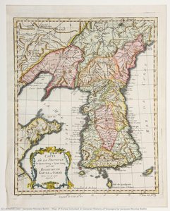
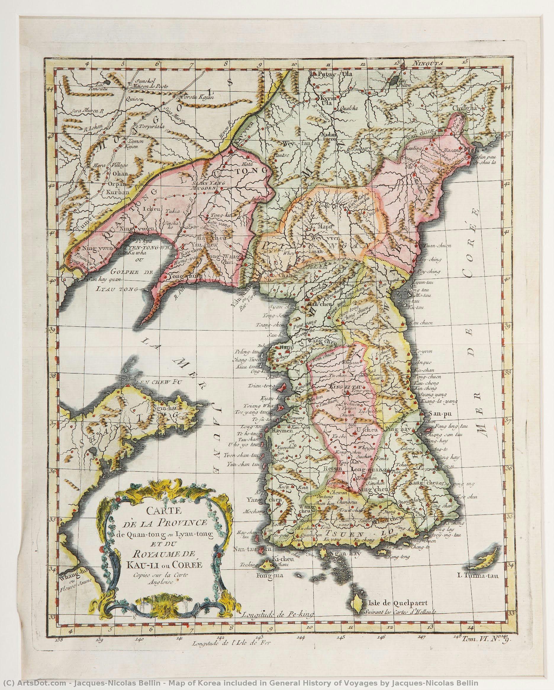
Map of Korea included in General History of Voyages by Jacques-Nicolas Bellin


 Read More
Giclée / Art Print
Museum-quality giclée or canvas print with fast production and flexible finish options. ( Buy Hand Made Painting Buy Image)




































Pick from our preset sizes that match the artwork's original proportions.

You may enter your own dimensions to fit a specific frame or space. If your selected size does not match the original image's proportions, we will either crop the artwork or extend the image with a mirrored or solid-fill edge. A digital mockup will be sent for your approval before production begins.
Please note that the on-screen preview does not reflect the actual cropping or extension. Only the mockup will accurately show the final composition.
While custom sizes are available, we recommend selecting a dimension from the predefined list to preserve the original proportions.
Worldwide Delivery () in 2 weeks instead of standard 4/5 weeks. (3 September)

Free Worldwide Express Shipping

High-Quality Linen Canvas

Full Shipping Insurance

Customs Tax Refund Guarantee

True Color Matching Guarantee

60-Day Return Policy (Defects Only)

100% Money-Back Guarantee

Bulk Discount Offer
 Glass option is only available in size under 110 CM

Map of Korea included in General History of Voyages by Jacques-Nicolas Bellin
Giclée / Art Print
Reproduction Size
-


Total Price
$ 63
A Window into the Enlightenment: The Cartographic Mastery of Bellin
In the grand tapestry of eighteenth-century exploration, few artifacts capture the spirit of discovery as elegantly as the Map of Korea, featured within Jacques-Nicolas Bellin’s General History of Voyages. Created in 1752, this exquisite piece is far more than a mere navigational tool; it is a profound testament to the Age of Enlightenment, where the pursuit of scientific precision met the artistry of classical cartography. As one gazes upon the delicate coastlines of China, Japan, and the Korean peninsula, there is an immediate sense of traveling through time, back to an era when every new coastline charted represented a triumph of human intellect over the vast, unknown oceans.
The composition of this map breathes with a quiet, rhythmic grace. The artist’s hand—or rather, the hydrographer's meticulous eye—guides the viewer across a sea of parchment, where the intricate details of maritime geography are balanced by an airy, expansive sense of space. Small, solitary vessels drift across the painted waves, serving as poignant symbols of human vulnerability and courage amidst the immense scale of the Pacific. These tiny boats do not merely represent commerce or travel; they embody the very essence of the philosophes' era: the daring attempt to navigate and document the world through reason, observation, and unyielding curiosity.
The Artistry of Precision and Historical Legacy
Technically, the work reflects the pinnacle of French hydrographic skill. The precision of the coastlines and the careful placement of a classic compass rose near the upper corner demonstrate Bellin’s dual identity as both a scientist and an artist. The subtle interplay of ink and tone creates a sense of depth, making the maritime boundaries feel tangible. For the discerning collector or interior designer, this piece offers a sophisticated aesthetic that transcends simple decoration. It possesses a scholarly weight, bringing an atmosphere of intellectual prestige and historical depth to any curated space.
To possess a reproduction of this map is to invite a piece of the French Empire’s maritime glory into one's home. Whether placed in a sunlit study, a formal library, or as a focal point in a contemporary living area, the map acts as a conversation starter—a bridge between the rugged reality of naval exploration and the refined elegance of classical art. It evokes a sense of wanderlust and a deep respect for the historical foundations of our modern, interconnected world, making it an indispensable acquisition for those who find beauty in the intersection of history, science, and fine art.
Related Artworks







Artist Biography
Jacques-Nicolas Bellin: Cartographer of the French Empire
Jacques-Nicolas Bellin (1703 – 21 March 1772) stands as a pivotal figure in the history of French cartography and a testament to the meticulous dedication demanded by naval hydrography. Born in Paris, he wasn’t merely a mapmaker; he was an integral part of the intellectual ferment of his time, belonging to the influential group known as the philosophes – those Enlightenment thinkers who sought to understand and shape the world through reason and observation. Bellin's legacy rests primarily on his extraordinarily detailed maps, particularly those charting Canada, Louisiana, and the broader territories of New France, which remain invaluable historical documents today. His work wasn’t simply about depicting geography; it was a crucial element in France’s imperial ambitions and its burgeoning maritime power.
Bellin's career began formally in 1721 when he was appointed hydrographer to the French Navy, a remarkably young age for such a prestigious position. This appointment marked the start of a fifty-year period during which he produced an astonishing volume of charts and atlases – including the monumental Atlas Maritime and the smaller but equally impressive Petit Atlas Maritime (containing 580 individual charts). These weren’t merely reproductions of existing knowledge; Bellin brought a level of precision and artistry rarely seen in his era. He meticulously incorporated contemporary observations, utilizing new surveying techniques to create maps that were remarkably accurate for their time. His work was highly sought after throughout Europe, with many other mapmakers adopting his standards of excellence.
The Philosophes and the Pursuit of Knowledge
Bellin’s involvement with the Encyclopédie, the ambitious project spearheaded by Denis Diderot and Jean le Rond d'Alembert, speaks volumes about his intellectual standing. He contributed a staggering 994 articles to this vast compendium of knowledge, demonstrating a breadth of interests that extended far beyond cartography. This engagement with the philosophes reflects a broader commitment to rational inquiry and the systematic pursuit of understanding – principles deeply embedded in his approach to mapmaking. Bellin’s work wasn't driven solely by practical necessity; it was fueled by a genuine desire to document, analyze, and disseminate knowledge about the world.
Furthermore, Bellin’s dedication to accuracy extended beyond purely technical considerations. He famously acknowledged the source of one significant error in his maps – a misinterpretation of a map created by Spanish missionary Pedro Murillo Velarde charting the Philippines. This act of intellectual honesty, a rarity for cartographers of the time, highlights Bellin's commitment to rigorous scholarship and responsible representation. He meticulously documented the origins of his information, demonstrating a respect for the work of others and acknowledging the potential for error in any system of knowledge.
Mapping the New World: Canada, Louisiana, and Beyond
Bellin’s most enduring contributions lie in his detailed maps of North America. His charts of Canada were particularly crucial to French colonial administration, providing essential navigational information for trade routes, settlements, and military operations. He meticulously documented the waterways, coastlines, and interior geography of New France – encompassing territories that would later become Quebec, Ontario, and other parts of Eastern Canada. Similarly, his maps of Louisiana, including the vital port of New Orleans, were instrumental in asserting French control over this strategically important region.
Bellin’s work extended beyond these specific regions, producing comprehensive atlases depicting vast stretches of the Atlantic Ocean and the Indian Ocean. These atlases showcased his mastery of cartographic techniques and his ability to synthesize complex geographical data into visually compelling representations. The sheer scale and detail of these projects underscore Bellin's dedication to his craft and his significant role in shaping European understanding of the world.
A Lasting Legacy
Jacques-Nicolas Bellin’s influence on cartography is undeniable. His meticulous approach, combined with his commitment to accuracy and intellectual honesty, set a new standard for mapmaking during the 18th century. His maps are not merely historical artifacts; they offer invaluable insights into the geography, politics, and culture of France's colonial era. They stand as a testament to the power of observation, analysis, and artistic skill – qualities that continue to resonate with art historians and cartographic enthusiasts today. His work remains a vital resource for researchers studying early American history, maritime exploration, and the development of European cartography.
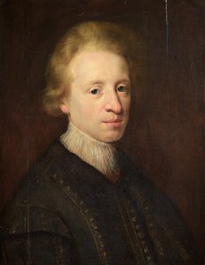
jacques-nicolas bellin
1703 - 1772 , France
Quick Facts
- Artistic Movement Or Style: Hydrography, Cartography
- Artists Or Movements Influenced By This Artist:
- European cartography
- 18th-century France
- Artists Who Influenced This Artist:
- Denis Diderot
- Jean le Rond d'Alembert
- Date Of Birth: 1703, Paris, France
- Date Of Death: 1772, Versailles, France
- Full Name: Jacques-Nicolas Bellin
- Nationality: French
- Notable Artworks:
- Carte réduite de l'océan septentrional
- Map of Korea (General History Voyages)
- Place Of Birth: Paris, France
Related Articles
Illuminating the Enlightenment: Art & Sociopolitical Context of the 18th Century
Explore the art of the Enlightenment! Discover Rococo's elegance, Neoclassicism’s virtue, & David’s revolutionary masterpieces. Uncover the sociopolitical context shaping 18th-century European painting.
18th Century Masters: 10 Artworks That Define an Era | ArtsDot
Journey through 18th century art! Explore 10 iconic paintings – from Rococo elegance to Neoclassical grandeur. Discover Fragonard, David & more. Find museum-quality reproductions and elevate your home decor on ArtsDot.com.
Echoes of Time: Nostalgia, Technique & Cultural Significance in Vintage Paintings
Explore the captivating world of vintage paintings! Discover key styles, cultural significance & collecting tips from art experts at ArtsDot. Find authentic reproductions and elevate your home décor.
Illuminating the Enlightenment: Artistic Expression in 18th-Century Europe
Explore the artistic brilliance of the Enlightenment era! Discover Rococo's elegance & Neoclassicism’s virtue with expert insights into 18th-century masterpieces. Learn about David, Kauffmann & more.
Illuminating the Enlightenment: A Comprehensive Exploration of 18th-Century Painting
Explore the captivating world of 18th-century painting! Discover Rococo's playful elegance & Neoclassicism’s Enlightenment ideals with expert insights into Fragonard, David, and more. A comprehensive guide for art enthusiasts.