

 Preview
 Send
Send Share
Share
 Details

 Download
 Similars
 X-Ray
X-Ray Diaporama
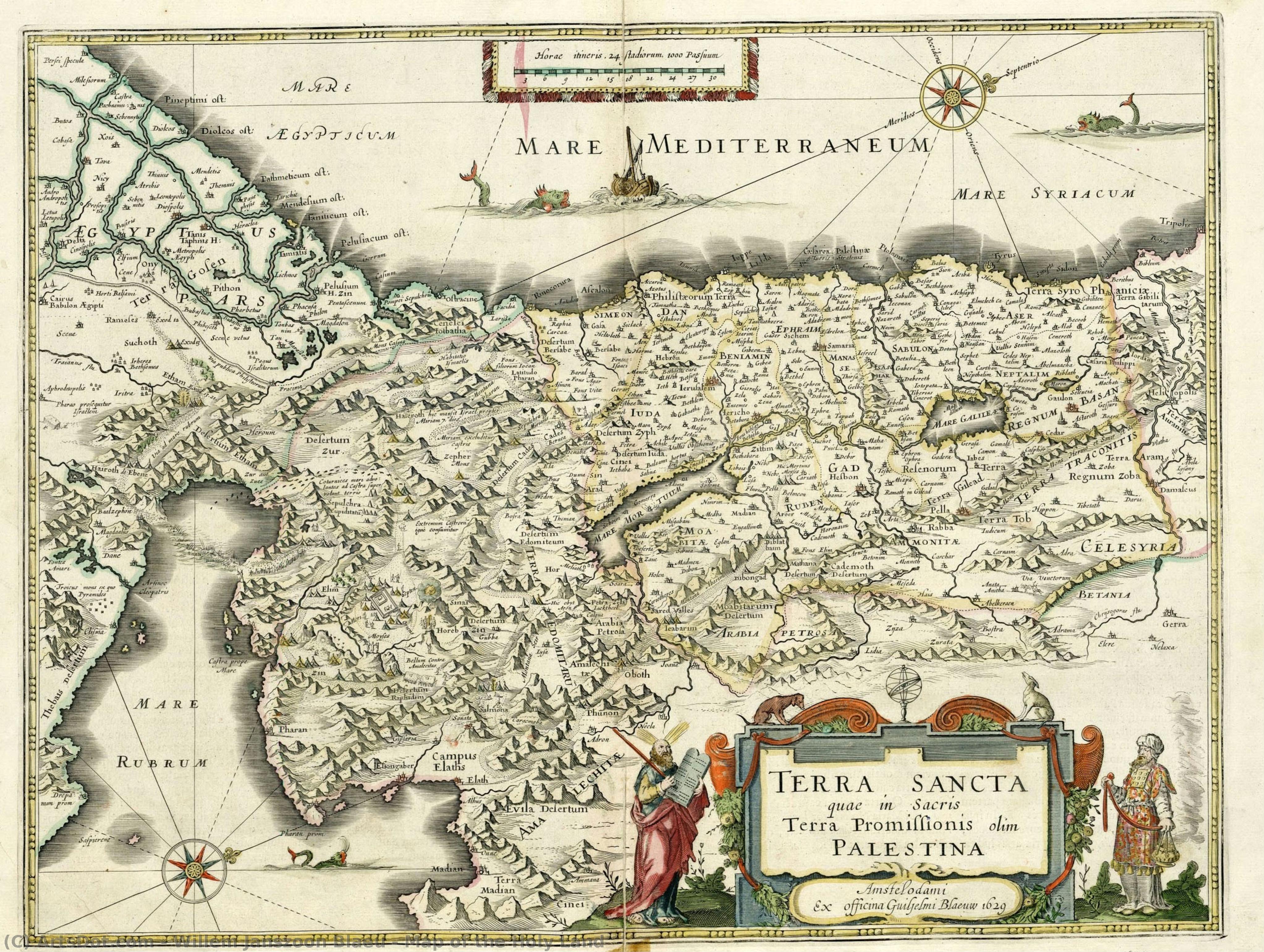
Map of the Holy Land
 Oil On Copper
- Baroque
 1629
1629- Early Modern
 38.0 x 49.0 cm
 the-national-library-of-israel
 Read More
Purchase a high-resolution, enhanced digital image, far superior to the online preview.
Each file is meticulously prepared by our in-house specialists using advanced tools and expert manual retouching. We ensure every image has exceptional clarity, precise color accuracy, and fine detail.
The final file is delivered via email within 72 hours, optimized for immediate use in professional, editorial, and print environments. This is the same quality trusted by top-tier design studios, publishers, and galleries.
Digital Image
Download a high-resolution file for personal display, printing, and creative projects. ( Buy Print Buy Hand Made Painting)
Included in Every Digital Image Order
Expert Digital Delivery, Guaranteed
When you choose ArtsDot.com, you're not just getting an image - you're receiving a professionally enhanced digital artwork, crafted with precision and backed by a satisfaction guarantee. Here's everything that comes with your order, automatically:

Fast Email Delivery
Your high-resolution digital image file will be emailed to you within 72 hours of ordering - ready for immediate use.

AI-Enhanced Digital File
Your artwork is professionally optimized using advanced AI tools and manual editing, ensuring maximum detail, clarity, and color accuracy.

Free Lifetime Re-Delivery
Accidentally deleted or lost your file? No worries - we'll resend it to you anytime, free of charge.

No Import Fees - Ever
Enjoy your artwork instantly with zero customs, duties, or delivery fees - digital downloads are always tax-free.

Color Accuracy Guarantee
We ensure your digital image reflects the original colors as closely as possible using professional tools and color management.

60-Day Satisfaction Guarantee
If you're not satisfied with your digital image, we'll revise it or refund 100% within 60 days - no questions asked.

100% Money-Back Guarantee
Not satisfied? Get a full refund within 60 days of receiving your digital file - no questions asked.

Bulk Order Discounts
Buy 3 images, save 10% - Buy 5, save 15% - Buy 10+, save 20%. Great for creative projects, galleries, and agencies.
Collectible Description
A Journey Through Time: The Cartographic Mastery of Willem Janszoon Blaeu
In the quiet corridors of the National Library of Israel, there exists a window into the seventeenth century that transcends mere geography. Map of the Holy Land, created in 1629 by the legendary Dutch cartographer Willem Janszoon Blaeu, is far more than a navigational tool; it is a profound piece of historical storytelling. Rendered with the meticulous precision that defined the Dutch Golden Age, this work captures the sacred topography of a region central to human faith and history. As one gazes upon the intricate details of Jerusalem, Bethlehem, and Nazareth, the map ceases to be a flat surface and becomes a spiritual pilgrimage, inviting the viewer to wander through the ancient landscapes of Mount Sinai and Mount Tabor.
The technical brilliance of this piece lies in its medium and execution. Originally etched onto copper, the work possesses a clarity and sharpness that allowed Blaeu to communicate complex topographical data with unparalleled elegance. In this particular presentation, the monochromatic palette lends an air of timelessness and gravity to the composition. The stark contrast of black and white emphasizes the delicate linework, highlighting the rugged silhouettes of mountains and the precise placement of ancient settlements. For the discerning collector or interior designer, this aesthetic offers a sophisticated, understated elegance that complements both classical and contemporary spaces, providing a focal point that is intellectually stimulating and visually serene.
To understand this map is to understand the era of great exploration. Willem Janszoon Blaeu was not merely a drawer of lines; he was a man shaped by the scientific revolutions of his time, having worked alongside the great astronomer Tycho Brahe. His work represents the intersection of art, science, and theology. During the 1600s, maps like this served as vital bridges between the known world and the mysteries of the divine. Every mountain range and riverbed depicted was a testament to the human desire to document, understand, and honor the sacred geography of the Earth. Owning a reproduction of such a masterpiece is an opportunity to possess a fragment of the Age of Discovery, bringing the spirit of intellectual curiosity and historical reverence into the modern home.
Related Artworks







Artist Biography
Willem Janszoon Blaeu: Life and Legacy
Early Life and Education
- Born: 1571, possibly in Alkmaar or Uitgeest, Netherlands.
- Willem Janszoon Blaeu’s early life was rooted in the family's herring trade business. However, his interests soon shifted towards more intellectual pursuits.
- He developed a keen interest in mathematics and astronomy, leading him to seek guidance from Adriaan Anthonisz, a surveyor and astronomer who became his scientific advisor.
- In 1592, at the age of 23, Blaeu moved to Amsterdam intending to further his involvement in the herring trade but quickly prioritized his burgeoning passion for cartography.
Years with Tycho Brahe and Early Cartographic Work
- A pivotal moment in Blaeu’s development came with a two-year stay (1594-1596) on the island of Hven, Denmark.
- There, he worked alongside Tycho Brahe, the renowned Danish astronomer, assisting with astronomical observations and mapmaking. This experience honed his skills in precision measurement and celestial mapping.
- Upon returning to Amsterdam, Blaeu established himself as a cartographer and globe maker, quickly gaining recognition for his accuracy and innovative techniques.
Establishing a Cartographic Empire
- In 1604, Blaeu published a world map that drew heavily from the work of Gerardus Mercator, particularly his projection. This map established Blaeu’s reputation as a leading cartographer.
- He expanded his business, producing globes and atlases alongside individual maps. His workshop became one of the largest and most productive in Amsterdam.
- Blaeu's Atlas Novus, published in 1635, was a landmark achievement – a comprehensive collection of maps renowned for their detail, accuracy, and artistic quality.
- The family business continued after his death with his sons Joan Blaeu and Cornelis Blaeu continuing the work.
Influences and Artistic Development
- Gerardus Mercator’s map projections profoundly influenced Blaeu's cartographic approach, particularly his use of the Mercator projection for nautical charts.
- Tycho Brahe’s emphasis on precise astronomical observation instilled in Blaeu a commitment to accuracy and scientific rigor.
- Blaeu integrated artistic elements into his maps, employing decorative cartouches, elaborate borders, and detailed illustrations. This combined scientific precision with aesthetic appeal.
Major Achievements and Historical Significance
- Innovation in Mapmaking: Blaeu pioneered new techniques for map production, including the use of multiple plates to create colored maps.
- Comprehensive Atlases: His atlases were among the most comprehensive and influential of their time, providing detailed geographical information for merchants, explorers, and scholars.
- Stimulating Competition: Blaeu’s rivalry with Jodocus Hondius and his heirs spurred a period of intense competition in cartography, leading to unprecedented levels of production and innovation during the Dutch Golden Age.
- Legacy: Willem Janszoon Blaeu's maps remain valuable historical documents, offering insights into 17th-century geography, exploration, and artistic sensibilities. His work significantly contributed to the advancement of cartography and our understanding of the world.
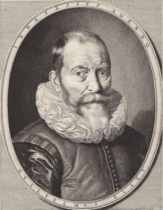
willem janszoon blaeu
1571 - 1638 , Netherlands
Quick Facts
- Birth Date: 1571
- Birth Place: Alkmaar, Netherlands
- Death Date: 1638
- Influenced: Jodocus Hondius
- Influenced By: Gerardus Mercator, Tycho Brahe
- Movement: Golden Age Cartography
- Name: Willem Janszoon Blaeu
- Nationality: Dutch
- Notable Works: World Map (1604), Atlases, Globes

