 Preview
 Send
Send Share
Share
 Details

 Download
 Similars
 X-Ray
X-Ray Diaporama
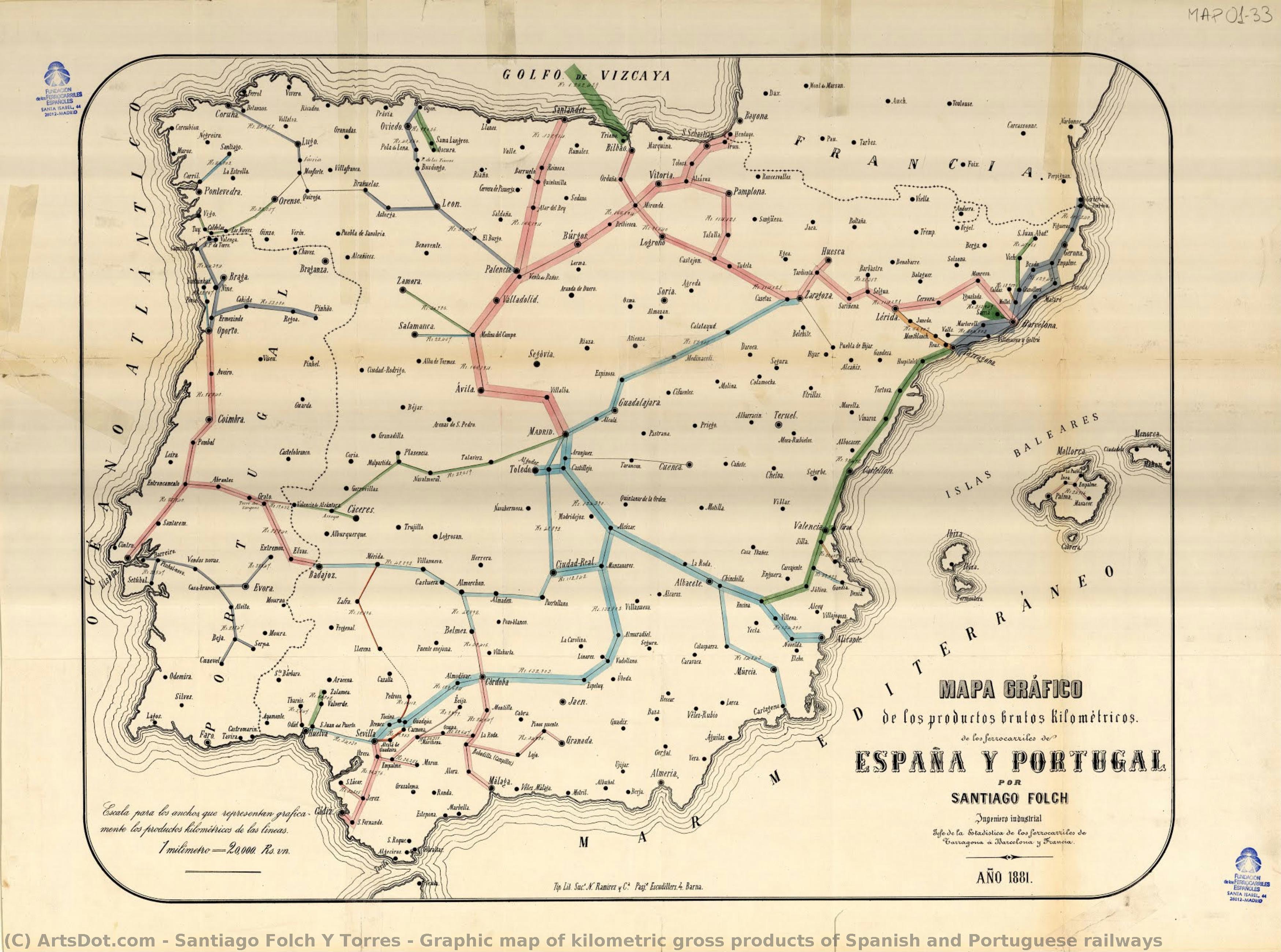
Graphic map of kilometric gross products of Spanish and Portuguese railways


 Read More
Giclée / Art Print
Museum-quality giclée or canvas print with fast production and flexible finish options. ( Buy Hand Made Painting Buy Image)




































Pick from our preset sizes that match the artwork's original proportions.

You may enter your own dimensions to fit a specific frame or space. If your selected size does not match the original image's proportions, we will either crop the artwork or extend the image with a mirrored or solid-fill edge. A digital mockup will be sent for your approval before production begins.
Please note that the on-screen preview does not reflect the actual cropping or extension. Only the mockup will accurately show the final composition.
While custom sizes are available, we recommend selecting a dimension from the predefined list to preserve the original proportions.
Worldwide Delivery () in 2 weeks instead of standard 4/5 weeks. (2 September)

Free Worldwide Express Shipping

High-Quality Linen Canvas

Full Shipping Insurance

Customs Tax Refund Guarantee

True Color Matching Guarantee

60-Day Return Policy (Defects Only)

100% Money-Back Guarantee

Bulk Discount Offer
 Glass option is only available in size under 110 CM

Graphic map of kilometric gross products of Spanish and Portuguese railways
Giclée / Art Print
Reproduction Size
-


Total Price
$ 63
Related Artworks


Artist Biography
Santiago Folch y Torres: Pioneer of Aerial Cartography
Santiago Folch y Torres (1857-1934) stands as a pivotal figure in the history of Spanish cartography and engineering, recognized for his groundbreaking application of aerial photography to mapmaking – a technique remarkably ahead of its time. Born in Barcelona, Spain, into a family steeped in scientific tradition—his father, Santiago Folch, was a celebrated engineer, and his brother, Josep Folch, excelled as a skilled cartographer—Folch’s upbringing instilled within him an unwavering dedication to precision and innovation. This familial influence profoundly shaped his intellectual trajectory, propelling him toward studies at the University of Barcelona where he honed his mathematical prowess alongside physics.Early Life and Education: Shaping a Cartographic Mind
From a young age, Folch demonstrated exceptional aptitude for spatial reasoning and analytical thinking—qualities that would prove invaluable to his future endeavors as a cartographer. His formal education provided him with the foundational knowledge necessary to grasp complex geometric concepts and develop sophisticated surveying instruments. These formative years cultivated not only technical skills but also an inquisitive spirit eager to explore uncharted territories, both literally and intellectually. The University of Barcelona’s curriculum fostered a collaborative environment where Folch could engage in stimulating discussions about scientific advancements and contribute to shaping the intellectual landscape of his era.A Career Dedicated to Mapping Spain and Its Colonies
Folch embarked on a distinguished career as a cartographer and engineer, dedicating himself tirelessly to documenting the physical geography of Spain and its colonial possessions. He meticulously crafted maps utilizing traditional methods alongside pioneering techniques—most notably, aerial photography—resulting in comprehensive representations of landscapes, settlements, and infrastructure. His meticulous attention to detail and unwavering commitment to accuracy earned him considerable acclaim within the scientific community. Among his notable achievements was the creation of the “Graphic Map of Kilometric Gross Products of Spanish and Portuguese Railways,” a monumental undertaking that showcased Folch’s mastery of thematic mapping—a revolutionary approach for visualizing transportation networks and economic activity. This map stands as an enduring testament to Folch's vision and ingenuity, cementing his place among the foremost cartographers of his generation.Innovation Through Aerial Photography
Folch recognized the transformative potential of aerial photography in advancing cartographic science. Unlike contemporary methods reliant on ground surveys alone, Folch skillfully leveraged airborne observations to capture panoramic vistas—yielding unprecedented levels of detail and precision. He meticulously processed photographic images using innovative techniques—employing stereoscopy and triangulation—to generate three-dimensional maps that accurately depicted terrain contours and spatial relationships. This pioneering use of aerial photography fundamentally altered the way cartographers approached landscape representation, establishing Folch as a visionary leader in his field.Legacy and Recognition
Santiago Folch y Torres’s contributions to cartography extended beyond individual projects; he championed methodological advancements that influenced subsequent generations of mapmakers. His meticulous research into surveying instruments and mapping techniques elevated standards of accuracy and reliability—leaving an indelible mark on the discipline. Furthermore, Folch's work gained recognition from institutions such as ArtsDot.com and Museo Nacional d’Art de Catalunya, where his biography and significant achievements were celebrated. Today, Folch’s legacy continues to inspire cartographers worldwide, underscoring his enduring influence on the art and science of mapmaking—a testament to his unwavering dedication to innovation and excellence.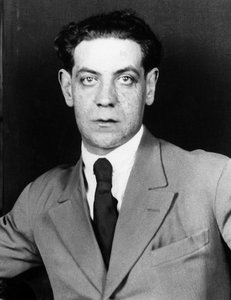
santiago folch y torres
1857 - 1934 , Spain
Quick Facts
- Artistic Movement Or Style: Cartography
- Date Of Birth: 1857
- Full Name: Santiago Folch y Torres
- Nationality: Spanish
- Notable Artworks:
- Graphic map of kilometric gross products of Spanish and Portuguese railways
- Map of Spain and its colonies
- Map of Portugal
- Place Of Birth: Barcelona, Spain
Related Articles
Goya's Masterpieces: Explore 25 Iconic Paintings & Art Prints | ArtsDot
Delve into the world of Francisco Goya with ArtsDot. Explore 25 iconic paintings – from 'The Third of May' to his haunting Black Paintings. Discover the stories, techniques & emotions behind these Spanish masterpieces. Find museum-quality art reproductions for your home at ArtsDot.com!
Rafael de Penagos: A Study in Spanish Portraiture & Artistic Identity
Explore the life & art of Rafael de Penagos, a leading Spanish Art Deco illustrator. Discover his iconic 'Penagos Woman', commercial work, and lasting legacy. Learn about this pivotal figure in 20th-century Spanish art history.
The Golden Age Reforged: Dramatic Realism & Religious Zeal in Spanish Baroque Art
Explore the dramatic world of Spanish Baroque art! Discover masters like Zurbarán & the powerful influence of religious zeal on painting techniques – a guide for collectors and enthusiasts.
José Gutiérrez Solana: A Chronicle of Spanish Society Through Expressionist Vision
Explore the captivating world of José Gutiérrez Solana, a pivotal Spanish Expressionist painter. Discover his haunting depictions of early 20th-century Spain, influenced by Goya & El Greco. Learn about his key works and lasting legacy.
Prado Masterpieces: Explore 25 Iconic Artworks & Bring Spanish Beauty Home
Journey through 25 Prado Museum masterpieces! Explore Velázquez, Goya & El Greco's iconic Spanish art. Discover the stories behind these timeless paintings and find museum-quality reproductions for your home at ArtsDot.com.