- Home

- Print on canvas
- Secretariat Of State For Environment And Water Resources Of The Federal District
 Preview
 Send
Send Share
Share
 Details

 Download
 Similars
 X-Ray
X-Ray Diaporama
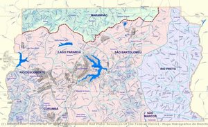
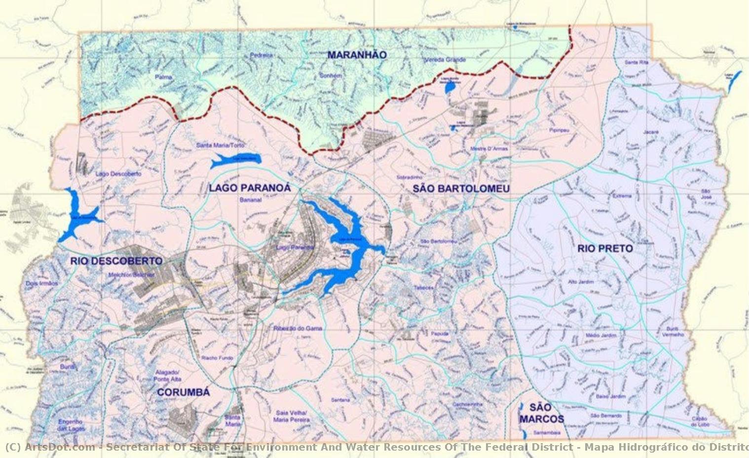
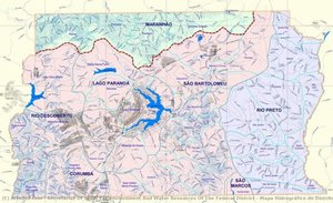
Mapa Hidrográfico do Distrito Federal


 Read More
Giclée / Art Print
Museum-quality giclée or canvas print with fast production and flexible finish options. ( Buy Hand Made Painting Buy Image)




P118B $10

P118H $10

P118W $10

P438Z $10

P508JH $12

P508YH $12

P805H $10

P805Z $10

P919BZ $10

P919G $10

P919XJ $10

P959ZH $10

P968JZ $12

W106C $8

W218G $10

W218JH $8

W218Y $10

W307PJ $10

W316G $10

W316PJ $8

W316Y $10

W398PJ $8

W4111J $10

W500HY $15

W500JH $15

W692G $12

W849H $8

W940BG $15

W953PJ $8




Pick from our preset sizes that match the artwork's original proportions.

You may enter your own dimensions to fit a specific frame or space. If your selected size does not match the original image's proportions, we will either crop the artwork or extend the image with a mirrored or solid-fill edge. A digital mockup will be sent for your approval before production begins.
Please note that the on-screen preview does not reflect the actual cropping or extension. Only the mockup will accurately show the final composition.
While custom sizes are available, we recommend selecting a dimension from the predefined list to preserve the original proportions.
Worldwide Delivery () in 2 weeks instead of standard 4/5 weeks. (2 September)

Free Worldwide Express Shipping

High-Quality Linen Canvas

Full Shipping Insurance

Customs Tax Refund Guarantee

True Color Matching Guarantee

60-Day Return Policy (Defects Only)

100% Money-Back Guarantee

Bulk Discount Offer
 Glass option is only available in size under 110 CM

Mapa Hidrográfico do Distrito Federal
Giclée / Art Print
Reproduction Size
-


Total Price
$ 63
Related Artworks




Artist Biography
Charting the Waters: The Cartographic Vision of the Secretariat Of State For Environment And Water Resources Of The Federal District
The Secretariat Of State For Environment And Water Resources Of The Federal District, while perhaps an unconventional name to find associated with artistic creation, represents a fascinating intersection of scientific precision and aesthetic beauty. This entity isn’t simply a governmental body; it is a custodian of place, a chronicler of the Brazilian landscape through the meticulous art of cartography. Their work transcends mere mapmaking, evolving into a visual language that speaks volumes about the region's ecological importance, its complex terrain, and the delicate balance between nature and human development. The maps produced by the Secretariat are not born from abstract data alone, but from an intimate understanding of the Federal District’s rivers, lakes, forests, and urban sprawl—a perspective rooted in their mandate to protect and manage these vital resources.A Legacy Forged in Topographic Detail
The origins of the Secretariat's cartographic endeavors are deeply intertwined with the need for informed environmental policy. As Brazil underwent rapid modernization, particularly within its capital region, a comprehensive understanding of the land became paramount. The Secretariat rose to meet this challenge, establishing a dedicated team focused on creating highly detailed topographic maps. These weren’t intended solely for bureaucratic purposes; they were envisioned as tools for education, conservation, and sustainable planning. Early works prioritized accuracy, employing traditional surveying techniques alongside emerging technologies to capture the nuances of the Federal District's geography. The resulting maps quickly became invaluable resources for researchers, policymakers, and local communities alike. However, it was the deliberate embrace of artistic principles that elevated these charts beyond functional documents.The Artistry Within the Science
What distinguishes the Secretariat’s cartographic output is its commitment to visual appeal. While adhering to rigorous scientific standards, their maps are imbued with a sense of artistry rarely found in technical illustrations. Hand-painting plays a central role in this process. Skilled artisans meticulously color each contour line, riverbed, and forested area, creating a rich tapestry of hues that reflect the region’s diverse ecosystems. The use of shading techniques adds depth and dimension, allowing viewers to intuitively grasp the terrain's complexities. This aesthetic sensibility isn’t merely decorative; it serves to enhance clarity and accessibility. By employing color and form strategically, the maps become more engaging and easier to interpret, fostering a deeper connection between people and their environment. The Mapa Hidrográfico do Distrito Federal, for example, is a testament to this approach—a stunning visual representation of Brazil’s waterways that seamlessly blends scientific accuracy with artistic finesse.Influences and Development
The Secretariat's cartographic style draws inspiration from several sources. Traditional European mapmaking traditions, particularly those emphasizing topographic detail and elegant rendering, are evident in their early works. However, they also incorporate elements of Brazilian indigenous art, reflecting a respect for local knowledge and cultural heritage. The vibrant color palettes often echo the hues found in native textiles and paintings, creating a visual link between the maps and the region’s rich artistic traditions. Over time, the Secretariat has embraced new technologies while remaining true to its core principles. Digital mapping tools are now used to generate base layers, but hand-painting continues to be an integral part of the process, ensuring that each map retains its unique character and artistic quality.Historical Significance and Ongoing Impact
The cartographic work of the Secretariat Of State For Environment And Water Resources Of The Federal District holds significant historical importance. These maps provide a valuable record of the region’s landscape evolution over time, documenting changes in land use, river courses, and forest cover. They serve as crucial resources for environmental monitoring, conservation efforts, and sustainable development planning. Beyond their practical applications, these maps have also played a role in shaping public perception of the Federal District's natural beauty and ecological importance. By presenting this information in an accessible and visually compelling format, the Secretariat has fostered a greater appreciation for the region’s unique environment. Today, they continue to produce new maps, adapting their techniques to address emerging challenges and ensure that their cartographic legacy endures for generations to come. Their work stands as a powerful example of how scientific precision and artistic expression can converge to create something truly meaningful—a visual testament to the enduring beauty and ecological importance of Brazil’s Federal District.- Key Achievements: Creation of highly detailed topographic maps of the Brazilian Federal District.
- Artistic Style: Blends scientific accuracy with hand-painting techniques, vibrant color palettes, and elements of Brazilian indigenous art.
- Historical Impact: Provides a valuable record of landscape evolution, supports environmental monitoring, and fosters public appreciation for the region’s natural beauty.
Quick Facts
- Artistic Movement Or Style: Hydrographic Mapping
- Date Of Death: Living
- Full Name: Secretariat Of State For Environment And Water Resources Of The Federal District
- Notable Artworks: ['Mapa Hidrográfico do Distrito Federal']
Related Articles
Benedito Calixto: A Brazilian Modernist's Landscape of Memory & National Identity
Explore the captivating world of Benedito Calixto, a pivotal Brazilian Modernist painter. Discover his iconic landscapes, the story behind the famous Bandeirante portrait, and his lasting impact on Brazilian national identity. Learn more at ArtsDot.
Jean-Baptiste Debret: Witnessing Brazil’s Emergence Through Art & Identity
Explore the captivating art of Jean-Baptiste Debret, a key witness to Brazil’s imperial era. Discover his iconic portraits, historical scenes & insightful depictions of Brazilian life. Learn about his legacy and find museum-quality reproductions at ArtsDot.
Alceu de Paula Penna: A Synthesis of Brazilian Modernism & Poetic Abstraction
Explore the captivating world of Alceu de Paula Penna, a pivotal figure in Brazilian Modernism. Discover his innovative concrete poetry & influence on Latin American art history. Expert insights for collectors.
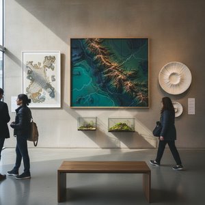
Mapping Beauty: Transform Your Space with Stunning Topographical Artworks
Elevate your interiors with breathtaking topographical art. From vintage cartography to textured 3D reliefs, discover how hand-painted maps and historical landscapes can transform any room into a sophisticated sanctuary of discovery and timeless beauty.
Abraham Hulk Senior: Pioneering Maritime Topography of the Dutch Golden Age
Explore the captivating seascapes of Abraham Hulk Senior, a leading Anglo-Dutch marine painter of the 19th century. Discover his signature style, family legacy & collectable artworks at ArtsDot.