 Preview
 Send
Send Share
Share
 Details

 Download
 Similars
 X-Ray
X-Ray Diaporama
Fernão Vaz Dourado


 Read More
Hand Made Oil Reproduction
Hand-painted oil on canvas in your size and frame, made to order by our artists. ( Buy Print Buy Image)




P118B $10

P118H $10

P118W $10

P438Z $10

P508JH $12

P508YH $12

P805H $10

P805Z $10

P919BZ $10

P919G $10

P919XJ $10

P959ZH $10

P968JZ $12

W106C $8

W218G $10

W218JH $8

W218Y $10

W307PJ $10

W316G $10

W316PJ $8

W316Y $10

W398PJ $8

W4111J $10

W500HY $15

W500JH $15

W692G $12

W849H $8

W940BG $15

W953PJ $8




Pick from our preset sizes that match the artwork's original proportions.

You may enter your own dimensions to fit a specific frame or space. If your selected size does not match the original image's proportions, we will either crop the artwork or extend the painting with additional hand-painted elements. A digital mockup will be sent for your approval before production begins.
Please note that the on-screen preview does not reflect the actual cropping or extension. Only the mockup will accurately show the final composition.
While custom sizes are available, we recommend selecting a dimension from the predefined list to preserve the original proportions.
After order, ArtsDot.com team will email client for instructions and provide a mockup preview
Worldwide Delivery () in 3/4 weeks instead of standard 5 weeks. (22 August). No compromise on quality.

Free Worldwide Express Shipping

High-Quality Linen Canvas

Full Shipping Insurance

Customs Tax Refund Guarantee

True Color Matching Guarantee

60-Day Return Policy (Defects Only)

100% Money-Back Guarantee

Bulk Discount Offer
 Glass option is only available in size under 110 CM

Fernão Vaz Dourado
Reproduction Medium
Reproduction Size
-


Total Price
$ 263
Artwork Description
The Golden Age of Discovery Captured in Ink
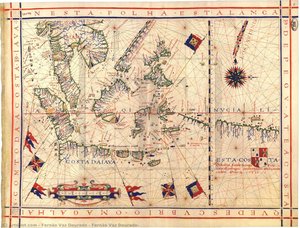
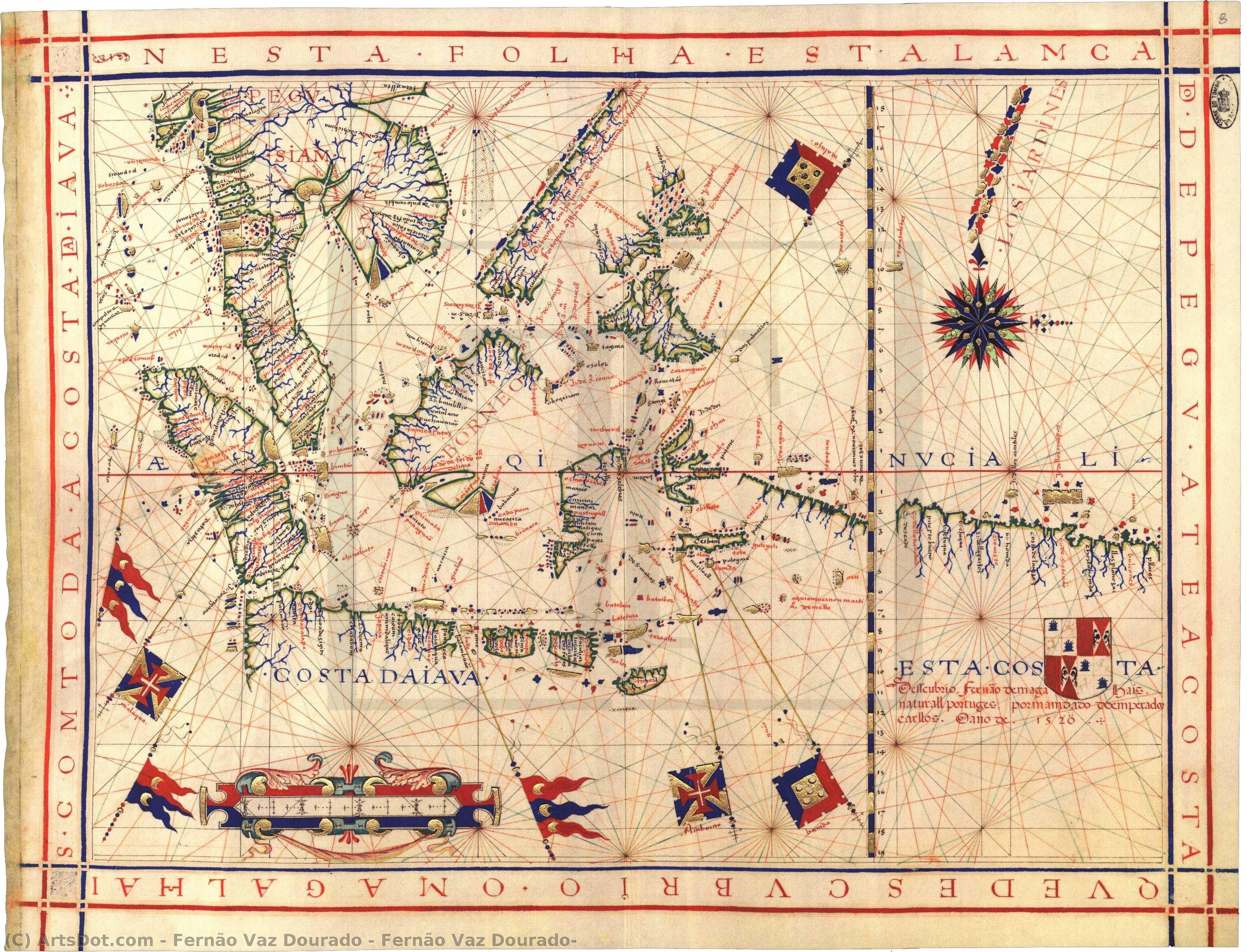
To gaze upon the works of Fernão Vaz Dourado is to embark on a voyage through the sixteenth century, a period when the edges of the known world were being redrawn by the courage of explorers and the precision of master cartographers. This particular piece serves as a breathtaking window into that era of maritime wonder. Rather than a mere utilitarian tool for navigation, this painting functions as a vibrant tapestry of geography and artistry. The composition is anchored by a central sun that radiates warmth across the parchment, casting a celestial light over the intricate borders of distant lands. A meticulously rendered compass rests in the upper corner, acting as a silent sentinel of direction, while various flags flutter across the painted landscape, marking the reach of empires and the shifting tides of political power.
The artistry of Dourado transcends the boundaries of traditional mapmaking, blending the scientific rigor of the Portuguese school with an almost poetic sensibility. The technique employed here showcases a profound attention to detail, where every coastline is traced with deliberate grace and every territory is adorned with miniature figures that breathe life into the static geography. These small, human elements—likely representing significant historical figures or local landmarks—transform the map from a cold document of measurement into a living narrative of human presence. The interplay between the delicate linework and the rich, symbolic iconography creates a visual depth that invites the viewer to linger, searching for the hidden stories tucked within the folds of the painted continents.
A Masterpiece of Symbolism and Historical Grandeur
Beyond its aesthetic splendor, the work is steeped in the symbolism of the Age of Discovery. The presence of the sun and the compass represents more than just navigational aids; they are emblems of enlightenment and the human quest for truth amidst the vast, unknown oceans. For the discerning collector or interior designer, this piece offers a sophisticated layer of intellectual depth. It captures the tension between the known and the unknown, the terrestrial and the celestial. The inclusion of heraldic details and various flags serves as a historical ledger, documenting a time when the world was expanding through trade, conquest, and cultural exchange.
Integrating such a profound work into a contemporary space provides an immediate sense of heritage and worldly elegance. Whether placed in a grand library, a refined study, or a curated gallery wall, this reproduction evokes a sense of timelessness and adventure. It is not merely a decoration but a conversation piece that celebrates the intersection of art and science. For those seeking to infuse their surroundings with the spirit of exploration and the prestige of the Renaissance, Dourado’s vision offers an unparalleled opportunity to possess a fragment of history, rendered with the exquisite care of a master's hand.
Related Artworks





Artist Biography
Fernão Vaz Dourado: The Master of Portuguese Nautical Cartography
Fernão Vaz Dourado, a name largely absent from mainstream art history yet profoundly influential in the world of maritime cartography, was a Portuguese cartographer and painter active during the 16th century. Born around 1520 in Goa, India – a vibrant hub of trade and cultural exchange within the burgeoning Portuguese Empire – Dourado’s legacy lies not in grand canvases or courtly portraits, but in exquisitely detailed nautical charts that shaped European understanding of the East and profoundly impacted the development of mapmaking itself. His work represents a pivotal moment in Portuguese cartography, marking a decisive shift away from the rigid conventions of Ptolemy and towards a more accurate and artistically compelling depiction of distant lands.
Dourado’s early life remains shrouded in relative obscurity. He was part of a family deeply rooted in cartography and mathematics; his father, Pero Fernandes, was himself a skilled mapmaker, and Dourado received an exceptional education under the tutelage of Pedro Nunes, the esteemed cosmographer in chief. This formative environment instilled within him not only technical expertise but also a deep appreciation for the artistic potential of mapping – a crucial distinction that set him apart from many of his contemporaries.
The Third Period of Portuguese Nautical Cartography
Dourado’s work falls squarely within the third period of old Portuguese nautical cartography, a remarkable era characterized by a radical departure from the established Ptolemaic tradition. While earlier maps adhered closely to Ptolemy's geocentric model and often prioritized theoretical accuracy over practical utility, Dourado and his peers embraced a more empirical approach. They meticulously observed coastal features, measured magnetic declination, and painstakingly plotted their findings onto parchment – resulting in charts that were both remarkably precise and visually stunning.
This shift was driven by the Portuguese quest for new trade routes to the East and a growing desire to challenge the limitations of existing knowledge. Dourado’s maps weren't simply reproductions of previous work; they represented a conscious effort to improve upon them, incorporating firsthand observations and employing innovative techniques. His charts are distinguished by their scale – often quite large – and their inclusion of detailed annotations, providing valuable information about harbors, currents, and navigational hazards.
Notable Works: Atlases and Beyond
Dourado is most celebrated for his six nautical atlases produced between 1568 and 1580. These meticulously crafted volumes represent the pinnacle of Portuguese cartographic artistry and are considered among the finest examples of their kind. The Biblioteca Nacional in Lisbon, the Huntington Library in San Marino, and the Torre do Tombo National Archive hold invaluable specimens of these atlases, each a testament to Dourado’s skill and dedication.
Among his most significant achievements is the charting of Ceylon (Sri Lanka) and Japan – regions previously poorly represented on European maps. His depiction of the northwestern coast of Africa utilizes the “plain chart model,” a technique that involved plotting observed latitudes and magnetic directions directly onto a flat plane, reflecting a pragmatic approach to navigation. The 1571 atlas, in particular, stands out for its lavish detail and artistic merit, incorporating heraldic symbols, decorative compass roses, and intricate illustrations of flora and fauna.
Beyond the atlases themselves, Dourado’s “arquivos estatales” – collections of maps and charts – offer further insight into his work. These documents showcase his meticulous attention to detail and his ability to synthesize disparate sources of information into cohesive and informative cartographic representations. The British Library holds a remarkable example of one such chart.
Legacy and Influence
Fernão Vaz Dourado’s impact extends far beyond the confines of his own time. His innovative techniques and artistic sensibilities profoundly influenced subsequent generations of cartographers, both within Portugal and across Europe. The meticulous detail, vibrant colors, and dynamic composition of his charts set a new standard for nautical mapping – moving it from a purely functional tool to a work of art.
His legacy is also reflected in the collections of institutions like the Hastings Museum and Art Gallery, which houses an impressive selection of Dourado’s maps and charts. These works serve as tangible reminders of his contributions to the field and provide valuable insights into the cultural and intellectual landscape of 16th-century Portugal. The ArtsDot.com collection also features reproductions of his work, allowing a wider audience to appreciate the beauty and significance of this often-overlooked master cartographer.
Dourado’s story is a testament to the power of observation, innovation, and artistic vision – qualities that continue to resonate with art historians and map enthusiasts today. He remains a vital figure in understanding the evolution of cartography and a compelling example of how art and science can converge to create enduring works of beauty and knowledge.
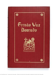
fernão vaz dourado
1520 - 1580 , India
Quick Facts
- Artistic Movement Or Style: Nautical cartography
- Artists Or Movements Influenced By This Artist: ['Old Portuguese nautical cartography']
- Artists Who Influenced This Artist: ['Pérez Fernandes']
- Date Of Birth: c. 1520, Goa, India
- Date Of Death: 1580, Portuguese India
- Full Name: Fernão Vaz Dourado
- Nationality: Portuguese
- Notable Artworks:
- Atlas by Fernão Vaz Dourado
- Arquivos estatales
- Place Of Birth: Goa, India
Related Articles
Samuel Walters: Capturing Victorian Maritime Life with Precision & Artistry
Explore the exquisite maritime paintings of Samuel Walters (1811-1882). Discover his mastery of detail, historical scenes & influence on Victorian art. Learn about collecting his works and find high-quality reproductions at ArtsDot.
Abraham Hulk Senior: Pioneering Maritime Topography of the Dutch Golden Age
Explore the captivating seascapes of Abraham Hulk Senior, a leading Anglo-Dutch marine painter of the 19th century. Discover his signature style, family legacy & collectable artworks at ArtsDot.
Robert W. Salmon: Navigating the Currents of Maritime Painting & American Realism
Explore the captivating maritime paintings of Robert W. Salmon, a pioneer of American Luminism. Discover his Boston Harbor scenes, legacy, and collecting guide at ArtsDot.
Willem van de Velde the Elder: Master of Maritime Painting & Chronicler of the Dutch Golden Age
Discover the captivating maritime paintings of Willem van de Velde the Elder, a master chronicler of the Dutch Golden Age. Explore his unparalleled realism and lasting influence on naval art history.
Navigating the Depths of Representation: A Historical Exploration of Marine Painting
Explore the rich history of marine painting with ArtsDot. Discover Dutch Masters, Romantic seascapes & renowned artists like Wyllie and Harris. Expert guidance for collectors & custom reproductions.