

 Preview
 Send
Send Share
Share
 Details

 Download
 Similars
 X-Ray
X-Ray Diaporama
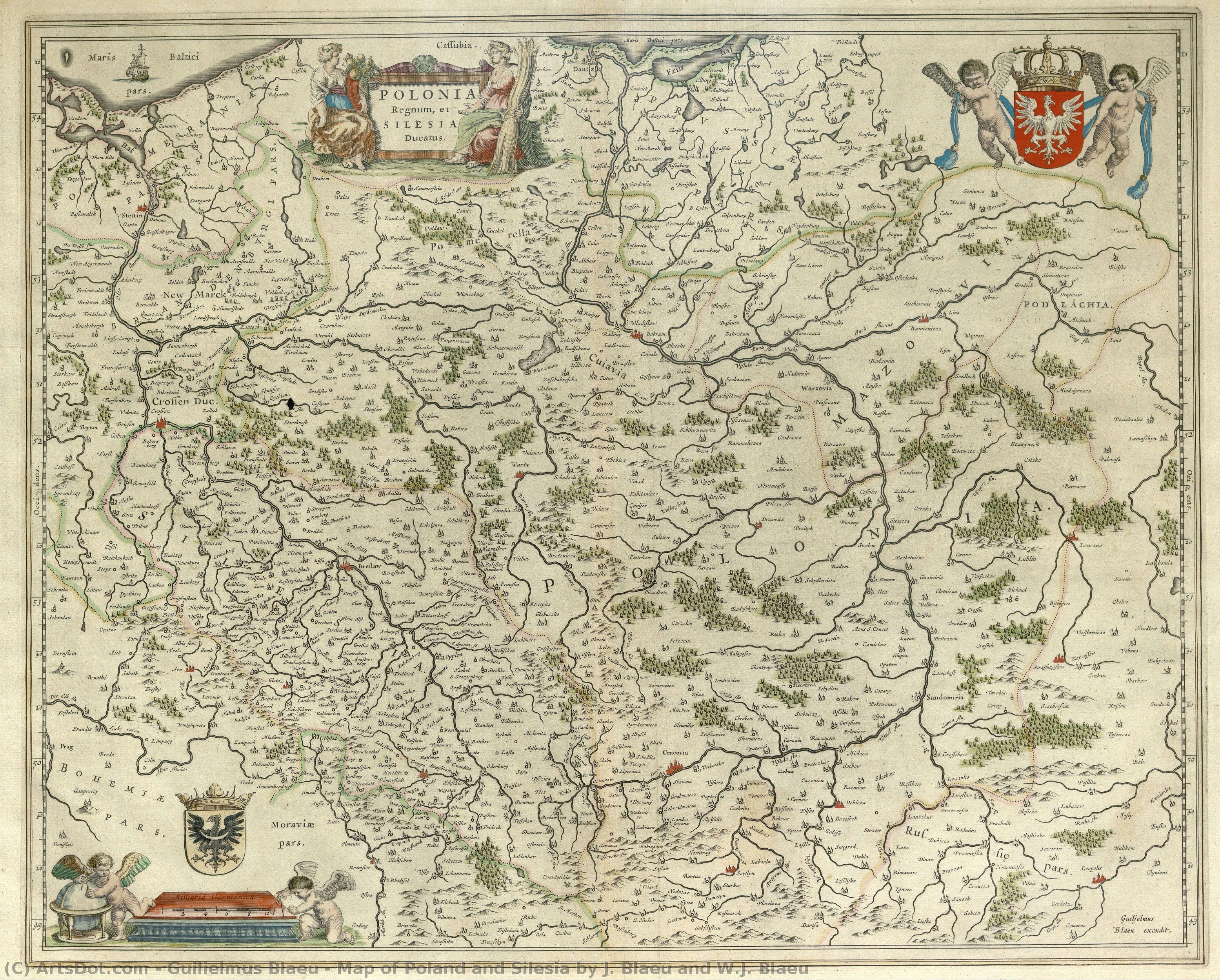
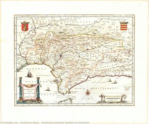
Map of Poland and Silesia by J. Blaeu and W.J. Blaeu


 Read More
Giclée / Art Print
Museum-quality giclée or canvas print with fast production and flexible finish options. ( Buy Hand Made Painting Buy Image)




P118B $10

P118H $10

P118W $10

P438Z $10

P508JH $12

P508YH $12

P805H $10

P805Z $10

P919BZ $10

P919G $10

P919XJ $10

P959ZH $10

P968JZ $12

W106C $8

W218G $10

W218JH $8

W218Y $10

W307PJ $10

W316G $10

W316PJ $8

W316Y $10

W398PJ $8

W4111J $10

W500HY $15

W500JH $15

W692G $12

W849H $8

W940BG $15

W953PJ $8




Pick from our preset sizes that match the artwork's original proportions.

You may enter your own dimensions to fit a specific frame or space. If your selected size does not match the original image's proportions, we will either crop the artwork or extend the image with a mirrored or solid-fill edge. A digital mockup will be sent for your approval before production begins.
Please note that the on-screen preview does not reflect the actual cropping or extension. Only the mockup will accurately show the final composition.
While custom sizes are available, we recommend selecting a dimension from the predefined list to preserve the original proportions.
Worldwide Delivery () in 2 weeks instead of standard 4/5 weeks. (2 September)

Free Worldwide Express Shipping

High-Quality Linen Canvas

Full Shipping Insurance

Customs Tax Refund Guarantee

True Color Matching Guarantee

60-Day Return Policy (Defects Only)

100% Money-Back Guarantee

Bulk Discount Offer
 Glass option is only available in size under 110 CM

Map of Poland and Silesia by J. Blaeu and W.J. Blaeu
Giclée / Art Print
Reproduction Size
-


Total Price
$ 63
Related Artworks




Artist Biography
The Architect of the Earth: The Life and Legacy of Willem Blaeu
In the golden age of Dutch exploration, when the horizons of the known world were expanding through the daring voyages of the East India Company, one man possessed the singular vision to capture that vastness on paper. Willem Janszoon Blaeu, born in 1571 near Alkmaar, was far more than a mere printer; he was a master of spatial storytelling. His journey did not begin with the ink of a cartographer, but with the celestial observations of an astronomer. Driven by a profound curiosity about the heavens, Blaeu traveled to the island of Hven to study under the legendary Tycho Brahe. This apprenticeship in the rigorous mathematics of astronomy provided him with a scientific foundation that would later distinguish his maps from the mere illustrations of his contemporaries. He learned not just how to see the stars, but how to translate the infinite geometry of the cosmos into the tangible precision of globes and instruments.
Upon returning to the bustling maritime hub of Amsterdam, Blaeu transformed his scientific expertise into a commercial and artistic empire. By 1605, he had established a printing business that would become a cornerstone of the Dutch Golden Age. His work was characterized by an exquisite marriage of technical accuracy and aesthetic splendor. To hold a Blaeu map was to hold a window into a world being rediscovered; his lines were precise, yet they were adorned with the vibrant artistry of the era, featuring intricate cartouches, sea monsters, and delicate flourishes that breathed life into the silent expansions of the ocean. His appointment as the official hydrographer for the Dutch East India Company (VOC) in 1633 marked the pinnacle of his professional prestige, granting him access to the most secretive and cutting-edge geographical data of the age.
A Legacy Written in Ink and Gold
The true magnitude of Blaeu’s contribution lies in his ability to synthesize information into monumental works of reference. His publications were not merely tools for navigation but were profound cultural artifacts that shaped the European understanding of geography. The Atlas Maior, though reaching its most magnificent form through the continued efforts of his family, stands as a testament to the tradition he ignited. These atlases were masterpieces of multi-lingual scholarship, published in Latin, French, German, and Dutch, ensuring that his vision of the world reached the desks of scholars, merchants, and monarchs alike.
The impact of his career can be seen through several defining achievements:
- Scientific Precision: The integration of astronomical observations from his time with Tycho Brahe into maritime cartography.
- The Atlas Tradition: Establishing a lineage of atlas-making that prioritized both the density of information and the beauty of presentation.
- Global Influence: Creating a standardized visual language for geography that supported the era's great maritime expansions.
- Artistic Innovation: Elevating the map from a functional tool to a high art form through detailed engraving and hand-colored embellishments.
As we look back upon the works of Guilielmus Blaeu, we see more than just historical documents; we see the heartbeat of an era defined by discovery. His life was a bridge between the medieval reliance on myth and the modern era of empirical measurement. Through his globes, charts, and atlases, he did not just record the world—he helped define it for generations to come, leaving behind a cartographic heritage that remains as breathtaking today as it was in the seventeenth century.
guilielmus blaeu
1571 - 1638 , Netherlands
Quick Facts
- Artistic Movement Or Style: Early Modern Cartography
- Artists Or Movements Influenced By This Artist: ['Renaissance Cartography']
- Artists Who Influenced This Artist: ['Tycho Brahe']
- Date Of Birth: 1571
- Full Name: Willem Janszoon Blaeu
- Nationality: Dutch
- Notable Artworks:
- Atlas Maior
- Globes and Atlases
- Maps of the Dutch East India Company
- Place Of Birth: Alkmaar/Uitgeest, Netherlands
Related Articles
Giclée Prints: Archival Quality & Aesthetic Nuances for the Discerning Collector
Explore the world of giclée prints with ArtsDot. Learn about archival quality, aesthetic nuances & investment potential. Expert guidance for discerning art collectors seeking museum-quality reproductions and lasting value.
Echoes of Time: Exploring the Enduring Appeal & Historical Context of Vintage Art Prints
Explore the captivating world of vintage art prints! Discover their history, collecting tips & enduring appeal. Expert insights on chromolithography and building a legacy collection with ArtsDot.
The Enduring Legacy of Fine Art Prints: Technique, History & Aesthetic Impact
Explore the rich history & techniques of fine art prints. Discover investment potential, assess authenticity, and learn how to preserve your collection with expert guidance. Trusted insights for discerning collectors.
The Enduring Legacy of Printmaking: Techniques, Themes & Artistic Innovation Across Centuries
Explore the rich history of printmaking with ArtsDot. Discover techniques from intaglio to lithography, learn about collecting valuable prints & find museum-quality reproductions. Expert insights for art enthusiasts and collectors.
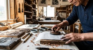
The Enduring Legacy of Woodblock Printmaking: Technique, History & Artistic Expression
Explore the rich history of woodblock printmaking – from ancient techniques to Ukiyo-e masterpieces. Discover expert insights on collecting, preserving & appreciating this enduring art form.


